http://www.fhwa.dot.gov/infrastructure/us666.cfm
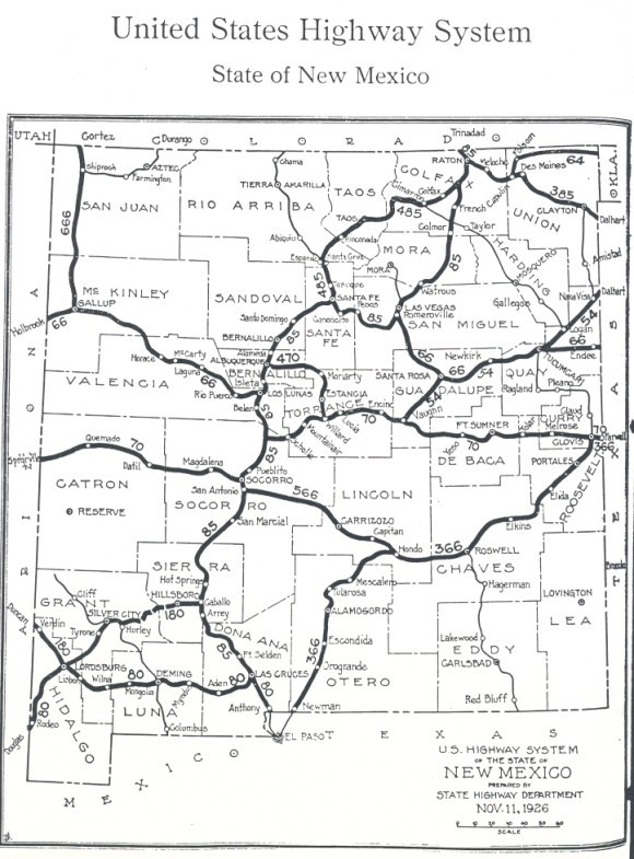
The map itself came from the 1927 issue of New Mexico Highway Journal. Click for an enlarged view.
U.S. Highways in New Mexico
Jump to Interstate Routes below.
Jump to lists of U.S. and Interstate routes.
|
History of the U.S. highway system. The
U.S. highway system was applied to the existing New Mexico highway network
in 1927. Unlike some states that kept their original route numbers
alongside the new U.S. numbers (at least for a while), in New Mexico the
original state route numbers were immediately eliminated on the newly
established U.S. routes. A map of this U.S. route system shows the
significant differences between the system as first laid out and as it
existed 10 years later (described below). This map is taken from an
article "U.S. 666: Beast of a Highway?" by Richard F. Weingroff. The
entire article actually provides a detailed history of the origins of the
U.S. Highway System in New Mexico, and can be found at:
http://www.fhwa.dot.gov/infrastructure/us666.cfm The map itself came from the 1927 issue of New Mexico Highway Journal. Click for an enlarged view. |
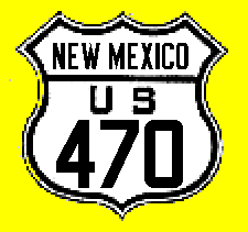
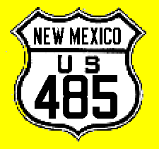
As the map above shows, the original U.S. routes that were on more or less their more familiar alignments alignments were 54, 66, 80, 666, and 85. U.S. 70 crossed the state but on the alignment later assigned to U.S. 60. There were a number of 3-digit routes that disappeared by the 1930s: 366 (the first of two that existed), 180 (no connection to today's route), 385 (no connection to today's route), 470, 485, and 566. All of these routes were gone within ten years, though most of them are still marked as U.S. or interstate routes. In the 1930s, U.S. 60, 62, 84, 87, 285 and 550 were extended into the state; U.S. 70 was rerouted on one or two new alignments before adopting its current routing (along with an extension of 54); and the second U.S. 366 came and went. By the late 1930s, the U.S. Highway System in New Mexico was mostly on the alignments it had at the beginning of the interstate system. There were a few changes in the 1940s, with the introduction of U.S. 180 (second incarnation) and new alignments for U.S. 84 and 285 in the northern part of the state. The 1950s and 60s brought U.S. 56 and 164 (later renumbered 160). U.S. 64 was also extended in the 1970s and 90s onto a longer routing, and U.S. 550 was extended south to Albuquerque around 2000.
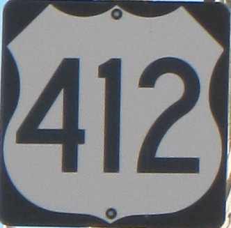
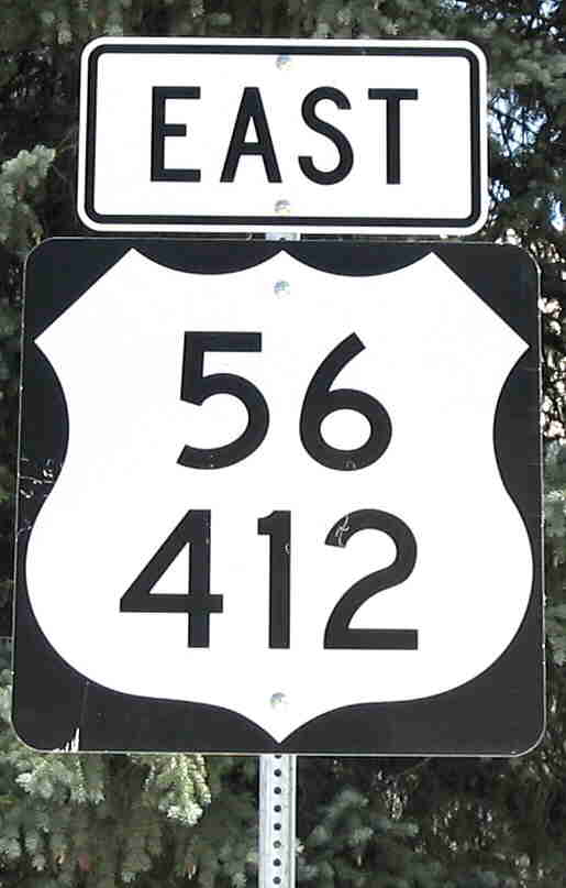
The coming of the interstate system has resulted in U.S. routes being either decomissioned because of their redundancy, or hidden where adjoining states can't be convinced to agree to a decommissioning. U.S. 66 and 80 were decommissioned in their entirety, while U.S. 85 has essentially ceased to exist in New Mexico without an official elimination by AASHTO (Texas must be holding out for its portion of that route). One new route was overlaid on an existing route (412 on 56) and U.S. 666 has been exorcised to 491.
As far as bannered routes (i.e., ALTERNATE,
BYPASS), see the summary under each individual route that has had one
or more bannered routes.
The original 1925-26 plans were a
little different. These went through several iterations. The two biggest
changes before the final system was posted in New Mexico were, (1)
designating what was originally to be U.S. 60 as U.S. 66; and (2) moving U.S. 85
onto a new alignment. These changes also affected a number of proposed
branch (3-digit) routes. A brief summary of these proposals and
changes is below
As marked in 1926
Originally proposed /
Modified proposal after
originally proposed 60 became 66
385
85 (Original U.S. 85 plan took it SE
from Raton through Clayton to Ft. Worth, TX)
85
285 - Romeroville to
Raton
60/66 - Los Lunas to
Romeroville
460/466/570 - Jct 70 to Los
Lunas
70 - Socorro to jct 460
370
- Las Cruces to Socorro
485
Not originally planned as U.S. Route
66
60
366
360
566
560 (added before change of 60 to 66)
666
560/660
There are three interstate routes in New Mexico, all of them considered major cross-country routes (x0 or x5 numbers). These are east-west I-10, I-40, and north-south I-25, which begins at Las Cruces. New Mexico is among a very few states that do not have any 3-digit interstate routes ("3di") around its major cities. Considering the limitations imposed by terrain and the layout of the city, it is unlikely that Albuquerque will have an interstate bypass constructed in the foreseeable future. There are a number of Interstate Business Loops which have replaced the original U.S. routings through cities, sometimes running concurrent with state route numbers.
Lists of U.S. and Interstate Highways
List of past and present U.S. and Interstate highways in New Mexico. In the U.S. Highway table, banner routes (BYPASS, ALTERNATE, TRUCK) are listed under their parent route. Interstate business loops are also listed under their mainline route. Background of table row (for U.S. banner routes as well) indicates whether route currently exists or era of decommissioning as follows:
|
U.S. Highway Listings |
Interstate Highway Listings |
|
Currently authorized and marked routes |
Currently authorized and marked routes |
| Routes renumbered or decommissioned from the 1980s-2000 | Interstate Business loops
Note: my source for interstate business loop information, besides personal observation, is |
| Routes renumbered or decommissioned 1920s through early 1960s | http://www.interstate-guide.com/business-routes/ |
|
Route |
Note: The history of
each route, where available, lists the 1926 New Mexico route number(s) on
which the U.S. route was established. Because of renumbering that occurred
after establishment of the U.S. route system, these 1926 route numbers may
not match the later routes summarized on the New Mexico State Route pages.
The information below was taken in part from information on my map collection. However, the ultimate source of information because of more precision in years and routings, are the web site operated by Robert Droz, www.us-highways.com/nm-us.htm, and (I believe) the original source of this information, James Allen, http://www.ees.nmt.edu/~jaguar/nmus/. Much of the information reported below was complied by these researchers, though where my information differs from that they present, I use my sources. Look for active links to web sites for adjoining states. | ||||
|
Cropped from the photo below, taken March 2008. |
South (west)
terminus: TX State Line at Newman Originally --- U.S. 70 (became 60) at Vaughn (1927-34) Nationally --- Texas Loop 375 near the international bridge to MX-45 at El Paso TX East terminus: TX State Line near Nara Visa Nationally --- I-72 near Pittsfield, IL Length (NM): 356.076 mi. NHS: Entire length in New Mexico County: Otero, Lincoln, Torrance, Guadalupe, Quay History: The original extent of U.S. 54 was from Nara Visa to Tucumcari (Route 18), and then southwest to Vaughn (Route 3 ), where it terminated at U.S. 70 (now 60). It was extended south along NM-29 and 3 through Carrizozo and Alamogordo to El Paso in 1934, replacing in part U.S. 70 in its second alignment. Improvements: Two lane except between Tularosa and the Texas state line, which is divided. The segment from Tularosa north to Corona has been improved to widen the shoulders but still has frustratingly slow 55 mph speed limit through open country (albeit with poor sight distance in places). This raises to 65 mph north of Corona. Comments: Most of 54 is more or less east-west, but the most westerly segment turns due north-south. This was matched on this route's east end in Illinois, where it ran due north into Chicago until that last part of the route was decommissioned in the 1970s. It is marked as north-south south of I-40.
| ||||
|
|
West
terminus: BL
I-25 at Springer
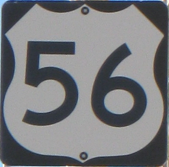
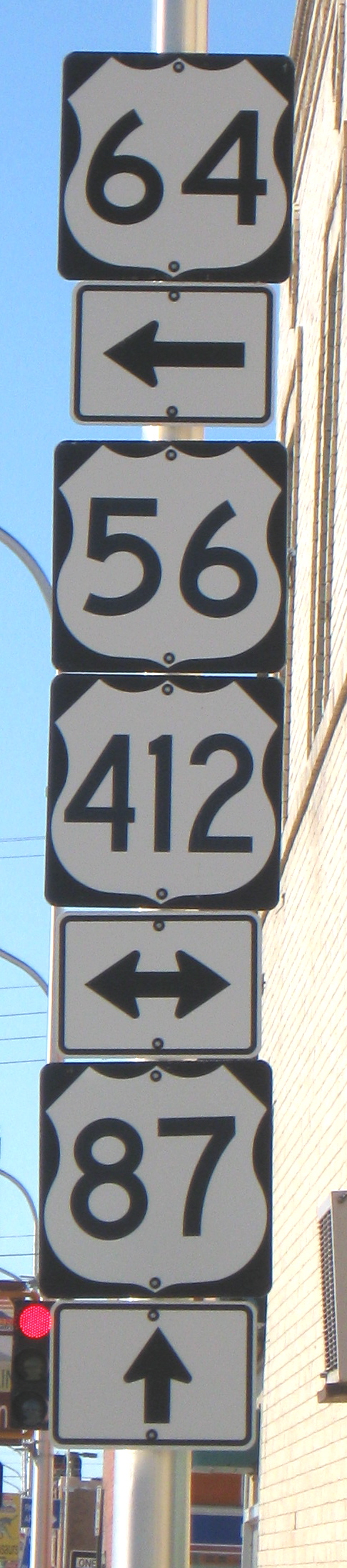
East terminus: OK State Line NE of Clayton Nationally --- To: U.S. 71 at Kansas City, MO Length (NM): 94.172 mi. NHS: Only the section concurrent with U.S. 64, NE of Clayton County: Colfax, Union History: U.S.
56 was established in New Mexico in 1956. This was a new route laid
over existing U.S. and state routes in Missouri, Kansas and Oklahoma. It
replaced NM-58 between Springer and Clayton, and was overlaid on U.S. 64
going towards Oklahoma. "Sine Stack" in Clayton (June
2009). | ||||
| West
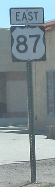
terminus: AZ State Line W of Red Hill Nationally --- I-10 E of Quartzsite, AZ East terminus: TX State Line near Clovis Nationally --- U.S. 58 at Virginia Beach, VA Length (NM): 397.895 mi. NHS: West of I-25 at Socorro, and the segment concurrent with U.S. 84 E of Ft. Sumner County: Catron, Socorro, Torrance, Guadalupe, de Baca, Roosevelt, Curry History: As established in 1926, U.S. 60 terminated well east of New Mexico (near Springfield MO) until 1932. In that year, it was extended west. In New Mexico, it replaced the original route of U.S. 70, which took it westward through Fort Sumner, Vaughn, Willard, Socorro, and Datil. In Arizona, U.S. 60 took a new southwestward route toward Globe rather than the northwestward route originally taken by U.S. 70 toward Holbrook along what is now U.S. 180. Improvements: Generally two-lane, except for the common section with U.S. 285 from Encino to Vaughn, and from west of Clovis to the Texas border, which are segments of divided highway. Comments: The designation U.S. 60 was initially proposed for the route that became U.S. 66. This was printed on some maps, but never actually marked. | |||||
| West
terminus: TX State Line SW of Carlsbad Originally --- NM-2 at Carlsbad (1930-32) Nationally --- Mexican border at El Paso TX East terminus: TX State Line E of Hobbs Nationally --- Canadian border at Niagara Falls, NY Length (NM): 109.712 mi. NHS: Entire length in New Mexico County: Eddy, Lea History: First signed in New Mexico in 1930 along the original NM-16, originally terminating at Carlsbad at NM-2, but extended westward to El Paso by 1932. Also at that time it followed a different route eastward into Texas. It turned north before Hobbs and followed present day NM-483, U.S. 82, NM-206, and U.S. 380 eastward. The route toward Hobbs was then NM-16. In 1944, the second incarnation of U.S. 180 was established in Texas and was made concurrent with a realignment of U.S. 62, on its current alignment in far eastern New Mexico. U.S. 62 and 180 since that time have been concurrent all the way through New Mexico west to El Paso. (U.S. 62 has a brief independent existence just before entering Mexico in El Paso.) Improvements: Divided from Carlsbad east to the Texas border east of Hobbs. Comments: In New Mexico, U.S. 62 only exists in tandem with U.S. 180. The highway is shown on the state highway inventory as U.S. 62 rather than 180, since concurrent routes are designated by the lower number. Note that 62 manages to be an east-west, border-to-border route, thanks to a serious turn to the north in Pennsylvania and New York. | |||||
|
Photo taken at junction NM-527 in Gobernador in San Juan County. |
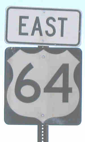
West
terminus: AZ State Line W of Shiprock Nationally --- U.S. 160 at Teec Nos Pos, AZ East terminus: OK State Line NE of Clayton Nationally --- U.S. 158 at Nags Head, NC Length (NM): 439 mi. NHS: West of U.S. 550 at Bloomfield, East of Raton to the Oklahoma border County: San Juan, Rio Arriba, Taos, Colfax, Union History : From 1926 to about 1949, U.S. 64 entered New Mexico just west of Kenton, OK, and followed present-day NM-456 and NM-325 to Capulin, where until 1931 it ended at U.S. 385 (now 87). There was apparently not an original state route number for this highway. In 1931, it was extended westward to Raton and southwestward as a replacement for U.S 485 to Santa Fe. In the late 1940s, the eastern segment was realigned along a more southerly route, entering New Mexico from Oklahoma just northeast of Clayton and following U.S. 87 to Raton. In 1974, the west end was realigned from Taos north and west to follow former NM-111 and NM-553 over the mountains west of Tres Piedras to Tierra Amarilla. It then followed U.S. 84 west of Chama and NM-17 to Farmington, where it terminated at (then) U.S. 550. In 1989, it was extended west, replacing 550 to Shiprock and following NM-504 and AZ-504 to U.S. 160 just inside Arizona. Improvements :
Divided from Shiprock to Bloomfield, two-lane the rest of the way to I-25
near Raton. A twisty, slow road over Taos Pass. East of
Raton, see U.S. 87 for status of common
section. Comments: Crosses the Rio Grande Gorge bridge northwest of Taos. This is an impressive 600 foot-deep gorge in an otherwise flat plain, showing a geologic rift that extends from northern New Mexico to west of Santa Fe.(A really good view of the rift can be seen from White Rock Park in White Rock, near Los Alamos.) The crossing of the southern San Juan Mountains east of Tierra Amarilla, over which this was rerouted in the mid-1970s, has a summit elevation of 10,500 feet. This makes U.S. 64 the highest continuous highway in New Mexico. It is also the only, or one of a very few segments in the U.S. highway system routinely closed in the winter (none in Colorado are routinely closed). | ||||
|
|
West
terminus: AZ State Line at Lupton Nationally --- U.S. 101A (now CA-1) at Santa Monica, CA East terminus: TX State Line at Glen Rio Nationally --- U.S. 41 at Chicago, IL Length (NM): 368 mi. County: McKinley, Valencia (later Cibola), Bernalillo, Santa Fe, Torrance, Guadalupe, Quay History: The original U.S.
numbering plan had this as U.S. 60. States
in the east (especially Kentucky) felt slighted that a U.S. x0 route
bypassed them, and so a separate U.S. 60 was established and this route
became 66. U.S. 66 in New Mexico originally ran from Gallup to
Los Lunas (Route 6, now marked NM-6 where it branches off I-40), then
northward along U.S. 85 through Santa Fe almost to Las Vegas (Route 1) ;
southeastward to Santa Rosa (Route 56, now U.S. 84); directly east from
Santa Rosa along Rt. 104, then northeast to join Rt. 3 at Cuervo and
eastward through Tucumcari to Texas. The bend through Santa Fe and Los
Lunas was bypassed when U.S. 66 was rerouted over then NM-6 from Santa
Rosa through Albuquerque to near Laguna around 1937. The route from Santa
Rosa to south of Las Vegas became the extension of U.S. 84, and the Laguna
to Los Lunas segment became new NM-6. Comments: New Mexico has excellent signage marking both the pre-1937 and post-1937 routes of U.S. 66. The signage is generally white on brown, HISTORIC U.S. 66. | ||||
|
Photo taken on West Pine St., BL I-10, in Deming, March 2008. (Remnant sign? Not actually part of U.S. 70 today). |
West
terminus: AZ State Line NW of Lordsburg Previously --- in NM, AZ State Line W of Quemado (1927-32),TX State Line S of Alamogordo (1932-34); Previous National terminus U.S. 66 at Holbrook AZ (1927-32), (probably) U.S. 80 in El Paso (1932-34) Nationally (currently) --- U.S. 60 at Globe, AZ East terminus: TX State Line E of Clovis Nationally --- Atlantic, NC Length (NM): 448.264 mi. NHS: East of I-10 at Las Cruces County: Hidalgo, Luna, Do�a Ana, Otero, Lincoln, Chaves, Roosevelt, Curry History: U.S. 70 was relocated at least twice in New Mexico after its initial establishment. Initially, it followed present-day U.S. 60 from east of Springerville, AZ to Socorro (Route 5); then via Route 19 east through Willard, Vaughn, Fort Sumner, and Clovis. In 1932, U.S. 60 was extended into New Mexico from Texas and took over this route, and U.S. 70 was then rerouted southwest over former U.S. 366 (I) through Portales, Roswell, Alamogordo, and south to El Paso. I have a 1934 map that shows a third alignment westward from Hondo to San Antonio (replacing U.S. 380) and then south to U.S. 180 (I) and replacing that route through Hillsboro to Silver City and Lordsburg. However, Allen and Droz report that U.S. 70 was actually realigned that year along NM-3, its current route from Alamogordo to Las Cruces, then west to Lordsburg and replacing U.S. 180 (I) from here towards Arizona. U.S. 54 replaced the old routing of U.S. 70 to El Paso. Improvements: 2-lane west
of Lordsburg. Divided from Las Cruces to north of Alamogordo, with a
freeway segment just east of Las Cruces, and including a 4-lane divided
"relief route" bypass of Alamogordo. East of Tularosa, divided through
Ruidoso, including the newly constructed divided section between Ruidoso
and U.S. 380. Divided from the junction with U.S. 380 to Roswell. Has a
common two lane "relief route" bypass of Roswell with U.S. 285. East of
Roswell, divided (except possibly for the urban segment through Portales)
all the way to Clovis, and much of this lonely route is posted 70 mph.
Comments: Not currently marked where it runs along I-10 between Las Cruces and Lordsburg. Now improved to freeway status --- New Mexico's first non-interstate freeway, I believe --- east of Las Cruces. Also, the only non-freeway in the state with a 75 mph speed limit across the White Sands Missile Range. | ||||
|
Photo of a remnant sign taken along Business Loop I-10 in Deming, March 2008. |
West
terminus: AZ State Line near Rodeo Nationally --- U.S. 101 at San Diego, CA East terminus: TX State Line at Anthony Currently runs from I-20 E of Dallas TX To: Tybee Island, GA Length (NM): 191 mi. County: Hidalgo, Luna, Do�a Ana History: Established in 1926 along Route 42, Route 4 and Route 1 . Decommissioned by 1990, replaced mostly by I-10, but by NM-80 south of I-10 on the west end, and NM-478 through Las Cruces. Had an Alternate route south of Las Cruces prior to opening of I-25 (now NM-478), then a new Alternate was marked along the Anthony connector from I-10, now NM-460, in the early 1960s. Improvements: Paved by the
mid-1930s. When first established, it may have temporarily been marked on
the road through Aden (SW of Las Cruces) that entered Mesilla rather than
Las Cruces from the west. It is interesting to note that a two-lane
highway carrying U.S. 80-85 that bypassed the old Rio Grande Valley route
(which became U.S. 80-85 ALTERNATE, later NM-478) was constructed in the
1950s along the alignment that became I-10 south of Las Cruces.
Comments: Still exists east of Dallas, TX. | ||||
|
Taken March 2008 at Cloudcroft. I don't think the grayish numbers are an artifact of the digital photography. |
West
terminus: U.S. 70 at Alamogordo
Previously --- U.S. 80-85-180 (BL I-10) in Las Cruces (1961-90) To: TX State Line NE of Lovington Nationally --- I-95 near Brunswick, GA Length (NM): 192.557 mi. NHS: None County: Otero, Chaves, Eddy, Lea History: Until the early 1960s, U.S. 82 ended at Lubbock. It was extended from Texas into New Mexico in the early 1960s, replacing NM-337 from the Texas border west to Lovington and NM-83 from there west to Alamogordo. It was originally overlaid on U.S. 70 from Alamogordo to Las Cruces so that it terminated at U.S. 80, but was eliminated along this segment around 1990. Improvements: Generally just two-lane. Comments: A few U.S. 82 signs are still posted along U.S. 70 across the White Sands Missile Range and in Alamogordo along White Sands Blvd. The rise out of Alamogordo is dramatic - you gain over 4000 feet in elevation in about 16 miles. | ||||
|
Photo taken south of I-40 in Santa Rosa. |
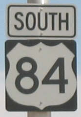
West (north)
terminus: CO State Line at Chromo Previously --- U.S. 666 at Shiprock (1937-40), U.S. 85-285 in Santa Fe (1940-43) Nationally --- U.S. 160 at Pagosa Springs, CO East terminus: TX State Line near Clovis Nationally --- U.S. 82 at Waycross, GA Length (NM): 356 mi. NHS: South of I-25 near Las Vegas to I-40 and southeast from there to Ft. Sumner, then east to the Texas border County: Rio Arriba, Santa Fe, San Miguel, Guadalupe, de Baca, Roosevelt, Curry
Improvements: Two-lane
except for the common section with U.S. 285 north of Santa Fe, which is
divided highway through Santa Fe (St. Francis Drive), a true freeway from
NM-599 to Pojoaque, and divided to the junction with NM-68 in Espa�ola.
See photos of the freeway section of this
road.
Comments: This route is way out of place in the numbering grid by the time it enters Colorado. In fact, it allows Colorado to boast the largest spread of any state between its lowest and highest even-numbered (2-digit) U.S. routes --- 6 and 84 --- though they don't meet. It is not marked along its common section with I-25. It is interesting to note that this route is signed as a north-south route north of Ft. Sumner where it leaves U.S. 60, all the way to the Colorado border. Mileposts on the independent portion of this route have mile 0 at Ft. Sumner. | ||||
|
Remnant sign, photo taken March 2007- looking east on Marquette Avenue at 3rd St., Albuquerque. See comment at right for explanation. |
South
terminus: TX State Line at Anthony
Previously --- U.S. 80 at Las Cruces (until 1935) Nationally --- Mexican border at El Paso TX North terminus: CO State Line N of Raton Nationally --- Canadian border near Fortune ND Length (NM): 483 County: Do�a Ana, Sierra, Socorro, Valencia, Bernalillo, Sandoval, Santa Fe, San Miguel, Mora, Colfax History: U.S. 85 as the
replacement for Rt. 1, the El Camino Real, was a last-second
modification to the U.S. highway system before it was approved in final
form in 1926. The original routing of U.S. 85 was southeast from
Raton to Amarillo and beyond. But, New Mexico authorities
convinced AASHO to provide the 2-digit U.S. route across the state from
north to south. As originally proposed, from Raton south this would
have been U.S. 285, U.S. 60/66, U.S.
460/466/570, and U.S. 370 .
Improvements: The entire
road was paved by 1937. As noted above, at the time the route was
established, it took new routings that differed from Rt. 1, such as in the
Rio Grande Valley between Las Cruces and Hatch. Rt. 1 actually followed a
routing upland of the valley close to present-day I-25, while U.S. 85 was
quickly moved before 1930 to the route through the valley. There were two
major segments of original 1920s roadway north of Albuquerque that were
upgraded in the 1930s on new alignments. At La Bajada Hill south of Santa
Fe, the original narrow switchbacks were relocated east to approximately
the current alignment of I-25 by 1932. At Raton, the original Raton
Pass road ran near the summit of Goat Hill, then west and north from
Raton, crossing the state line about three miles west of current Raton
Pass. These roads are visible today, but except for several miles west
from Goat Hill, are not accessible; nor is the original road on the
Colorado side open to the public. It appears that, based on the relative
position shown on various New Mexico maps relative to the railroad, that
road was replaced around 1940 with a new alignment of U.S. 85-87
approximately on the current I-25 alignment. Before construction of the
interstate, the only segment of U.S. 85 that was improved beyond 2-lane
paved was from north of Bernalillo to Santa Fe. This was divided highway
before it was upgraded to I-25. Comments: Not formally removed by AASHTO, and present in Colorado and Texas, but this route has not been marked in New Mexico since around 1990. Where it left the interstate to pass through adjoining towns, these routes have either been redesignated as interstate business loops or given state route numbers. Nor is U.S. 85 even considered an "invisible" overlay on I-25 like it is in Colorado, at least by NMDOT (the state map does not show it, nor do nationally published maps, which would indicate that New Mexico is indicating the route is nonexistent). Thus, it is shown on this page as eliminated. I would look for other ways to run this designation south from Colorado, such as using the designation on U.S. 285 instead. The photo at top left is interesting in that it is a rare remnant of this route. Around 1976, Albuquerque closed 4th Street, which carried U.S. 85, between Central and Marquette Avenues for a mall and civic plaza. Originally, Marquette was one-way west, which forced southbound traffic west two blocks to 6th St., because 5th St. was one-way northbound. Northbound traffic had to detour to 2nd St. (then marked U.S. 85 Alternate) because 3rd St. was one-way southbound. I never saw any signage for the rerouted U.S. 85 before I moved away (1977). Apparently, Marquette and other streets in the area were changed to two-way operation and U.S. 85 was routed east one block to 3rd St. prior to 85 being eliminated - thus, this sign probably dates from the early 1980s. | ||||
|
|
North (west)
terminus : CO State Line on I-25 N of Raton
Nationally --- U.S. 2 at Havre, MT South (east) terminus: TX State Line E of Clayton Nationally --- Port Lavaca, TX Length (NM): 100 mi. NHS: East of I-25 at Raton to the Texas border County: Colfax, Union History: In 1935, it replaced U.S. 385 east of Raton and was connected to U.S. 87 running south from Colorado. Improvements: Four lane divided for 10 miles east of Raton and 25 miles west of Clayton, and from Clayton to the Texas line. These segments are mostly marked 70 mph. The remainder is two lane, pretty good shoulders, posted 65 mph. Comments: This route is
marked east-west in New Mexico as noted in the to/from listing above. The
photo at left, taken in the short independent segment east from Clayton is
representative. There are a couple of signs along the common section with
U.S. 64 in a newly constructed divided segment that have a separate
directional from the U.S. 64 marker and that indicate north-south. Also,
the mileposts begin at the Texas line, which is consistent with a
north-south route. | ||||
|
|
West terminus: AZ State Line near Four
Corners
Nationally --- U.S. 89 Near Tuba City, AZ East terminus: CO State Line Near Four Corners Nationally --- U.S. 60 at Poplar Bluff, MO Length (NM): 0.861 mi. NHS: None County: San Juan History: Redesignated from U.S. 164 about 1970. This rerouting of 160 (which had previously extended northwest from Cortez, CO into Utah and ultimately to U.S. 6-50/I-70) was part of a larger reshuffling of routes, including establishment of U.S. 163 from Arizona north to incorporate the north end of U.S. 160, and extension of U.S. 666 from Cortez to Monticello, UT. Improvements: Two lane Comments: Ironically, the old U.S. 164 designation, which was non-standard at the time it was established, would have become an appropriate number once U.S. 64 was extended west into Arizona around 1990. | ||||
|
|
West terminus: AZ State Line near Four Corners
Nationally --- U.S. 89 Near Tuba City, AZ East terminus: CO State Line Near Four Corners Nationally --- U.S. 160 at Cortez, CO Length (NM): 0.861 mi. County: San Juan History: A new road was constructed near the Four Corners in the early 1960s, running just southeast of the Four Corners and thus clipping the extreme northwest corner of New Mexico. The road was first designated AZ-364 and CO-40, but I have no information on what it was designated in New Mexico (364?). Around 1966, a new U.S. route, 164, was established along AZ-64 and this road. Only about four years later, the road was renamed U.S. 160 as part of a reshuffling of the other U.S. routes in Arizona and Utah. Comments: This was one of the first non-standard U.S. designations assigned by AASHTO. | ||||
|
(I) |
West
terminus: AZ State Line W of Luna
Nationally --- U.S. 80 at Phoenix East terminus: U.S. 85 at Caballo Length (NM): ~140 mi. County: Hidalgo, Grant, Sierra History: Established in 1926 along Route 106 from Duncan, Arizona to Lordsburg, then northeast along Route 42 to Silver City. From there, it was routed over an impassible route over Emory Pass through Hillsboro to U.S. 85. By 1935, U.S. 70 replaced the segment from Lordsburg northwest to Arizona, and the remainder of the route became NM-180. (Today the segment east of Lordsburg is NM-90 and NM-152.) Comments: This route over the Black Mountains may have never been completely passible while it had this designation. The designation was reused about 10 years later with new U.S. 180. | ||||
|
(II) Photo taken at Santa Clara at junction of NM-152, March 2008. |
West
terminus: AZ State Line NW of Luna
Nationally --- AZ-64 S of Grand Canyon NP, AZ, previously marked to the NP boundary East terminus of western segment: TX State Line on I-10 at Anthony and West terminus of eastern segment: TX State Line SW of Carlsbad East terminus: TX State Line E of Hobbs Nationally --- I-20 W of Fort Worth, TX Length (NM): 248 mi (West Leg), 109.7 mi (East Leg) NHS: From Silver City southeast to I-10 at Deming, and the entire east leg (concurrent with U.S. 62) County: Catron, Grant, Luna, Do�a Ana, Eddy, Lea History: Established 1944, routed along U.S. 62 from Texas west to El Paso. Around 1961, the route was extended along U.S. 80 to Deming and replaced U.S. 260 northwest to Arizona. Improvements: West leg is two-lane except for Silver City to Bayard. East leg is divided from Carlsbad to Hobbs and into Texas. Comments: The west leg of this route is overlaid on I-10 between Deming and the Texas border, and is not marked along this common segment. The east leg is overlaid in its entirety in New Mexico on U.S. 62. | ||||
| Western
terminus: AZ State Line NW of
Luna
Nationally --- U.S. 66 at Holbrook, AZ Eastern terminus: U.S. 80 at Deming Length (NM): 166 mi. County: Catron, Grant, Luna History: Established in 1935 along NM-11. Replaced by the westward extension of U.S. 180 in 1961. Comments: | |||||
| South
terminus: TX State Line S of Carlsbad
Nationally --- U.S. 90 at Sanderson TX North terminus: CO State Line N of Tres Piedras Nationally --- I-25 at Denver, CO Length (NM): 412.654 mi. NHS: Entire segment north of Carlsbad to the Colorado border County: Eddy, Chaves, de Baca, Lincoln, Guadalupe, Torrance, San Miguel, Santa Fe, Rio Arriba, Taos History: Established around 1934 and routed along entire length of NM-2 from northeast of Chama, south through Tierra Amarilla and Espa�ola to Santa Fe, then southeast through Encino and Vaughn to Roswell, then south through Carlsbad to Texas. The segment northwest of Espa�ola was realigned onto former NM-74 in the early 1940s, and the alignment north to Chama became U.S. 84. Improvements: 2-lane through northern New Mexico, but a divided highway from I-40 to Carlsbad. Includes a 2-lane "relief route" bypass of Roswell. The common section with U.S. 84 north of Santa Fe is also divided, and includes a 13-mile freeway section (see U.S. 84 for more details). Travelogue: You see a great deal of variation in the 400+ miles of this route. Entering from Texas, you have been traveling through a rather desolate desert climate with scrubby mesquite. The Guadalupe Mountains, which form the highest peaks in Texas, are visible in the distance to the west. Soon after entering New Mexico, you pass through small, struggling towns that appear to have been dependent on both the oil industry and the agriculture in the area before entering Carlsbad. U.S. 62-180 joins on the south end of Carlsbad and exits downtown. U.S. 285 takes you through the bulk of the Carlsbad business district, bending west and then north again before leaving town. Be sure to visit the Living Desert State Park on the north side of Carlsbad, which has great examples of Chihuahuan Desert vegetation and wildlife. From Carlsbad to Roswell, the landscape consists of limited agriculture combined with high plains vegetation. 285 is a divided highway, posted 70 mph except near population centers. At Roswell, 285 is marked through the city but officially runs along the 2-lane "Truck Bypass" around the west. Your choices are to follow the former route (still marked as U.S. 285) through downtown Roswell, with numerous stoplights and substantial traffic, or take the two-lane bypass where you can easily be stuck behind a truck. Before leaving the city, be sure to check your gas gauge --- next fuel is 90 miles north. "Lonely" is the only word to describe the Roswell to Vaughn segment. There are no towns, no service stations, and only two junctions - NM-247 west to Corona and NM-20 north to Fort Sumner. It is a divided, 70 mph segment with little to look at except the mountains to the west. (However, there is a sign marking the road to the alleged UFO crash site northwest of Roswell.) Just east of Vaughn, you intersect U.S. 60 and 54. Vaughn is a city that appears to have fallen on hard times, possibly due to cutbacks in jobs connected with the railroad. The main drag consists of mostly boarded-up businesses, but there are a couple of service stations. Photos below taken by Matt Salek, November 2007
West of Vaughn, U.S. 54 cuts off to the south and then U.S. 285 turns north from U.S. 60 at Encino. From here, you begin to gain significant altitude, crossing I-40 at Clines Corners. North of here the divided highway ends. The landscape evolves to the mountainous landscape associated with northern New Mexico. 285 intersects I-25 and follows it west ("south" on I-25), though it's not marked on the Interstate, to St. Francis Drive in Santa Fe. From here, 285 is concurrent with U.S. 84. You can bypass Santa Fe traffic by following I-25 7 miles south to the NM-599 exit and taking the relief route. St. Francis Drive can be heavily congested, especially during weekday mornings and afternoons. The route skirts the west side of the Santa Fe Plaza area, whereas it once passed through the Plaza. North of Santa Fe, at the intersection with NM-599 (Relief Route), U.S. 84-285 has been improved to freeway to just east of Espa�ola. From Santa Fe to Espa�ola, you lose well over 1000 feet in elevation and go back to the level of the Rio Grande. In Espa�ola, keep a sharp lookout for the junction with NM-68 where 84-285 were routed left onto a new river crossing south of the downtown bridge. It isn't well marked. As rerouted, the highways bypass the heart of downtown, jog north at NM-30 and immediately west onto their original route. U.S. 285 and 84 (toward Chama) split a few miles northwest of Espa�ola, with U.S. 285 turning north. From here, you begin a real gain
in altitude and enter mountainous country. 285 in this area does not go
through any major population centers - the next city of any size is
Alamosa, Colorado, about 34 miles north of the state line. The highway is
2-lane the whole way to Colorado. As you approach the state line, you
enter the broad and flat San Luis Valley, which supports mainly
agriculture that does not depend on a long growing season such as hay and
alfalfa. | |||||
|
(I) |
West (south)
terminus: TX State Line S of Alamogordo
Nationally --- U.S. 80 at El Paso, TX East terminus: TX State Line E of Clovis Nationally --- U.S. 66 at Amarillo, TX Length (NM): ~310 mi. County: Otero, Lincoln, Chaves, Roosevelt, Curry History: The original U.S. route plan had this as a branch of U.S. 60, and so this was intended to be U.S. 360 until 60 became 66. Established in 1926 along Route 50 from north of El Paso to Alamogordo, then northeast along Route 16 to Hondo and 13 to Roswell. From there, it was routed northeast along Route 18 to Clovis. By 1932, it was replaced in the Texas panhandle by U.S. 60 and in New Mexico and Texas near El Paso it became the first realignment for U.S. 70 Comments: | ||||
|
(II) |
West
terminus: U.S. 66-85 in Albuquerque
(1932-37); U.S. 66 at Moriarty (1937-39)
East terminus: U.S. 60 at Willard Length (NM): 63 and 28 mi. County: Bernalillo, Santa Fe, Torrance History: Established in 1932 as a renumbering of U.S. 470 when U.S. 70 was realigned and its original route replaced by U.S. 60. In 1937, U.S. 66 was routed along the Tijeras Canyon part of U.S. 470, but U.S. 470 continued to exist south of Moriarty for about two years thereafter. It was then decommissioned. The north-south part reverted to its original 1910s designation NM-41. | ||||
|
Photo - tilt and all - taken at Carrizozo, March 2008. |
West
terminus: I-25 at San Antonio East terminus: TX State Line E of Gladiola Nationally --- I-30 at Greenville, TX Length (NM): 242.092 NHS: None except concurrent section with U.S. 70 County: Socorro, Lincoln, Chaves, Lea History: Established in 1932, replacing NM-13 and U.S. 566. Improvements: Two lane except for a divided section in the common segment with U.S. 70 west of Roswell. Comments: | ||||
|
|
West
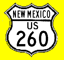
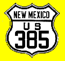
terminus: U.S. 85 at Raton East terminus: TX State Line E of Clayton Nationally --- U.S. 66 at Amarillo, TX Length (NM): 100 mi. County: Colfax, Union History: The original U.S. highway plan had this as U.S. 85, extending southeast to Ft. Worth. New Mexico argued for a single route along the El Camino Real, and so this became a branch of U.S. 85 in the final marked system. Established in 1926 along Route 37 from Raton through Clayton to Texas. It was redesignated U.S. 87 by 1935. Comments: Not directly associated with today's U.S. 385, though the two routings with this designation overlap near Amarillo. | ||||
|
|
West
terminus: BL
I-25 at Springer
East terminus: OK State Line NE of Clayton Nationally --- I-65 near Columbia, Tennessee Length (NM): 94.172 mi. NHS: None except concurrent section with U.S. 64 NE of Clayton County: Colfax, Union History: U.S.412 was extended into New Mexico in 1994 from its former western terminus in Oklahoma. This extension mostly overlays existing U.S. routes, and 412 is overlaid on 56 in its entirety in New Mexico. Improvements: See U.S. 56
| ||||
|
|
West
terminus: U.S. 66-85 in Albuquerque
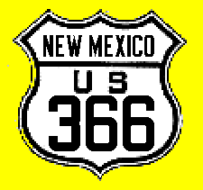
East terminus: U.S. 70 (60) at Willard Length (NM): ~63 mi. County: Bernalillo, Santa Fe, Torrance History: The initial U.S. route established from Albuquerque east along Route 10 and 46 through Tijeras Canyon to Moriarty, then south along Route 41 to Willard. In 1932, U.S. 60 replaced U.S. 70 across central New Mexico, thus eliminating the "parent" route of this highway, and it was renumbered as the second U.S. 366. | ||||
|
|
South
terminus: U.S. 85 at Santa Fe North terminus: U.S. 85 S of Raton Length (NM): ~125 mi. County: Santa Fe, Rio Arriba, Taos, Colfax History: Established in 1926 along Route 8 at Santa Fe to Taos, then over the Sangre de Christo Range on Route 33 through Agua Fria to Cimarron, and northwest through Colfax on Route 21 to U.S. 85. By 1931, U.S. 64 had replaced this route, and south of Taos it is now NM-68. Comments: | ||||
|
|
South
terminus: I-40 at Gallup North terminus: CO State Line N of Shiprock Nationally --- U.S. 191 at Monticello, UT Length (NM): 107.308 mi. NHS: Entire length in New Mexico County: McKinley, San Juan History: Redesignated from U.S. 666 in 2003. Comment: This was so designated because it begins at U.S. 191. The numbers 291 and 391 were not considered because they were in use in Colorado. The three states involved originally proposed 393 as the new designation, but thankfully AASHTO (for once) insisted on a (sort of) systematic route number. | ||||
|
Photo taken near Blanco Trading Post in San Juan County. |
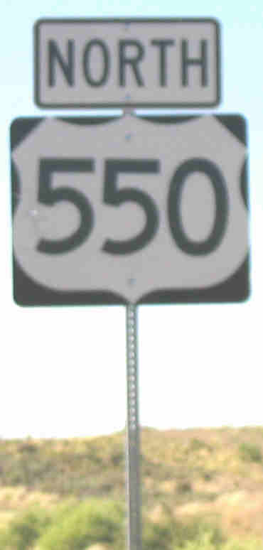
South terminus: I-25 at Bernalillo Previously --- U.S. 666 at Shiprock (1935-89); U.S. 64 at Farmington (1989-2000) North terminus: CO State Line N of Aztec Nationally --- U.S. 50 at Montrose,CO Length (NM): 174.885 mi. NHS: Entire length in New Mexico County: San Juan, Rio Arriba, Sandoval History: Extended into New Mexico from Colorado over NM-19 in 1935. Shortened from Shiprock to Farmington when U.S. 64 was extended west from Farmington into Arizona in 1989. Around 2000, it was rerouted south from Aztec to Bernalillo along former NM-544 and NM-44, when this road was upgraded to divided highway. The former route from Aztec to Farmington is now NM-516. Improvements: Four-lane highway, divided by a narrow median delineated with a double double line and rumble strips between Bernalillo and Bloomfield. Once you leave Bernalillo and the outskirts of Rio Rancho, the highway has a 70 mph speed limit. Take care, though, because there are much loser speed limits through towns along the way as low as 25 mph. Comments: The improvement of old NM-44 is a case study in how to efficiently upgrade a major highway. True, the cost was $312 million, but New Mexico got the work done in under three years, and has a 20 year warranty on the road due to the design-build contract that was awarded. The road crosses the Continental Divide at a fairly lofty altitude of around 7300 feet. | ||||
|
|
West terminus: U.S. 85 at San
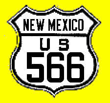
Antonio East terminus: U.S. 366 (I) at Hondo Length (NM): 106 mi. County: Socorro, Lincoln History: A later addition to the draft U.S. route system, it first was proposed as U.S. 560 (displacing the originally planned 560 that ultimately became 666) and then changed to 566 when 60 became 66. Established in 1926 on the western part of Route 13 as one of the original U.S. routes. Became part of U.S. 380 in 1932 when that route was established and extended into New Mexico. | ||||
|
|
South terminus: I-40 at Gallup
Previously --- Arizona State Line at Lupton (1940-91); U.S. 66 at Gallup (1926-40) Nationally --- Mexican border at Douglas, AZ (1940-91) North terminus: CO State Line N of Shiprock Nationally --- U.S. 160 at Cortez, AZ (1926-70; U.S. 163/191 at Monticello, UT (1970-2003) Length (NM): 108 mi. County: McKinley, San Juan History: The original plan for the U.S. route system had this as U.S. 560, as a branch of U.S. 60. Another branch was then added which took the 560 number and this was then proposed as 660. Only when U.S. 66 replaced U.S. 60 in the planned system was this changed to be 666. Designated in 1926 and routed over Route 32 and 121 from Gallup north. OK folks, let's get this straight: it was the sixth named branch of U.S. 66, and consistent with the number pattern of the U.S. route system was designated 666. It was extended west and south into Arizona in the early 1940s, and when this segment was made part of U.S. 191, U.S. 666 was again truncated at Gallup. (The renumbering of the Arizona segment had nothing to do with the number controversy, but rather was due to the fact that U.S. 191 had been extended south and 666 in Arizona was directly in line with this road --- look at a map.) In 2003, it was redesignated U.S. 491. Improvements: Divided from Gallup to Ya-Ta-Hey (NM-264) and just north and south of Shiprock. Plans are being discussed to widen the road from Gallup to Shiprock. Comments: I think the whole number "controversy" was blown out of proportion. Governor Bill Richardson insisted on a new identity for the "Devil's Highway" not out of religious conviction, but to draw attention to the need for upgrades aong the road. All this controversy would have never occurred if the original proposed numbering for U.S. 66 as U.S. 60 had occurred, and then this route would have been U.S. 560. |
Interstate Highways
|
Taken March 2008 on E. Pine Street in Deming (a trailblazer [with a "TO" banner] sign). |
West terminus: Arizona State Line W of Lordsburg
Nationally --- CA-1 at Santa Monica, CA East terminus: Texas State Line at Anthony Nationally --- I-95 at Jacksonville, FL Length: 170 mi. History: Part of the original interstate network, routed mainly along U.S. 80 (except westernmost five miles, routed along NM-14). Improvements: Completed by mid-70s. First segments were at Arizona state line and south of Las Cruces. Travelogue: I-10 is by far the easiest of the interstates, but also the least interesting from the standpoint of scenery. You enter from the high Arizona desert, and across New Mexico there are no significant elevation changes. The highway travels across the desert floor with mountain ranges visible to the north and the south. The highest point is near the Continental Divide, elevation approximately 4600 feet, although the area is relatively flat and does not suggest you are crossing a major drainage divide. In fact, as I was surprised to find, the high points along I-10 in both Arizona and Texas are higher than the Continental Divide summit in New Mexico (Arizona boasts the highest point along I-10 at almost exactly 5000 feet, east of Benson). As you approach Las Cruces, the Organ Mountains east of the city become visible. South of Las Cruces, the highway travels on the east side of the Rio Grande valley, with its well-developed agricultural base (cotton, pecans, chiles). Comments: The segment south of Las Cruces was constructed on an alignment of U.S. 80 that had been built in the mid-1950s to bypass the southern Rio Grande valley towns. | ||
|
|
Lordsburg: Loop 21, Exits 20-24. 4.370
miles long on Railroad Avenue. Includes a portion of U.S. 70
Deming: Loop 22, Exits 81-85. 4.458 miles long on Pine Avenue. (Both routes follow old U.S. 80.) There was formerly a Business I-10 marked in Las Cruces, along Picacho Avenue and Main St. (bypassing the Main Street downtown mall). These are now designated as U.S. 70 and NM-478. | ||
|
Photo taken at exit 364 (S exit of NM-161) N of Las Vegas.
|
South
terminus: I-10 at Las Cruces North terminus: Colorado State Line N of Raton Nationally --- I-90 at Buffalo, WY Length: 460 miles History: Part of the original interstate network, routed along U.S. 85. Improvements: First segment from Socorro to Belen. Completed by 1980, last segment was north of Bernalillo to La Bajada Hill. Travelogue: From Las Cruces north to Truth or Consequences (T or C), the interstate runs mostly along the east side of the Rio Grande valley, crossing the river near Arrey. The highway was not constructed in the valley itself, most likely to minimize the need to take productive agricultural land, but rather was built across the alluvial outwash hills that border the valley, making for some occasional ups and downs. North of T or C, the highway swings well west of Elephant Butte Reservoir and the Rio Grande, which in this area does not provide irrigation for agriculture. The hills to the west of the river in this area are steeper, and there are two deep canyons to cross that are marked with warnings about gusty winds; wind socks are erected to provide visual indication of the strength of the winds. North to Socorro is a relatively lonely stretch of road, with no major towns. As noted below, this piece of the interstate was originally constructed two-lane. North of Socorro, the valley is
apparently wider and one leaves the hilly terrain. Also, one again
encounters small villages, and by the time you reach Belen there is again
a significant agricultural base supported by the Rio Grande. Sprawl
development is heavy at Los Lunas but is broken by the Isleta
Pueblo. North of Albuquerque, you encounter Indian reservations such
as Sandia Pueblo that limit development along the highway. To this point,
because the highway has been relatively close to the Rio Grande, you have
only climbed gradually. (The elevation at Las Cruces is 3900', Albuquerque
downtown is 5000'.) North of the Cochiti Pueblo turnoffs, however, the
highway turns up La Bajada hill at the Cochiti Pueblo exit for a fairly
steep climb to Santa Fe (7000'). This hill marks a fast transition from
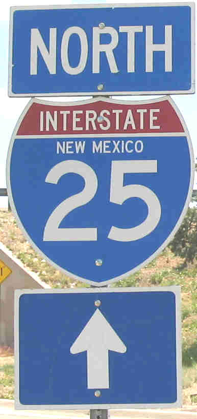
desert landscape to the mountainous landscape around Santa Fe. At Santa Fe, you enter the "P-trap" portion of I-25; the interstate bends east and then southeast as it climbs Glorieta Pass. This is not a significant climb from Santa Fe, but there is a fairly lengthy segment with significant curves as you descend the east side of Glorieta Pass. The mountains to your north here are the southernmost extent of the Rockies, the Santa Fe Mountains of the Sangre de Christo Range. South of Las Vegas, the interstate bends northward again and you exit the mountains. Just east of the U.S. 84 interchange, the interstate actually runs along the western border of the Great Plains; to the west are foothills, while to the east is gently undulating grassland. Between Las Vegas and Raton, you are unambiguously on the Plains, although the mountains are generally visible to the west virtually the whole way. Around Wagon Mound, look for two dramatic rounded peaks to the distant north. These are the 12,000-foot Spanish Peaks northwest of Trinidad, Colorado, which will then disappear from view as you approach Raton Mesa. (I know I'm getting close to home, since I see the north side of those peaks from my house.) Around Springer, you have a spectacular view to the west, with the Raton Mesa ahead and the Culebra Range of the Sangre de Christo Mountains to the northwest (punctuated by 14,000' Culebra Peak, just inside Colorado). Starting around Springer, you will begin to see numerous volcanic cones. The Raton volcano field was active from around 10 million years ago to as recently as 10,000 years, and a number of cones are visible from here. The field extends nearly as far east as Clayton. The Raton Mesa and other similar features were produced by this period of volcanism, because the lava flows prevented erosion of the underlying sandstones, thus creating the mesas. On the north side of Raton you will exit the Plains and begin to climb Raton Mesa. The highway here has some significant curves, and the speed limit is reduced to 65 mph. The Colorado border is at Raton Pass, elevation 7834', the highest point anywhere on I-25. Comments: This was constructed in some areas at a distance of several miles from old U.S. 85, so that road held more importance as a local connector than segments of old U.S. 66 or 80. These segments are mostly designated as independent state routes, with a few I-25 business loops (T or C, Socorro, Belen, Las Vegas, Springer, Raton). I-25 was originally constructed as two-lane between T or C and Socorro, with the road widening to four lanes at interchanges and narrowing down within 1/4 mile again. It was fully widened by the early 1980s. | ||
|
|
Truth or
Consequences: Loop 11. Exits 75-79. 5.711 miles long along
Broadway, Main and Date Streets
Socorro: Loop 12. Exits 147-150. 2.879 miles long along California St. Includes part of U.S. 60. Belen: Loop 13. Exits 190-195. 6.645 miles long along Main Street. Las Vegas: Loop 15. Exits 343-347. 4.240 miles long along Grand Avenue. Springer: Loop 16. Exits 412-414. 3.430 miles long along Maxwell Avenue. Raton: Loop 17. Exits 450-454. 4.161 miles long along 2nd Street. Includes part of U.S. 64. These generally follow old U.S. 85 (except for a connecting route on the north side of Belen) and as noted above in a couple of instances are concurrently marked with other routes. There was previously a Business Loop 25 marked through Santa Fe. It may have followed NM-14 and NM-466 (Cerrillos Road, St. Michaels Road and Old Santa Fe Trail). | ||
|
Entrance from EB NM-118 west of Gallup |
West
terminus: Arizona State Line at
Lupton
Nationally --- I-15 at Barstow, CA East terminus: Texas State Line at Glenrio Nationally --- Wilmington, NC Length: 368 miles History: Part of the original interstate network, routed along U.S. 66. Improvements: First segments near Santa Rosa. Completed by 1980, last segment was Tijeras Canyon east of Albuquerque. Travelogue: If you're expecting relatively sparse traffic, forget it. I-40 is a major east-west transcontinental route, and has very heavy truck traffic. As you cross the Painted Desert in Arizona and approach the New Mexico border, you will observe a line of mesas that provide a dramatic contrast to the relatively flat and featureless desert you have been crossing since Holbrook. This mesa is at Lupton, just west of the state line, and provides a dramatic entrance to New Mexico. To the north from Gallup east is a sandstone mesa that forms an almost continuous cliff, similar to the Book Cliffs as seen from I-70 in eastern Utah and western Colorado. The scenery stays much the same through Gallup until you climb to the Continental Divide. At 7275', this is the highest point on I-40 in New Mexico (and rivals a similar summit west of Flagstaff, which is probably the highest point anywhere on I-40). Signs invite you to "Visit the Continental Divide"; don't bother, it's just the top of a hill. From the Continental Divide, begin a slow descent toward Grants. Outside Grants, you will cross a lava flow that extends into the "malpais" (bad lands, an area of relatively recent volcanic activity) south of here. To the north is Mt. Taylor (11,300'), sacred to the Navajo. You pass by numerous Indian pueblos here, including Acoma (notable for a battle with the Spanish in the 16th century). East of Grants, the highway enters a more featureless plain, which you will cross to Albuquerque. One of the more unusual exit names is Exit 131: To'hajiilee. It's a Navajo village surrounded by Laguna Pueblo. Also unusual in this area is the presence of at-grade turnoffs (not open to the public) into the Laguna Pueblo. Because of a series of hills just west of Albuquerque, the entrance to the city at night is dramatic. While you see the glow of the city lights, you don't actually see the lights until you crest the last hill just west of the Central Avenue (old U.S. 66) exit. Then, the city unfolds before you as you look down on it from the west. As you pass Central Avenue, look to the north for a series of volcano cones (hence the exit for "Paseo del Volcan"). The interstate descends a fairly steep grade down into the Rio Grande Valley. On the east side of downtown, you find the "Big I", the interchange with I-25. This formerly had all directional ramps, with left and right exits and entrances. Out of state traffic that didn't pay attention to the signage would make sudden, last-second transits across one or two lanes to find the thru lanes. It is now reconstructed as a four-level stack with all right-hand exits and entrances. Sandia Peak rises steeply east of the city. This mountain is a classic tilted fault block, extremely steep on the west side but with a gentle enough slope on the east side that you can drive to the top (NM-536). To illustrate how far this block has tilted, the formation on top of the mountain (5,000 feet above the city) can be found 20,000 feet beneath the city --- a five mile uplift.
As you enter the east side of Albuquerque, you gradually climb out of the river valley toward the Sandia Mountains. Much of Albuquerque's "Northeast Heights" is an alluvial outwash plain washed down from the Sandias. (At sunset, the reddish glow of Sandia Peak shows why it was so-named; "sandia" means "watermelon" in Spanish.) The freeway leaves Albuquerque at Tramway Boulevard and enters Tijeras ("scissors") Canyon, which provides a passage between the Sandia and Manzano Mountains. From here east, you will gradually climb through a grassland until, at Clines Corners, the highway crests at around 7000'. (This elevation comes as a surprise to westbound traffic, because except for the continual climb off the Great Plains at Santa Rosa, the elevation is not indicated by the presence of a noticeable range of mountains.) It's all downhill from here, for all intents and purposes, all the way to the Mississippi. From Clines Corners, you will drop significantly until Santa Rosa, which is the beginning of the Great Plains. From here east, the landscape is not flat but rather punctuated by numerous mesas. These become fewer in number after leaving Tucumcari. If you want flat, just wait until you climb the Caprock Escarpment just inside Texas and come out on top of the Llano Estacado (staked plain). Comments: Even though U.S. 66 has been replaced by either I-40 business loops or separately numbered state routes, these are marked as "Historic 66" all along I-40. | ||
|
|
Moriarty: Loop 34. Exits 194-197. 2.922
miles long along old U.S. 66.
Santa Rosa: Loop 35. Exits 273-277. 4.367 miles long along Coronado St., Parker Avenue, and Will Rogers Drive. Includes parts of U.S. 54 and 84. Tucumcari. Loop 36. Exits 329-335. 7.652 miles long along Tucumcari Blvd. Includes part of U.S. 54. All generally follow old U.S. 66 and are marked with "Historic 66" signs. There were previously I-40 business loops through Gallup ( NM-118), Grants (NM-615 and 122) and Albuquerque (Central Avenue, now a city street). |
Travel on...
Last revision: May 21, 2010