 |
Currently marked routes |
 |
Routes eliminated or renumbered 1960-present |
 |
Routes eliminated or renumbered 1950-1960 |
 |
Routes eliminated or renumbered 1930-1950 |
 |
Routes for which there is conflicting information about their present or past existence. |
| 71 | Routes for which no record has been found so far of this number being assigned. (Post-1927 only). |

Taken May 2005 at Los Alamos.
North terminus: Diamond Drive at Ridgeway Drive in Los Alamos
Length: 7.323 miles
County: Los Alamos
History: Originally part of Loop NM-4, designated in the 1970s as a business loop through Los Alamos. Redesignated as a separate route in 1988 and divided into NM-501 and 502.
Improvements: Two-lane paved
Comments: Follows West Jemez Road and Diamond Drive

Taken May 2005 east of Los Alamos.
East terminus: U.S. 84-285 at Pojoaque
National Highway System entire length
Length: 18.301 miles
County: Los Alamos, Santa Fe
History: Originally the east part of Loop NM-4 through Los Alamos and NM-4, which was renumbered east of the junction with the Los Alamos loop in 1988.
Improvements: Paved, two lane and four-lane (east of the NM-4 junction)
Comments:

Taken May 2005 near Pojoaque
East terminus: NM-76 E of Chimayó
Length: 14.570 mi.
County: Santa Fe
History: The easternmost segment of former NM-4, renumbered in 1988.
Improvements: 2-lane, paved road
Comments:
East terminus: U.S. 666 near Shiprock
Length: 23 mi.
County: San Juan
History: Established around 1960 when an existing road west to the Four Corners area was paved. After establishment of U.S. 164 (which became 160) in the mid-1960s, the connecting Arizona route took the same number as this road. Around 1990, U.S. 64 was extended from Farmington west to Arizona over this road, and the state route number was eliminated.
Improvements: Two-lane, paved
Comments:
East terminus: NM-445 near Maxwell
Length: 12.100 mi.
County: Colfax
History: Established around 1970.
Improvements: The 2003 New Mexico highway map shows the entire route as paved, two lane road. In 1999, the western half was apparently gravel.
Comment: The route probably ends at NM-445 (old U.S. 85), but the I-25 exit just south of this junction is marked NM-505.
East terminus: NFS 537 Near Chatfield Peak
Previously --- Texas State Line N of Dell City (before 1983)
Length: 31.900 mi.
County: Otero
History: Its state route log history indicates it was established before 1983. Thus, due to not being shown on other maps probably established c. 1980. A field report by Bobby Magill indicates that the road is now marked Otero County 506. It still shows on the state highway log, so it might be county road at this point.
Improvements: Gravel
Comments: This is a logical route to have turned back to the county. Interestingly, Mr. Magill also noted a "US 506" marker on newly widened U.S. 54 (obviously an error by the highway contractor).
East terminus: Pecos River
Length: 3.304 mi.
County: Chaves
History: First indicated on the 2003 New Mexico highway map, but due to its short length was probably not shown on other maps. Probably established pre-1988 due to its number.
Improvements: Two lane, paved
Comments:
East terminus: NM-125 near Texas State Line
Length: 17.227 mi
County: Lea
History: Established around 1960. Route unchanged since that time.
Improvements: Two-lane paved
Comment:
Photo taken at junction NM-605 N of Milan
North terminus: IR-9 at White Horse
Previously --- Ambrosia Lake
Length: 36.500 mi
County: McKinley
History: Established around 1960 north to Ambrosia Lake. Route extended north around 1990.
Improvements: Two-lane, paved
Comment:

East terminus: NM-589 (Cerrillos Road at Paseo de Peralta) ??
Length: 2 mi
County: Santa Fe
History: Date of establishment and removal, and actual length not known.
Improvements: Urban street
Comment: This shows on on-line maps only, and the extent of the route is not consistent. I know that NM-14 replaced U.S. 85 along Cerrillos Road from I-25 to St. Francis Drive (U.S. 84-285) in the 1980s, so this route can not have ever run down Cerrillos Road west of St. Francis as these maps show. The only realistic portion of road this could have occupied is shown above, unless it ran through the Plaza and back along Old Pecos Trail to NM-466 at St. Michaels Drive.

North terminus: Colorado State Line (CO-172) S of Ignacio
Previously --- Navajo Dam (1960-70)
Length: 32.346 mi
County: San Juan
History: Established around 1960 northeast to Navajo Dam. Route extended north to the Colorado border around 1970.
Improvements: Two-lane, paved
Comment:
East terminus: Brazos Lodge
Length: 7.700 mi
County: Rio Arriba
History: Not shown on any map before 1995, but due to its short length the date of establishment is uncertain.
Improvements: Two-lane, paved
Comment:
North terminus: Abo at Salinas Pueblo Missions National Monument
Length: 0.700 mi
County: Torrance
History: Due to its short length the date of establishment is uncertain, but probably pre-1988 because it would otherwise be a 3xx number.
Improvements: Two-lane, paved
Comment:
North terminus: U.S. 66 (Central Avenue), Albuquerque
Length: 2 mi
County: Bernalillo
History: I never saw this on a map, so the dates it existed are not known.
Improvements: Four-lane, paved
Comment: This route is referenced in the state route log as the former use of NM-514. No dates of usage are provided.
East terminus: U.S. 64-84 at Los Ojos
Length: 1.500 mi
County: Rio Arriba
History: Not shown on maps, possibly a post-1988 route by its number
Improvements: Two-lane, paved
Comment:
East terminus: NM-522 S of Questa
Length: 2.100 mi
County: Taos
History: Appears to have been established around 1980. Not shown on earlier maps, but due to its short length it may not have been shown.
Improvements: Two-lane, paved
Comment:
North terminus: NM-CO state line
Length: 2 mi
County: Taos
History: Date of establishment not known. Turned back 1988.
Improvements: Two-lane, paved
Comment: This route is referenced in the state route log as the former use of NM-516. Now Taos County road B24
East terminus: U.S. 550 at Aztec
Length: 13.719 mi
County: San Juan
History: The original route of U.S. 550 (and before that, in the early 1930s, NM-19) from Aztec to Farmington. Around 2000, U.S. 550 was routed south over old NM-544 and NM-44 to Bernalillo, and this segment was renumbered NM-516.
Improvements: Four lane
Comment: Goes north on Browning Parkway from U.S. 64 east of Farmington, then east on Main Street. Old U.S. 550 followed Main Street all the way to Farmington.
East terminus: NM-11 S of Deming
Length: 6 mi
County: Luna
History: Appears to have been established in the mid-1960s and removed from the state highway system by 1980.
Improvements: Part paved, part gravel
Comment: Currently Luna County C-10
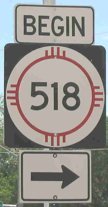
Photo at south end of route along Mills Ave. in Las Vegas
Previously --- BL I-25 (1988-late 1990s?)
North terminus: NM-68 at Ranchos de Taos
Length: 72.899 mi
County: San Miguel, Mora, Taos
History: The original route of NM-3 between Las Vegas and Taos. Renumbered as part of the 1988 route revisions.
Improvements: Generally two lane
Comment: Despite the actual south end of this route, it is marked with trailblazers ("To NM-518") off I-25 at both the north and south business loop exits to Las Vegas, and via NM-329 from BL I-25. The sign at left is noteworthy because one rarely sees "BEGIN" signs in New Mexico.
North terminus: Las Tablas
Previously --- U.S. 285 S of Tres Piedras; 7.397 mi. N of starting point (until 1995)
Length: 15.007 mi
County: Rio Arriba
History: Established mid-1960s. Date at which it was truncated back to Las Tablas is not known, but was after the mid-1980s.
Improvements: Two lane paved (old route was mostly gravel)
Comment:
North terminus: NM-76 at Chimayó
Length: 3 mi
County: Santa Fe, Rio Arriba
History: Established around 1970. Removed from state highway system around 2000.
Improvements: Two lane paved
Comment: Now Santa Fe County Road 99. Interestingly, this is a better road to Chimayó than the remaining state highway, NM-503.

East terminus: NM-24 at Weed
Length: 3 mi
County: Otero
History: Established mid-1960s. Probably turned back mid-2000s as part of route swap between NMDOT and Otero County for Alamogordo Relief Route.
Improvements: Two lane paved
Comment: Ken Johnson of Tularosa made me aware of this turnback, which I had already noted by its absence from the state route log but did not know the reason.
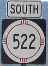
Photo taken at Colorado-NM state line north of Costilla.
North terminus: Colorado State Line (CO-159) N of Costilla
Length: 41.096 mi
County: Otero
History: The original route of NM-3 between Taos and the Colorado border. Renumbered in 1988.
Improvements: Two lane paved
Comment:
East terminus: NM-108 N of Texico
Length: 8.273 mi
County: Curry
History: Date of establishment not known because the route runs too close to U.S. 60-70-84 to shown on earlier maps. Likely pre-1988 due to its number.
Improvements: Two lane paved
Comment:
East terminus: U.S. 62-180-285 in Carlsbad
Length: 8.500 mi
County: Eddy
History: Date of establishment not known because the route runs too close to U.S. 285 to shown on earlier maps. Likely pre-1988 due to its number.
Improvements: Two lane paved
Comment: Lea Street and Happy Valley Road in Carlsbad. It is no longer marked on each end, which leads me to wonder whether this is being turned back.
North terminus: U.S. 380 E of Socorro
Length: 4.946 mi
County: Socorro
History: Date of establishment not known because the route is not shown on earlier maps. Likely pre-1988 due to its number.
Improvements: Two lane paved
Comment: This is the road you take to visit Trinity Site, the location where the first atomic bomb was set off. The site is generally open the first Saturday of April and October, and is a worthwhile visit.
Photo taken at junction NM-72. This road is an unambiguously north-south route.
North terminus: New Mexico border at Lake Maloya
Length: 6.339 mi
County: Colfax
History: Established around 1970
Improvements: Two lane paved
Comment: Road goes by Sugarite Canyon State Park and Lake Maloya, a water supply reservoir for Raton. It officially ends at the Colorado border. This would make it the only NM state route ending at the Colorado border that does not connect to a Colorado state route. In fact, the road in Colorado does not go far, appearing to end at land owned by the city of Raton for its watershed.
East terminus: U.S. 64 at Gobernador
Length: 16.922 mi
County: Rio Arriba
History: Established 1988 or after
Improvements: Two lane paved
Comment:
Previously --- NM-46 at Corralles (1970-80s)
North terminus: U.S. 550 at Bernalillo
National Highway System entire length
Length: 15.355 mi
County: Bernalillo, Sandoval
History: Established around 1970. Extended west over former NM-46 in part when former Corralles Road was extended to I-25 and became Alameda Blvd.
Improvements: Four and two lane urban roadway
Comment: Alameda Blvd. east of NM-448; Rio Rancho Blvd. west and north of this junction
East terminus: U.S. 62-180 near Arkansas Junction
Length: 31.307 mi
County: Eddy, Lea
History: Established mid-1960s on a newly constructed roadway.
Improvements: Two lane paved
Comment: Provides a directional link between U.S. 82 and 62-180.
East terminus: NM-92
Length: 5 mi
County: Hidalgo
History: Date of establishment and removal from state highway system would be pre-1988 until c. 2000. Shows on the 1999 Benchmark atlas, but no other maps. The road would run basically on the south side of the Gila River from NM-92, and due to this closeness may not be shown.
Improvements: Two lane paved
Comment:
East terminus: NM-162 in Tierra Amarilla
Length: 3.300 mi
County: Rio Arriba
History: Likely established 1988 or after
Improvements: Two lane paved
Comment:
Photo taken at NM-48 near Alto.
East terminus: NM-48 near Alto
Length: 11.869 mi
County: Lincoln
History: Established mid-1970s.
Improvements: Two lane paved
Comment: Serves not only the ski area, which is owned by the Jicarilla Apache band, but also campgrounds on the east side of Sierra Blanca Peak. This is the highest mountain (11,977 ft) in southern New Mexico.
East terminus: NM-80 N of Rodeo
Length: 0.800 mi
County: Hidalgo
History: Date of establishment not known. Route marker shown only on the 1999 Benchmark Atlas, but the road is shown as a state highway on the 2003 road map. Likely pre-1988 due to route number and could be temporally related to NM-530.
Improvements: Two lane paved
Comment: Leads into the Chiricahua Mountains and the Coronado National Forest in far southeast Arizona.
534
East terminus: NM-90 at Silver City
Length: 2 mi.
County: Grant
History: Date of establishment not known - not shown on current highway log.
Improvements: Urban street
Comment: This is the Silver City truck bypass that runs on the southwest side of that city. Dale Sanderson reported seeing this on on-line maps, and I confirmed that. It is not indicated on any printed maps that I have seen, nor the current state highway log. From the number, it would have been established pre-1988 and was most likely removed from the state highway system by the mid-1990s..

Taken May 2005 - same location as (and junction of) the NM-165 sign shown at that route's listing.
East terminus: NM-14 at San Antonito
Previously --- NM-44 at Balsam Glade Campground (1970-88)
Length: 13.392 mi
County: Bernalillo
History: Established around 1970, originally began at NM-44 (now NM-165). Extended over old NM-44 to NM-14 in 1988.
Improvements: Two lane paved
Comment: Allows you to drive to the top of Sandia Peak (elevation 10,678 ft.), which is possible because the east side is the tilted side of this fault block mountain. Still, it's a steep climb with many switchbacks. At the top, you drive by a forest of TV and FM radio transmitter towers. This does not come out at the same point as the Sandia Peak Aerial Tramway, but there is a trail that leads to the tramway station and restaurant. Still, don't drive up expecting to catch dinner at the top.
North terminus: U.S. 64 SW of Dulce
Length: 55.943 mi
County: Sandoval, Rio Arriba
History: Established mid-1960s.
Improvements: Two lane paved
Comment: Goes through the Jicarilla Apache Indian Reservation

Photo taken from EB U.S. 87 in Clayton, April 2009
North terminus: U.S. 56-64-412 at Clayton
Length: 1.510 mi
County: Union
History: Date of establishment not known because route is too short to show on most maps. Likely before 1988 because of number.
Improvements: Two lane paved
Comment: This is West Avenue, which of course runs on the east side of Clayton. It is not, that I can tell, part of old NM-18.
North terminus: NM-511 at Navajo Dam
Length: 5.840 mi
County: Rio Arriba, San Juan
History: Established around 1980
Improvements: Two lane paved
Comment:
East terminus: U.S. 54 at Logan
Length: 4.400 mi
County: Quay
History: Probably established 1980s (before 1988 because of number). Too short to show on most maps.
Improvements: Two lane paved
Comment:
541
East terminus: NM-41 S of Estancia
Length: 15.200 mi
County: Torrance
History: Established around 1980
Improvements: Two lane paved
Comment:
Length: 0.1 mi.
County: Santa Fe
History: Date of establishment not known - not shown on current highway log.
Improvements: Urban street
Comment: I only know of this because of a usenet posting by Jonathan Winkler in which he described a one block state highway behind the NMDOT headquarters in Santa Fe. A search of an on-line map for the NMDOT address (1120 Cerrillos Road) showed that there were no roads behind the location shown on the west side of Cerrillos (near a cemetery). On the east side, there is a railroad track a short distance east of Cerrillos and a short street named Pen Road which starts at Cordova Road. So, it could be Pen Road. If so, it was another "orphan" route that does not connect with any other state highway. Not being on the current highway log, it is likely not a current route.
North terminus: U.S. 550 in Aztec
Length: 8 mi
County: San Juan
History: Originally the northern part of NM-44. Renumbered in 1988 because of a short concurrency with NM-44 and U.S. 64 in Bloomfield. Became part of the realigned U.S. 550 around 2000.
Improvements: Now a four lane highway
Comment: This was one of the less desirable outcomes of the 1988 renumbering, breaking up an important connecting route like NM-44 because of a short concurrency with a U.S. route. Since U.S. routes are not subject to the same limitation, the through route has been restored.
East terminus: La Luz
Length: 2.500 mi
County: Otero
History: Probably established 1970s. Removed from system in 2005 as part of highway swap with Otero County for Alamogordo relief route.
Improvements: Two lane paved
Comment: Thanks to Ken Johnson of Tularosa for calling this to my attention.
East terminus: I-25 exit 51
Length: 0.660 mi
County: Sierra
History: Probably established early 1980s, but because the route is so short and would not show on most maps it's possible it was established earlier.
Improvements: Two lane paved
Comment: A short connecting route between old U.S. 85 and I-25 near the towns of Derry and Garfield.
East terminus: Coal Mine Canyon
Length: 13.010 mi
County: Cibola
History: Established around 1980
Improvements: Two lane paved
Comment: A road leading up the western slope of Mt. Taylor, that imposing 11,300-foot peak sacred to the Navajo that you see after crossing the Continental Divide.
East terminus: BL I-25 at Belen
Length: 2 mi
County: Valencia
History: Probably established early 1980s after the freeway bypassed Belen. Date of removal not known.
Improvements: Urban street
Comment: This route ran on Camino del Llano.

Photo taken near west end of route (BL I-10), March 2008.
East terminus: I-10 exit 116 E of Deming
Previously --- I-10 exit 102 at Akela (1960s-90s)
Length: 31.430 mi
County: Luna, Doña Ana
History: Originally U.S. 70-80 east of Deming, established as a separate state highway in the late 1960s when I-10 was completed through this area. Appears to have been extended further east along old U.S. 70-80 in the 1990s.
Improvements: Four lane divided for several miles east of Deming, two lane otherwise
Comment:
550
 for details of that route.