 |
Currently marked routes |
 |
Routes eliminated or renumbered 1960-present |

North terminus: Catron/Cibola County Line
Previously --- NM-36 at Fence Lake
Length: 27.900 mi.
County: Catron
History: Created late 1930s as NM-127, and by the early 1940s designated as a realignment of NM-32. This route extended north to Gallup. In 1988, renumbered as NM-601. In 1989, this was truncated at the county line south of its former terminus at NM-36.
Improvements: Mostly gravel
Comments: This is the first of the "600" series of highways that initially puzzled me, given that there are quite a few unused numbers in the 1-599 range. This is one of several routes established in 1988 in western New Mexico where the first digit is the NMSHTD district number (in this case, 6).
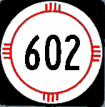
North terminus: I-40 (exit 20) and U.S. 491 at Gallup
Length: 30.724 miles
County: McKinley
History: Part of this road probably included original Rt. 35, and the original (c. 1930) road constructed on this alignment was designated NM-36. By 1935 this was designated NM-32, and it kept this designation through a number of route changes in this area in the 1930s. In 1988, it was renumbered NM-602.
Improvements: Two-lane paved highway
Comments:
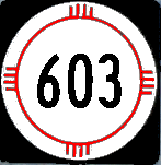
North terminus: NM-32 S of Techado
Length: 23.400 miles
County: Catron
History: This route was first established in the late 1930s as part of NM-117. In the 1940s, it became the southern extension of NM-36 and remained with this designation until 1988. It was then renumbered as NM-603.
Improvements: Gravel
Comments:
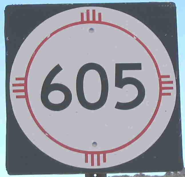
Photo taken north of Milan.
North terminus: San Mateo
Length: 22.234 miles
County: Cibola, McKinley
History: Established in the mid-1930s as part of NM-53. Renumbered in 1988.
Improvements: Two lane, paved
Comments:
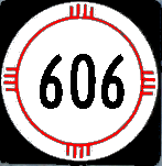
East terminus: NM-122 W of Grants (at I-40 Exit 72)
Length: 1.250 miles
County: Cibola
History: Established 1988 or after.
Improvements: Two lane, paved
Comments: This route number is not marked from I-40. The road is evidently the access road from I-40 to Bluewater, though it ends at NM-122, the I-40 frontage road.
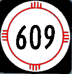
North terminus: U.S. 491 N of Gallup
Length: 1.969 miles
County: McKinley
History: Established 1988 or after.
Improvements: Two lane, paved
Comments: Runs along 9th St. from Maloney Avenue (just N of I-40), generally parallel to but eventually intersecting Muñoz Blvd. (U.S. 491). Appears to have been the original routing of U.S. 666.
East terminus: NM-118 at Gallup
Length: 2.314 miles
County: McKinley
History: Established 1988 or after.
Improvements: Urban boulevard
Comments: Maloney Avenue and Montoya Boulevard, which closely parallel I-40 on the north, from Muñoz Boulevard to Ford Drive (crosses I-40 at exit 22) and south to 66 Avenue.

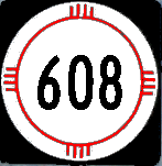
North terminus: NM-609 in Gallup
Length: 2.02 miles
County: McKinley
History: Established 1988 or after.
Improvements: Urban boulevard
Comments: 2nd Street, running from NM-602 on the south end of the city through town (through downtown, has a one-way duplex with 3rd Street carrying southbound traffic) and over I-40 to intersect Maloney Ave. (NM-609). Likely the original routing of NM-32 through Gallup.
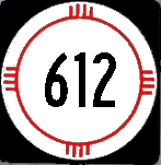
Previously --- Bluewater Lake Marina
North terminus: I-40 (exit 53) at Thoreau
Length: 9.186 miles
County: McKinley
History: Established around 1988. Apparently not a state highway before then, even though it received a 6xx number like the other newly redesignated routes at that time. Cibola County portion turned back early 2000s.
Improvements: Two lane, paved
Comments: On many maps, it appears ---wrongly --- to form a continuous loop with NM-412. It never intersected 412 at all, which ends at the state park on the north side of Bluewater Lake. I wonder if the choice of 612 was to echo 412, the highway on the other side of the lake.
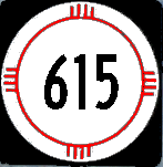
East terminus: NM-122 at Milan
Length: 0.468 miles
County: McKinley
History: Originally the west end of the I-40 Business Loop (Loop 32) through Milan and Grants. Redesignated probably late 1990s when the business loop designation was dropped.
Improvements: Two lane, paved
Comments: Not marked with this route. From I-40, the exit reads NM-605, which ends on NM-122 just north of this route. From NM-122, it is marked with trailblazers to I-40.
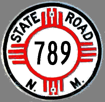
North terminus: Colorado State Line N of Shiprock (U.S. 666/CO-789)
Length: ~135 mi.
County: McKinley, San Juan
History: Apparently, the states from Arizona to Montana attempted to establish a U.S. 789 in the early 1950s to mark a route from Mexico to Canada. AASHO did not agree to the new U.S. route because it depended on overlay on existing U.S. routes for a significant amount of its length. So, for a period of around 10 years (c. 1955-65), Arizona, New Mexico, Colorado, Wyoming and Montana each marked a SR-789 that formed a continuous route from Nogales, Arizona (U.S. 89) to Sweetgrass, MT (U.S. 91). In New Mexico, the route followed U.S. 66 and U.S. 666. By the mid-1960s, some states (including New Mexico) ceased to mark the route. Colorado held onto it for a few more years.
Comments: This was unofficially the "Canada to Mexico Highway." Wyoming still has an independent state highway with this designation, having been the only state to actually change the numbering of the state routes on which it overlaid this route. However, this route still goes border-to-border in Wyoming, including concurrent sections with U.S. routes.

North terminus: NM-9 E of Animas
Length: 5.325 mi.
County: Hidalgo
History: Established 1995
Improvements: Paved, two lane access to mining area
Comments: Route number derived from former county designation, County 113, which may be derived from the nearly straight-on intersection with NM-113 at NM-9.
The only marker for this route, taken near Scenic Drive looking toward the museum.
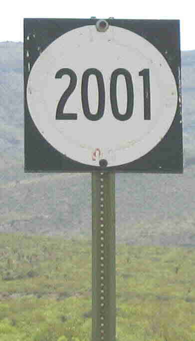
East terminus: International Space Center and Hall of Fame
Length: 0.3 mi.
County: Otero
History: Established 1990s. Not on the current highway log, so it is probably removed from the state system. The photo at left was taken 2003.
Improvements: Paved access road to museum.
Comments: This unusual designation was obviously based on the Arthur C. Clarke novel by the same name, inspired by the theme of the museum it connects to. This is one of only a couple of "orphan" routes in New Mexico that did not connect to another state highway at any place. Despite its degree of improvement unusual when compared to many Alamogordo city streets, Scenic Drive is not a state highway. It is a nice divided street through the better part of that city. This sign was still visible in 2008, and the city street sign at the intersection with Scenic Drive read "2001.".

East terminus: U.S. 64 E of Farmington
Length: 3.224 mi.
County: San Juan
History: Established early 2000s
Improvements: 2- and 4-lane, paved road
Comments: This road is actually shown as "U.S. 64 Truck Bypass" at either end and is marked along its route as simply "U.S. 64." (As is Broadway, the actual route of 64 through Farmington.) I still think the designation --- which may exist as an inventory designation only --- is based on a former San Juan County designation. To my knowledge, AASHTO has not approved a relocation of U.S. 64 from Broadway nor establishment of a U.S. 64 business route.
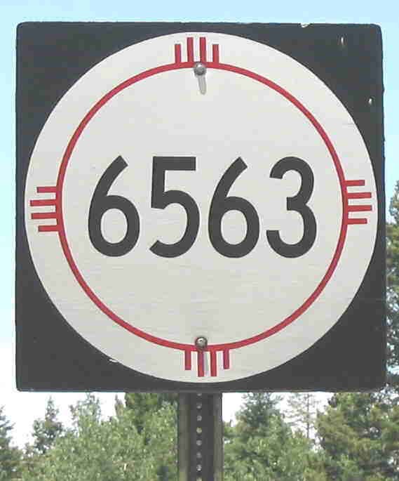
Photo taken at NM-130 near Cloudcroft.
East terminus: NM-130 near Cloudcroft
Length: 15.530 mi.
County: Otero
History: Established mid-1980s on former NFS road
Improvements: 2-lane, paved road
Comments: This designation threw me until a commenter on my web site explained that the number refers to the wavelength of the Balmer hydrogen transition (6563 Angstroms) which is observed in sunlight (apropos to the observatory at Sunspot). That wavelength is used by the solar astronomers to view the sun. The solar observatory has a visitor center is open to the public, and you can go inside a couple of the buildings housing telescopes as well.