|
|
Currently marked routes |
|
|
Routes eliminated or renumbered 1960-present |
|
|
Routes eliminated or renumbered 1950-1960 |
|
|
Routes eliminated or renumbered 1930-1950 |
|
|
Pre-1927 Routes - Not a depiction of an actual route marker. Where the route has a common, continuous history with a newer route this symbol will appear with that listing. |


North terminus: Rt. 13 at Roswell
1927 designation: NM-13 (on a different alignment)
Present-day roads along this route: NM-13 (in small part)
By 1927, the south end of this road was moved west of Hope, and the former routing does not show on a modern map.
No connection to post-1927 NM-51.

East terminus: Engel
Previously --- NM-52 at Elephant Butte
Length: 17.857 mi.
County: Sierra
History: Unclear when NM-51 was first marked as such because it was formerly a short route connecting U.S. 85 with longer NM-52 (see below). Likely in existence from before the 1930s, but probably a state highway with this designation no earlier than the mid-1950s. Although the amount of detail on the old maps I've reviewed is minimal, it appears that U.S. 85 may have followed this route up through the mid-1930s as far as what is now NM-179, then gone north to what is now NM-195 and followed that road west. After U.S. 85 was relocated, this was a county road until the 1950s.
Improvements: Paved, two lane.
Comments: It appears from observations on the ground that east of the Rio Grande, this road may have originally followed what is now NM-177 north to the intersection with (now-closed) NM-195, formerly NM-52, just east of Elephant Butte Dam. At some point, a bypass south of this intersection to intersect NM-52 (now 177) near the village of Elephant Butte was constructed. The eastern terminus of this route, the town of Engel (often misspelled as "Engle" on maps) is actually just a series of buildings that appear to serve as offices for the large Armendariz Ranch, owned by Ted Turner, which lies east of that point.

| South
terminus: Rt. 1 at Elephant Butte, by 1920s Rt. 40 at
Cutter (S of Engel) North terminus: Rt. 5 at Magdalena 1927 designation: NM-52 (on a different alignment in the northern part) Present-day roads along this route: NM-52 (the south half of the route at least). Extension to Cutter might include present-day Divide Well Road. As noted below, this original Rt. 52 was extended at both ends over time. The current route is somewhat close to the original extent of the route. The 1920s extension to Cutter is shown on a mid-1920s AAA map as the primary through route for traffic along with Rt. 40, not Rt. 1 between Ft. Selden and Hot Springs. |
Post-1927 Route:
Note: this is now properly a north-south highway from north of Truth or Consequences to U.S. 60. In the following description, it varies from north-south to east-west as the route's termini were moved.
North terminus: U.S.
60 between Datil and Magdalena
Previously --- (west) U.S. 85 at Hot
Springs (T or C) (1920s-30s); (north) U.S. 66
E of Laguna (1930s-40s); Near Alamo Band
Navajo Indian Reservation N of Magdalena (1940s-88)
South/East terminus:
NM-181 N of T or C
Previously --- U.S. 70
at Tularosa (1920s-40s); Engel
(1940s-88)
Previous
independent segment: U.S. 85 at
Belen to U.S.
60 at Abo Pass (1930s)
Length: 88.596 miles
County: Socorro, Sierra
History: As noted above, this road evolved from Rt. 52. On the east end, the pre-1927 route was extended over the east end of Route 26 and Route 112 across what is now White Sands Missile Range from Hot Springs (T or C) to Tularosa. In 1927, the north end was extended northwest of Magdalena to intersect U.S. 66 at about the junction with NM-6. This segment of road was apparently removed from the state highway system by the 1950s and was later shown as a primitive road. The segment of highway east of Engel, across the San Andres Range at Rhodes Pass to Tularosa, was probably closed during the Second World War as missile research began at White Sands. The route then ended at Engel, and in the 1988 renumbering it was terminated at I-25. The segment across Elephant Butte Dam was renamed NM-195, and the remainder became part of NM-51. The segment north of Magdalena was renumbered NM-169 in 1988. The independent segment shown above became the east extension of NM-6 in the 1940s and the south end of NM-47 in 1988.
Improvements: Still mostly gravel in its current alignment.
Comments: The independent segment between Belen and Abo Pass was hard to justify because of its lack of connection to the rest of NM-52, but upon examining the segment north of Magdalena to the Alamo Band Indian Reservation, I noticed roads from there east to Belen. There must have been a plan to ultimately connect these segments of NM-52.

North terminus: Rt. 6 at Rio Puerco
1927 designation: NM-12 (as far north as Puertocito, junction of NM-52)
Present-day roads along this route: No established roads appear to exist as remnants
No connection to post-1927 NM-53
Previously --- NM-32 at Ramah (1930s-1940s)
East terminus: NM-122 (E of I-40 exit 81) at Grants
Previously --- San Mateo (1940s-88)
Length: 83.002 miles
County: McKinley, Cibola
History: Originally the east end of Rt. 54 and then after 1927 a short route extending west from Grants, it was extended over old NM-36 to the Arizona border by the 1940s. Around the same time, it was extended northeast from Milan to San Mateo, a small town near Mt. Taylor. This segment was renumbered NM-605 in 1988.
Improvements: A major realignment created the loop through the El Malpais Lava Beds instead of straight across the hills from Grants to El Morro.
Comments:

See also 
East terminus: Rt. 6 at Grants
1927 designation: NM-53 (east of El Morro)
Present-day roads along this route: County roads and Indian routes serve as good approximations for the route from the Arizona border to El Morro. East of there it is NM-53 , except that the current segment through the El Malpais Lava Beds is not part of the original route.
No connection to post-1927 U.S. 54


| South
terminus: Rt. 1 at Bernalillo North terminus: Rt. 44 at Cuba 1927 designation: The pre-1927 routing had no designation. However, this same route had replaced former Rt. 44 from Cuba to Bloomfield. Present-day roads along this route: A road from U.S. 550 to Cabezon may be a remnant. Southeast of there, no established roads appear to correspond. |
Post-1927 Route:
South terminus: NM-44 near Cuba
North terminus: U.S. 550 at Aztec (1927-39)
Length ? miles
County: San Juan, Rio Arriba, Sandoval
History : Although north of pre-1927 Rt. 55, the post-1927 alignment was an extension of that route. It was routed over what had originally been Rt. 44 and later became NM-44 between Cuba and Aztec, along basically the same alignment that later became 44. At that time, NM-44 had a more easterly route through Canyon Largo. By the 1940s, 44 was moved onto this route and 55 disappeared.
Improvements: Gravel during this time period.
Comments: Maps from that era are a little unclear on what is 55 vs. 44.

Previously --- NM-10/14 near Tajique (1940s-88)
North (formerly east) terminus: NM-41 at Estancia
Length: 96.844 miles
County: Lincoln, Socorro, Torrance
History: Originally the first NM-15 , the portion east of Tajique was renamed NM-55 in the 1940s when NM-10 (later NM-14) was extended south over the remainder of NM-15. For a brief time in the early 1940s, the segment between Claunch (?) and U.S. 54 was designated NM-195 . In 1988, NM-14 was broken up into several routes to eliminate concurrent segments with other routes, and NM-55 assumed the former portion of NM-14 south of Tajique. It now again covers the entire length of the original route NM-15.
Improvements: Paved, two lane
Comments: I would recommend that NM-14 be restored over its previous extent and that this route be cut back to its pre-1988 extent.

North terminus: Rt. 1 SW of Las Vegas
1927 designation: U.S. 66
Present-day roads along this route: Though it has been realigned to the west, especially south of Dilia, it is generally the route of U.S. 84 .
No connection to post-1927 NM-56
See also

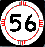
Previously --- NM-35 N of Chaco Canyon (1930-35); Chaco Canyon NM? (30s-40s), U.S. 66 at Thoreau (40s-mid-50s)
North terminus: NM-44 at Blanco Trading Post
Length: ~40 miles
County: Valencia (now Cibola), McKinley, San Juan
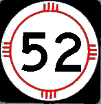
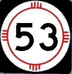
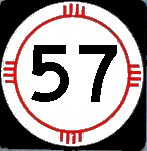
History: This route's early history is intertwined with that of original NM-35. The southern part of this route was originally designated NM-35, and after that route was eliminated, a small part near Thoreau was NM-164. The entire route became NM-56 in the late 1940s. The designation was extended around 1960 onto another road that went south from Milan and ended at NM-53. Around 1970, this route was renumbered NM-57 to avoid duplication with U.S. 56
Improvements:
Comments:

East terminus: Rt. 19 near Clovis
1927 designation: No apparent marked highways exactly along this route.
Present-day roads along this route: County roads from Puerto de Luna east; East of House, NM-89 is parallel to but not on the exact routing. NM-311 and NM-245 appear to have some of the same routing.
No connection to post-1927 NM-57
East terminus: NM-18 N of Amistad (1950-55)
Previously --- NM 18 E of Clapham (1935-50)
Length: ~48 miles
County: Harding, Union
History: Created in the mid-1930s from NM-120 through Bueyeros, then in large part along the route of original Rt. 84 through Reyes and Clapham to NM-18. Around 1950, the east end was moved onto a new road that went essentially east from Bueyeros to NM-18. By the late 1950s, the segment west of Bueyeros was removed from the state highway system and the segment east of Bueyeros became part of NM-102, which it is today. A small piece of the east end of the original route off NM-402 (former 18) is NM-562.
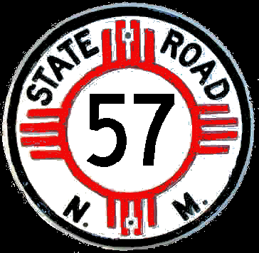
Previously --- I-40 at Thoreau (1988-1990s); NM-53 W of Ice Cave (1970-88)
North terminus: U.S. 550 at Blanco Trading Post
Length: 27.64 mi.
County: San Juan
History: As noted above, this route was previously designated NM-56 , and after the renumbering it extended all the way from I-40 to NM-44. In 1989, the portion of this route between Chaco Canyon and Crownpoint were removed from the state highway system and are now Indian Routes. The portion south of Crownpoint is now part of NM-371.A former segment from Milan to NM-53 around the ice cave was removed from the state system in 1988.
Improvements: Gravel
Comments: This route no longer directly connects to Chaco Culture National Historic Park. Traffic to the park from U.S. 550 uses County roads 7900 and 7950.

| West
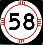
terminus: Rt. 21 at Cimarron East terminus: Rt. 37 at Clayton 1927 designation: NM-58 Present-day roads along this route: Still NM-58 from Cimarron to Springer, though it appears that original NM-58 ran south of Springer Lake directly into Springer from the west, rather than to the north as present. U.S. 56-412 from Springer to Clayton. |
Post-1927 Route:
West terminus: U.S. 64 at Cimarron
East terminus: I-25 N of Springer (Exit 419)
Previously --- U.S. 87 at Clayton (1927-1957)
Length: 18.909 mi.
County: Colfax
History: Part of original Rt. 58. In addition to its current route, originally ran along what is now U.S. 56 from Springer to Clayton. It may have been marked along U.S. 64 between Clayton and the Oklahoma border when that route was rerouted through Clayton in the late 1940s. Cut back to its current length when U.S. 56 was extended into New Mexico.
Improvements: Paved, two lane
Comments: Marked from the end of U.S. 56 in Springer as if this were still part of that road

North terminus: Rt. 8 at Questa
1927 designation: NM-3
Present-day roads along this route: It is now NM-522.
This replaced Rt. 8 as the main route between Taos and Questa, and appears to be basically the current route of NM-522.
No connection to post-1927 NM-59
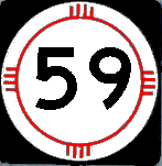
East terminus: Old NM-61 at Beaverhead
Length: 31.089 mi
County: Sierra, Catron
History: Called NM-185 in the 1930s. Might have been temporarily removed from state system in the late 1930s, or maybe my map from that era just doesn't show the road marking. In any event, it appears in the late 1940s as NM-59.
Improvements: Paved, two lane
Comments:

See also

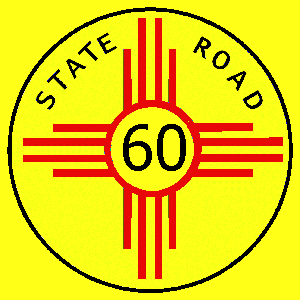
| South terminus: Rt. 14 at Jenkins North Terminus: Rt. 18 at Elida 1927 designation: NM-60 Present-day roads along this route: County roads |
South terminus: NM-18 at Jenkins
North Terminus: U.S. 366 at Elida
Length: ~30 mi.
County: Roosevelt
History: Part of original Rt. 60 , but removed from state highway system by 1930. It would have had to be renumbered if it had existed in 1932 due to the introduction of U.S. 60. Part of this road (south from Elida) was numbered as NM-440 in the 1950s through the late 1970s.
Comments: This road still exists in its entirety as a passable county road.


| South
terminus: Rt. 11 at Spalding North Terminus: Rt. 48 at Sherman 1927 designation: NM-61 Present-day roads along this route: NM-61 |
Post-1927 Route:
South terminus: U.S. 180 Near Faywood Hot Springs
North terminus: NM-152 near San Lorenzo
Previously --- U.S./NM-180 near San Lorenzo (1930s); NM-78 N of Beaverhead (1940s-88)
Length: 25.024 mi.
County: Grant, Luna
History: Part of original Rt. 61 . It was extended over NM-186 in the 1940s to NM-78. In the 1988 renumbering, the route immediately north of NM-152 became part of NM-35, and the remainder of NM-61 was removed from the state highway system. These roads are now Forest Service roads, some rated for 4-wheel drive only.
Improvements: Two lane, paved
Comments:

See also

| West terminus: Rt. 38 at Black
Lake East terminus: Rt. 39 at Roy 1927 designation: NM-62 Present-day roads along this route: NM-120 A mid-1920s extension from Roy to Pasamonte was designated Rt. 114. |
West terminus: NM-38 at Black Lake
East terminus: NM-58 E of Gladstone. May have extended as far east as NM-18 for a time.
County: Mora, Harding
History: Included original Rt. 62 and Rt. 114 east of Roy. The route was renumbered NM-120 around 1932 when U.S. 62 was extended into the state, and still bears this number.

| South
terminus: Rt. 1 at Pecos North Terminus: Cowles 1927 designation: NM-63 Present-day roads along this route: NM-63 Except for the extension south of Pecos, this road's alignment is essentially unchanged. |
Post-1927 Route:
South terminus: I-25 near Rowe (Exit 307)
Previously --- U.S. 84-85 at Pecos (1930-40s)
North terminus: Cowles
Length: 25.146 miles
County: San Miguel
History: Original Rt. 63. Portion south of Pecos part of Rt. 1. Extended south along old U.S. 85 when Pecos was bypassed.
Improvements: Paved, two lane
Comments:

See
also 
East terminus: Rt. 8 W of Taos
1927 designation: NM-96
Present-day roads along this route: NM-111, U.S. 285, NM-567
Purely coincidental that this intersected on the east what became U.S. 64 by the early 1930s.
No connection to post-1927 U.S. 64

Photo taken N of NM-329 in Las Vegas.
| West
terminus: Rt. 39 E of Mosquero East terminus: Rt. 18 N of Armstad 1927 designation: NM-65 Present-day roads along this route: NM-102, NM-420 This road followed approximately the present-day routes indicated above, but turned north to go through Hayden before intersecting Rt. 18. That northward segment appears to have been removed in 1927, and the route was extended west that same year. |
Post-1927 Route:
West terminus: El Porvenir
East terminus: NM-329 at Las Vegas
Previously --- NM-18 (402) near Amistad (1930s-1988)
Length: 15.505 mi.
County: San Miguel
History: The 1927 route included part of Rt. 22 (W of Las Vegas), all of Rt. 93 (Las Vegas to Mosquero) and part of Rt. 65 . In the 1988 renumbering, it was terminated at Las Vegas, and the segments northeast of NM-104 were renumbered NM-419 and NM-420.
Improvements: Pved, two lane
Comments: 65 and 104 had a fairly long concurrent section, with both routes extending west from Las Vegas into the mountains. 65 and 104 are still shown on the central Las Vegas exit, even though that route at that point is now just NM-104.

See also 
North Terminus: Rt. 1 at Salem
1927 designation: Probably none
Present-day roads along this route: This may be the route of present-day NM-187, old U.S. 85. Maps from the early 1920s show Rt. 1 bypassing Hatch to the north.
A very minor and short route that appeared to parallel Rt. 1 to the west.
No connection to post-1927 U.S. 66


| West
terminus: Rt. 20 S of La Liendre East terminus: Rt. 3 at Newkirk 1927 designation: NM-67 Present-day roads along this route: Possibly the very south end of NM-129, but otherwise only a few county roads approximate part of the route. |
Post-1927 Route:
South terminus: La Liendre
Previously --- U.S. 66 near Newkirk (late 1930s-1940s?)
North terminus: NM-104 E of Las Vegas
Previously --- NM-20 SE of La Liendre (1920s-30s)
Length: 11.066 mi.
County: San Miguel
History: The eastern part of this route was pre-1927 Rt. 67. That particular road doesn't even show up on a detailed map any more. Probably when NM-20 was cut back to Fort Sumner, the NM-67 designation was extended north to NM-65 (104) and then the south end was removed from the state highway system. Removed from the state highway system in 2004, turned over to San Miguel County.
Improvements: Northern two-thirds, paved, southern part gravel
Comments: This is the first route I've been able to document as being removed in its entirety from looking at minutes of the New Mexico Highway Commission (May, 2004).

East terminus: Rt. 3 at Cuervo
1927 designation: Probably none
Present-day roads along this route: Possibly county roads west of Cuervo approximate this route.
No connection to post-1927 NM-68

East terminus: U.S. 666 at Ya-ta-hey
Length: 19 mi.
County: McKinley
History: Route established mid-1930s. In mid-1960s, it was renumbered NM-264 to match the designation on the newly designated Arizona state route.
Comments:

Taken May 2005 in Española.
North terminus: U.S. 64 at Taos
Length: 45.513 mi.
County: Santa Fe, Rio Arriba, Taos
History: Originally designated U.S. 485 and then U.S. 64 . When U.S. 64 was extended northwest of Taos in the mid-1970s, it was renumbered as a state route.
Improvements: Four lane divided from Española to Velarde, remainder two-lane.
Comments: Coming south from Taos, you drop down into the Rio Grande valley, or gorge, created by the continental rifting.


| Probably not established pre-1927. |
Post-1927 Route:
South terminus: U.S. 66/I-40 at Cuervo
North terminus: NM-104 at Variadero
Previously --- NM-65 at Trementino (mid-1930s-1940s)
Length: ~25 mi.
County: Guadalupe, San Miguel
History: Established mid-1930s, and extended north to (then) NM-65 at Termentino. When NM-104 was extended southeast from Trementino to the Conchas Lake area in the 1940s, it occupied the northernmost part of NM-69. This route was removed from the state system around the time of the 1988 renumbering.
Improvements: Never paved
Comments: The northern part is designated San Miguel County routes C58B and C58D, while the southern part is shown on the map as now being a private ranch road.

See
also 
North Terminus: Rt. 1 at San Jose
1927 designation: NM-30
Present-day roads along this route: Possibly a short piece of NM-3 (Ribera to Villanueva) and NM-119. There is no road from Villanueva to Anton Chico today.
This road would have been renumbered in 1927 to avoid duplication with U.S. 70.
No connection to post-1927 U.S. 70

| West terminus: Rt. 41 at
Stanley East terminus: Rt. 1 at Bernal 1927 designation: NM-71 Present-day roads along this route: See history of post-1927 route below. Appears to have been extended west to NM-10 in 1927. Even so, it didn't last long after that. |
Post-1927 Route:
West terminus: NM-10 S of Golden
East terminus: U.S. 85 at San Jose
Length: ~40 mi.
County: Santa Fe, San Miguel
History: Includes pre-1927 Rt. 71 , removed from state highway system by 1932. The very westernmost segment is part of present-day NM-344, and part of the route east of U.S. 285 is formerly or presently part of NM-34. Parts of the road appear to be nonexistent today.
Improvements: Probably dirt its entire length at that time.
Comments: Given that this ended close to Las Vegas, it's possible but not likely that it is connected to the NM-71 that ran north from Las Vegas until recently.

North terminus: San Antonio
Length: ~ 5 mi.
County: San Miguel
History: Date of establishment not known. Eliminated by around 2000.
Comment: This route is still shown on Mapquest, and didn't seem to go anywhere of note. It ran up 8th Street in Las Vegas, either to the state park or ended on the north end of the city.

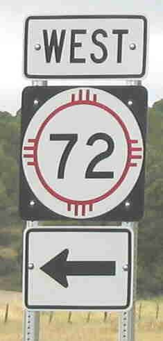 Photo taken at
junction NM-526 east of Raton
Photo taken at
junction NM-526 east of Raton
| West
terminus: Rt. 1 at Raton East terminus: Rt. 37 at Des Moines 1927 designation: NM-72 Present-day roads along this route: NM-72, NM-325 Almost unchanged in its extent since the early 1920s (see below). |
Post-1927 Route:
West terminus: I-25 (exit 452) at Raton
Previously --- U.S. 85/87 , later BL I-25 (until 1999)
East terminus: NM-456 at Folsom
Previously --- U.S. 385 / 64-87 at Des Moines (1920s-88); NM-58 at Gladstone (late 1920s)
Length: 36.001 mi.
County: Colfax, Union
History: Route 72 is an original New Mexico state route from the early 1920s. In the late 1920s, it extended south from just east of Des Moines to Gladstone, but this road probably does not exist any more. The only significant change in this route is that it was cut back from Des Moines to Folsom in 1988, and its east end became the new east end of NM-325. On the west, the segment west of I-25 in the city of Raton was removed from the highway system by 2000.
Improvements: Paved, two lane road its entire length.
Comments: A pleasant drive through the high plains country adjoining Raton Mesa. A slow, winding route, 55 mph at most with a lengthy 45 mph section. I would undo some of the 1988 renumbering by extending this route over current NM-325 (this route's former alignment) to U.S. 64-87.


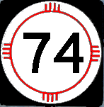
| South terminus: Rt. 72
at Folsom (may have bypassed Folsom to the east and ended at
Des Moines in the early 1920s North Terminus: Colorado State Line at Branson 1927 designation: NM-72 Present-day roads along this route: NM-456, NM-551 The 1923 state map shows a road east of Folsom that cannot be found on present-day maps. That would have run over some rough terrain. |
Post-1927 Route:
South terminus: US-64 N of Folsom
North terminus: Colorado State Line at Branson (present-day CO-389)
Length: 15 mi.
County: Union
History: Designated as a state route for a few years from the late 1920s to around 1940, then apparently removed from state highway system until the 1960s. Redesignated as a state highway with the new designation NM-551 . Runs through Tollgate Canyon.

Photo taken May 2005 at Peñasco
East terminus: NM-75 at Peñasco
Length: 2.688 mi.
County: Taos
History: Appears to have been designated as a state route in the late 1960s (shows on a 1967 map, but nothing else from that period). The road (but not a shield) is shown on the 2003 New Mexico highway map.
Comments: As noted above, the NM-73 designation was originally used on a road from old U.S. 64 (present-day NM-456) into Colorado near Branson. That road was removed from the state highway system from the 1940s until the 1960s when, presumably, this road had taken the NM-73 designation. That other route is now NM-551.

| South
terminus: Rt. 36 near Chamita North Terminus: Tres Piedras 1927 designation: NM-74 Present-day roads along this route: U.S. 285 The 1923 description is very close to present-day U.S. 285 and immediately post-1927 NM-74 south of La Madera. Also, prior to 1927, the road did not go through Taos Junction but on a parallel route to the west, which is still in existence. The road from Taos Junction to the Colorado border, onto which NM-74 was moved in 1927, was Route 116. |
Post-1927 Route:
South terminus: NM-68 at San Juan Pueblo
Previously --- NM-2 at Chamita (1920s-1940s)
North terminus: US-84 at Chamita
Previously --- CO State Line S of Antonito (1927-40s)
Length: 4.755 mi.
County: Rio Arriba
History: Originally part of Rt. 74, designated in the early 1920s and running from north of Española to the Colorado border. When extended north in the early 1930s, U.S. 285 followed what is now U.S. 84 and NM/CO-17. In the 1940s, 285 was rerouted up NM-74 into Colorado, and the route was reduced (and likely relocated) to a short connecting road between new 285 and (then) U.S. 64. The NMDOT Historic Highways document shows a 1930 map that has a route for NM-74 along what is now NM-554, from Tierra Azul to north of Ojo Caliente. Actually, in looking at the map I bet it's a typo - they meant to show NM-96. Further, I have a 1932 map that does not show this routing.
Comments:


Taken May 2005 at Chimayó
| West
terminus: Rt. 8 at Embudo East terminus: Rt. 30 at Holman (possibly projected - actual terminus may have been Rt. 76 near Trampas) 1927 designation: NM-75 Present-day roads along this route: NM-75, NM-580 The 1923 highway map shows a suspiciously straight road from about Trampas due east to Holman. There is no road there today, and those are some serious mountains in the way with peaks in the 10,000 to 12,000 foot range. Likely it was proposed but someone thought better of it and used existing roads through Vadito and Peñasco instead. |
West terminus: NM-68 at Embudo
East terminus: NM-518 E of Vadito
Length: 20.547 mi.
County: Rio Arriba, Taos
History: The western part of this road was original Rt. 75. The current route was established by the mid-1930s. The extent of this route is essentially unchanged since that time.
Improvements: 2-lane, paved road.
Comments: