 |
Currently marked routes |
 |
Routes eliminated or renumbered 1960-present |
 |
Routes eliminated or renumbered 1950-1960 |
 |
Routes eliminated or renumbered 1930-1950 |
|
|
Pre-1927 Routes - Not a depiction of an actual route marker. Where the route has a common, continuous history with a newer route this symbol will appear with that listing. |


| West
terminus: Rt. 4 at Deming East terminus: Rt. 40 at Engle 1927 designation: NM-26, NM-52. Present-day roads along this route: NM-26, NM-27, NM-51 to Engel Extended northeast of Deming toward Hillsboro, may have followed a now non-existent road north of current NM-152 along the east side of the Black Range to Las Palomas (Williamsburg). From Hot Springs, ended at Engle until the mid-1920s. A new route over the San Andres Mountains to Tularosa was designated Rt. 112 in the mid-1920s. The 1927 change was to terminate the route at Las Palomas and redesignate the route to Engle and along Rt. 112 over the San Andres Mountains as NM-52. |
Post 1927 Route:
West terminus: U.S. 180 at Deming
East terminus: I-25 (exit 41) E of Hatch
Previously --- (north) U.S./NM-180 at Hillsboro (1927-1940s)
Length: 47.862 mi.
County: Grant, Sierra, Doņa Ana
History: Route 26 is an original state route, and included this route from Deming to Nutt, and present-day NM-27. Originally it may have followed a road north from Hillsboro along the east flank of the Black Range and then east into Las Palomas (Williamsburg). This road no longer shows on a map. It then went east from Hot Springs (Truth or Consequences), followed what became NM-52 east through Engel, and over the mountain to Tularosa. In the late 1920s, it was cut back to Hillsboro. Some time in the 1940s, the routes north and east from Nutt (originally designated NM-27) were reversed and NM-26 was routed to Hatch.
Improvements: Paved, two lane
Comments: This is an important shortcut between I-10 west of Deming and I-25 north of Hatch. Two-lane but improvements to shoulders are underway. Posted 65 mph west of Hatch.


| West
terminus: Rt. 26 at Nutt East terminus: Rt. 1 at Hatch 1927 designation: NM-27 Present-day roads along this route: NM-26 The same routing as post-1927 NM-27. |
Post 1927 Route:
South terminus: NM-26 at Nutt
North terminus: NM-152 (formerly 90) at Hillsboro
Previously --- U.S. 85 at Hatch (1927-1940s)
Length: 30.200 miles
County: Grant, Sierra
History: This was an original, pre-1927 route. Route 27 ran from Nutt to Hatch along present-day NM-26, and the designation stayed the same until the 1940s. At that time, the routes north and east from Nutt were reversed and NM-27 was routed toward Hillsboro.
Improvements: Paved, two lane

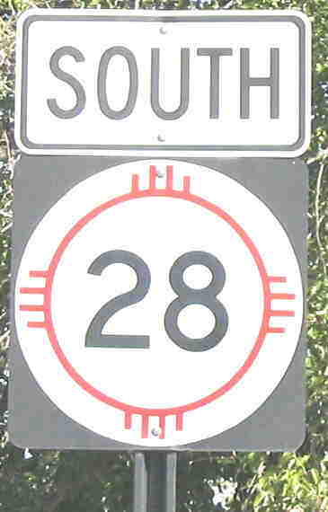
Photo taken south of Mesilla
| South
terminus: Texas state line near Canutillo North terminus: Rt. 1 at Mesquite 1927 designation: NM-28 Present-day roads along this route: NM-28, NM-192 The same routing as post-1927 NM-28. |
Post 1927 Route:
South terminus: Texas State Line S of La Union (FM 260)
North terminus: NM-478 in Las Cruces
Previously --- U.S. 80 at Mesquite (1927-35); U.S. 80 in Las Cruces (1935-40s); U.S. 85 (?) near Doņa Ana mid-1940s-1988
Length: 30.346 miles
County: Doņa Ana
History: Includes original Rt. 28. One of the original routes, it terminated at Mesquite until the mid-1930s when it was extended to Las Cruces. U.S. 85 was routed onto a new alignment immediately north of Las Cruces some time around the late 1930s, and the old alignment was first designated as NM-134 and soon afterward as the extension of NM-28. The extension through Doņa Ana was removed from the state system, probably around 1988.
Improvements: Two lane, paved
Comments: This is a pleasant drive through the lower Rio Grande Valley. It passes through historic Mesilla and the Staumann Farms pecan orchards, among the largest in the world.

North terminus: Rt. 4 at Deming
1927 designation: NM-11
Present-day roads along this route: NM-11
This road began as a short spur south of Deming and by the mid 1910s was extended south to Columbus. It was combined with Rt. 11 north of Deming and is currently the last remaining vestige of that road.
No connection to post-1927 NM-29.

North terminus: U.S. 85 SW of Las Vegas (1927-30?)
(2) South terminus: NM-3
at Duran
North terminus: U.S.
70/60 at Vaughn
(1930?-34)
Length (1): ~10 miles; (2): 17 miles
County: (1): San Miguel; (2): Torrance, Guadalupe
History: When the U.S. highway system was established in 1927, Route 3 in northeast New Mexico was rerouted from what became U.S. 54 to its current more north-south alignment. At first, NM-29 was established along a route from Villanueva to Bernal, which later became NM-3, and NM-3 ran from Vaughn to Anton Chico. When NM-3 was rerouted along its current more westerly route by 1930, the NM-29 designation was moved to the piece of old Route 3 between Duran and Vaughn, which was not then part of U.S. 54. This route became part of the extension of U.S. 54 around 1934.
Improvements: Gravel during this time period.
Comments: See also original NM-30. The original segment of NM-29 is no longer in the state highway system since NM-3 was rerouted from Villanueva northwest to Ribera.
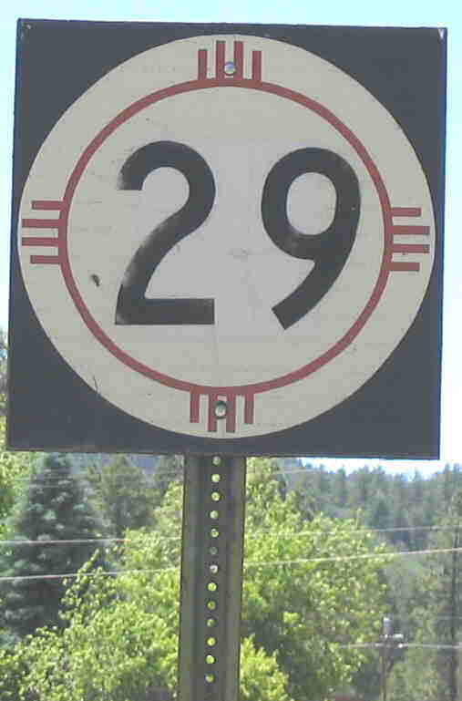
Photo taken at NM-17 in Chama.
North terminus: End of state maintenance
Length 1.05 miles
County: Rio Arriba
History: This road appears to have been the original route to the Colorado border and beyond to the village of Chromo and ultimately to Pagosa Springs (possibly Rt. 36A). It was originally designated as a leg of NM-17 and may have been temporarily removed from the state system in the 1930s. It was designated NM-29 some time in the 1940s. The road to Colorado existed until the 1970s at least, but does not show on a detailed current state atlas.
Improvements: Never paved, except for a segment at Chama.
Comments: This road does not show on the 2003 official New Mexico highway map, but from its current signage (6-2004) appears to still be a state route.

North terminus: Rt. 8 at Taos
1927 designation: NM-3
Present-day roads along this route: NM-518
This road and Rt. 21 coming up from Las Vegas were made the extension of NM-3 in 1927.
No connection to post-1927 NM-30.

East terminus: U.S. 66 at Anton Chico
Length: ~20 miles
County: San Miguel
History: Established on pre-1927 Rt. 70 along a route that probably no longer exists as a passable road. The segment from Ribera southeast to Villanueva is now NM-3, while part of the road near Anton Chico is now NM-119.
Improvements: Poor quality dirt road during this time period.
Comments: There appears to be no remnant of this road today between Villanueva and Anton Chico.

North terminus: U.S. 84 at Espaņola
Length: 8.949 miles
County: Santa Fe, Rio Arriba
History: It's unclear when this road was first designated as such. In the mid-30s, NM-5 extended down the south half of this road to (then) NM-4. It was designated NM-30 by the 1950s.
Improvements: Two lane, paved
Comments:


| West
terminus: Rt. 2 at Lake Arthur East terminus: Texas state line east of Lovington 1927 designation: NM-31 Present-day roads along this route: NM-249, U.S. 82, NM-83 It was a hard decision to not show this as having a separate history from present-day NM-31. That route, however, evolved from this one, with the east end being curved south to Maljamar and eventually south to U.S. 285, and it appears this route was still on its original alignment in 1927. |
Post 1927 Route:
South terminus: U.S. 285 at Loving
Previously --- NM-83 at Maljamar (1920s-1940s)
North terminus: U.S. 62-180 E of Carlsbad
Previously --- U.S. 285 (later Alt. U.S. 85 and NM-2) at Hagerman (1920s-1988)
Length: 22.676 mi.
County: Eddy
History: A direct descendant of Rt. 31, but no part of the current route includes any part of the original route. Original Route 31 extended from Route 2 at Hagerman to Lovington. The original route was extended south along what is now a county road and part of NM-360 to U.S. 62-180, then down the route that presently comprises 31. In the 1988 renumbering, the original route was renamed NM-249.
Improvements: Two lane, paved
Comments:


| South
terminus: Rt. 5 at
Quemado North terminus: Colorado state line N of Aztec 1927 designation: NM-32, U.S. 666, NM-19 Present-day roads along this route: NM-36, NM-602, U.S. 491, U.S. 64, NM-516, U.S. 550 The original, early 1910s extent of this road was north from Gallup, and it was extended south to Quemado by the early 1920s. |
Post 1927 Route:
South terminus: NM-12 at Apache Creek
Previously --- U.S. 60 at Quemado (until mid-1930s)
North terminus: U.S. 60 near Quemado
Previously --- U.S. 66 at Gallup (until 1988)
Length 41.323 mi
County: Catron
History: Original Route 32 ran north from Quemado toward Inscription Rock. By the mid-1930s, the southward extension to NM-12 had been established. Some time in the 1940s, the road north of U.S. 60 was redesignated NM-117 and 32 was shifted to a more westerly route that went through Salt Lake and Fence Lake, taking a more direct route into Gallup. In the 1988 renumbering, 32 was terminated at U.S. 60, and its former route was renumbered 601, 36, and 602 into Gallup.
Improvements: Two lane, paved
Comments:

East terminus: Rt. 21 at Cimarron
1927 designation: U.S. 485
Present-day roads along this route: U.S. 64
No connection to post-1927 NM-33.

East terminus: NM-34 (U.S. 82) E of Elk
(2) West terminus:
NM-24 at Piņon
East terminus:
NM-83 (U.S. 82) E of Elk
Length: (1): 45 mi; (2): 26 mi.
County: Otero, Chaves
History: First incarnation established by 1927, ran from north of Alamogordo through Cloudcroft east to what was then NM-34. When the original NM-33 and 34 east to the Texas border was renumbered NM-83 in the early 1930s, the NM-33 designation was moved onto the piece of former NM-34 that had run from Pinon to Elk. By 1940s, it was renumbered as an extension of NM-24, its current designation.
Comments: I can't tell if this route and NM-24 ended at the same spot or if 24 extended further southeast. The original NM-33 is now part of U.S. 82.

East terminus: Rt. 2 at Artesia
1927 designation: NM-34
Present-day roads along this route: NM-506, U.S. 82
No connection to post-1927 NM-34.
Previously --- NM-3 at White Sands (1927-32)
East terminus: Texas border east of Lovington
Length: ~100 mi.
County: Otero, Chaves, Lea
History: Part established pre-1927, It appears that the route was extended in 1927, and the segment from Piņon to Hope was rerouted onto a more northerly road (now NM-24). The entire route was shown on a 1932 map as "Poor Road." The segment from near Elk east to Lovington was combined with NM-33 and renumbered NM-83 by 1932, but the remaining piece to the Texas border kept the NM-34 designation probably until about 1944. That is when U.S. 62 was moved onto its current routing through Hobbs and U.S. 180 was extended into New Mexico from Texas, and NM-83 then took over the last piece of NM-34. The remaining section of NM-34 from Piņon to Elk became NM-33, and is now NM-24. The road east of Orogrande is now NM-506.
Comments:

Previously --- U.S. 285 near White Lakes (until 1990)
East terminus: I-25 frontage road FR 2116 near Rowe (near exit 307)
Length: 20.2 miles
County: San Miguel
History: Established in the 1950s as a dirt road connecting U.S. 285 and U.S. 85. The portion in Santa Fe County was removed from the state highway system in 1990 and is designated as County Road 34.
Improvements: Only paved portion is the I-25 frontage road (likely old U.S. 85)
Comments:


North terminus: Rt. 36 near Tierra Amarilla
1927 designation: NM-36, NM-32, NM-35
Present-day roads along this route: NM-602, NM-566, NM-57, U.S. 550, U.S. 64, NM-537(?), NM-95(?)
The original early 1910s route began at Aztec and went east to Tierra Amarilla. By the 1920s, the route had been extended south between Farmington and Gallup, through the Chaco Canyon area, and again south through Zuni to the tiny village of Atarque. The 1927 renumbering eliminated the original, Farmington to Tierra Amarilla route as well as the portion south of Gallup, and realigned the route's new south end to go south instead of southwest from Crownpoint, with a terminus close to Thoreau. Many of the roads over which this was routed are either gone or are minor BIA routes.
Post 1927 Route:
South terminus: U.S. 66 near Thoreau
North terminus: NM-55 (44)
Previously --- Colorado border N of Farmington (1940)
County: McKinley, San Juan
History: Route 35 is one of the original state routes, estending from Gallup up to Bloomfield. The first modern NM-35 has a confused history with NM-56 north of the Chaco Canyon. The 1932 map shows 35 extending north through Chaco Canyon but 56 designating the last leg before intersecting 55. My guess is that it may have been routed over a primitive road that paralled 55. The 1936 map has the southern part called 164 and the northern part 56. Just to confuse things, in 1936 and on the official NM map from 1940 it is also shown on what is now NM-170 north of Farmington, and by the late 1930s this is the only remaining segment of original NM-35. The 1937 map has the entire route south of NM-44 as 35, and running from U.S. 550 to the Colorado border in 1940, but south of 44 it has been replaced by 56 by the late 1940s. The southern part of this route is part of NM-371, and from near Crownpoint to Chaco Canyon it includes Indian routes 9 and 14. From Chaco Canyon north it is NM-57 (but see the discussion for NM-57 concerning closure near Chaco Canyon).
Improvements: Dirt or primitive roads during the time this designation was active.
Comments: Very difficult to separate the history of original NM-35 from that of NM-56. See also NM-164. More maps from the early to mid-30s would be helpful.

Previously --- NM-61 at the Continental Divide (1970-88)
North terminus: NM-15 W of Lake Roberts
Length: 27.52 mi.
County: Grant
History: Part of former NM-25 and NM-61. Portion that was NM-25 was redesignated around 1970 to eliminate duplication with I-25. NM-61 was probably truncated in 1988.
Improvements: Paved, two lane
Comments:

North terminus: Colorado state line NE of Chama
Spur Route: Route 36A ran from Chama NW to the Colorado state line
1927 designation: NM-2
Present-day roads along this route: U.S. 84, NM-17 (36A route may include NM-29)
A 1926 map shows the segment from Abiquiu to Espaņola designated as Rt. 115. That would have been a short-lived designation, as the entire original Rt. 36 became the extension of NM-2 in 1927.
No connection to post-1927 NM-36.

Photo taken October 2005 at W end of NM-117.
Previously --- NM-32 E of Zuni (1930s-1940s); U.S. 60 at Pie Town (1940s-1988)
North terminus: NM-53 W of Pescado
Previously --- Arizona Border W of Zuni Pueblo (1930s-1940s); NM-32 north of NM-53 (1940s[?]-1988)
Length: 72.22 mi.
County: Catron, Cibola, McKinley
History: Originally ran along what is now NM-53 from the Arizona border to East of Zuni. At some point, 53 ws extended west and 36 was routed south from Zuni to NM-36, then southeast from Fence Lake to Pie Town. A northern extension from east of Zuni to NM-36 was established in the 1950s. By 1988, the segments from Zuni south (which does not show on a current detailed map) and from NM-53 north to NM-602 (old 32), which is Indian route 4, were removed from the state highway system. The designation 32 was rerouted in 1988 onto the southernmost leg of old NM-117, and the former route to Pie Town became NM-603.
Improvements: Paved, two lane
Comments: The current route does not include any portion of the original route.

East terminus: Texas state line east of Clayton
1927 designation: U.S. 385
Present-day roads along this route: U.S. 64-87, U.S. 87. Also, the alignment of this road includes a piece of NM-193
The most significant story with this road is the southward dip east of Raton, an alignment which runs well south of the current alignment of U.S. 64-87. The original alignment of the road did not include Des Moines, and even by 1927 the dip was still there though the road had been brought up to Des Moines.
No connection to post-1927 NM-37.

Previously --- U.S. 70 near Ruidoso (1930-88)
North terminus: U.S. 380 E of Carrizozo
Length: 14.162 mi.
County: Lincoln
History: First established c. 1930. Segment south of the junction with NM-48 attached to 48 in the 1988 renumbering.
Improvements: Paved, two lane
Comments:


| South
terminus: Rt. 21 at Lucero (E of
Mora) North terminus: Rt. 8 at Questa 1927 designation: NM-38 Present-day roads along this route: NM-434, U.S. 64, NM-38 The original, early 1910s alignment of this road was essentially its current extent: Questa to what is now Eagle Nest. By the 1920s it was extended south to near Mora. |
Post 1927 Route:
West terminus: NM-522 at Questa
East terminus: U.S. 64 at Eagle Nest
Previously --- (south) NM-3 at Mora (mid-1930s-1988)
Length: 29.266 mi.
County: Taos, Colfax
History: Original Rt. 38. The southern end of the pre-1927 route was algined to end at Mora instead of Lucero by about 19930. This southern segment was renumbered NM-434 in 1988.
Improvements: Two lane, paved
Comments: Passes just north of Wheeler Peak, highest point in New Mexico. Serves several ski areas, including Red River. Very scenic drive, and generally a good mountain road.


| South
terminus: Rt. 84 S of Gallegos (originally Rt. 18 at
Logan) North terminus: Rt. 1 at French (between Springer and Maxwell) 1927 designation: NM-39 Present-day roads along this route: MN-39 This was originally established in the early 1910s along what is mostly its current alignment (except for the now non-existent northern segment from Taylor Springs to French), with its south end at Rt. 18 in Logan. By the early 1920s, the south end of Rt. 39 was realigned due south from Mosquero and intersected Rt. 84, which extended south from Gallegos, north of Tucumcari. A road from this intersection was projected to extend south to Tucumcari, though it isn't clear whether it was ever actually constructed (it would have crossed the Canadian River). Rt. 102 replaced Rt. 39 from Logan to at least Gallegos, where it would have intersected Rt. 84, and possibly northwest to the intersection with Rt. 65. NM-39 was extended back to Logan along its original alignment in the 1927 renumbering, which strongly suggests the Tucumcari routing was never built. The projecting routing south of Mosquero appears to correspond with present-day San Miguel County Road J1. |
Post 1927 Route:
South terminus: U.S. 54 at Logan
Previously --- NM-18 at Grady (1935-88)
North terminus: U.S. 56-412 at Abbott (1920s-40, 1945-present)
Previously --- U.S. 64-87 W of Capulin (1940s)
Length: 93.712 mi.
County: Quay, Harding, Colfax
History: Part of original Route 39. (which ran south to near Mule Creek). Extended south to Grady in the mid-1930s. This segment renumbered NM-469 in 1988. A short-lived extension to U.S. 64-87 west of Capulin --- more or less present-day NM-193 --- existed in the early 1940s but was removed from the state system after a few years. NM-193 came along some years later.
Improvements: Paved, two lane
Comments:

North terminus: Rt. 1 at San Marcial
1927 designation: none
Present-day roads along this route: County roads S of Engel. No through route north of Engel.
This road seems to parallel the BNSF railroad across the Jornada del Muerto. It is probably closer to the historic El Camino Real than the route of Rt. 1 further west. North of Engel, the route is on private land and through traffic is not allowed --- too bad.
No connection to post-1927 NM-40.

East terminus: NM-34 at Dunken
County: Otero
History: This route existed briefly in the late 1920s, and appears to have been removed from the state system by the early 1930s.
Improvements: Appears to have been dirt in the late 1920s.
Comments: This road still exists as forest roads, but has not been a state highway since the early 1930s. This designation pre-1927 was used on the piece of the El Camino Real (King's Highway) that ran across the Jornada del Muerto, but that road was removed from the state highway system by 1927.

See also
East terminus: NM-108 south of Hollene
Length: ~ 8 mi.
County: Curry
History: Established 1950s. Renumbered as NM-19 around 1970 to avoid duplication with I-40.
Comments: This road appears to provide access for farms on the far eastern edge of New Mexico.


South
terminus: Rt. 19 at Willard
North
terminus: Rt. 2 at Lamy
1927
designation: U.S. 470, NM-41
Present-day roads
along this route:
NM-41
Post 1927 Route:
South terminus:
U.S. 60 W of Willard
Previously
--- U.S. 470/366 at Moriarty (1927-39);
NM-15/10 N of Gran Quivira (1930s-40s);
U.S. 380 at Bingham (1940s-50s);
NM-10/14 N of Gran Quivira
(1950s-70s)
North terminus: U.S. 285 Near
Lamy
Previously --- Lamy (N of U.S. 285 from
the 1960s to 1988(?))
Length: 62.091 mi.
County: Torrance, Santa Fe
History: Established on the alignment of original Route 41. The segment from Moriarty to Willard was U.S. 470 and then 366 from 1927 until 1939. Extended south from NM-15 or 10 in the late 1930s over former NM-161. This segment removed from state highway system around 1960. An extension north to Lamy existed from the 1960s to 1988.
Improvements: Two-lane paved.
Comments: With extension and subsequent removal of south end from state system, this route is about the same as when it was established in the 1920s.

East terminus: Rt. 11 at Silver City
1927 designation: U.S. 80, U.S. 180 (I)
Present-day roads along this route: NM-80, NM-90
This designation was extended southwest from its original terminus over what was originally the west end of Rt. 4.
No connection to post-1927 NM-42.

Photo (windshield) taken at U.S. 54 in Corona, March 2008.
East terminus: U.S. 54 at Corona
Previously --- U.S. 285 S of Ramon (1940s-1950s); U.S. 60 W of Yeso (1950s-88)
Length: 35.542 mi.
County: Lincoln, Torrance
History: Established by mid 1930s. Extended east over former NM-179 to U.S. 285 in the 1940s, then north from there to U.S. 60 near Yeso in the 1950s. In 1988, the segment from U.S. 285 to U.S. 60 was removed from the state highway system, and the segment between U.S. 54 and 285 was renumbered NM-247. The route therefore has reverted to its original termini.
Improvements: Two-lane, paved.
Comments:

East terminus: Rt. 5 at Datil
1927 designation: NM-78?
Present-day roads along this route: NM-159, NM-163, NM-52, connecting Forest Service roads
No connection to post-1927 NM-43.
North terminus: U.S. 366 near Ruidoso
County: Otero
History: This route existed briefly in the late 1920s, but by 1932 it was marked as an extension of NM-24. It kept this designation until 1988, when it became NM-244.
Improvements: Appears to have been dirt in the late 1920s.
Comments:

Length: Unknown (but short)
County: Sandoval
History: Dates of establishment and removal from the state highway system unknown. Probably existed into the 1990s, established before 1988.
Comment: I was advised of this route by Rick Ballentine, who indicated it appeared to be aligned over a bridge west of old NM-44 (now U.S. 550) that had been washed out and terminated on a mesa. One can find this designation marked on the USGS topo map. I wonder if the designation (one removed from 44) was accidental or intentional.


| South
terminus: Rt. 1 at Bernalillo North terminus: Rt. 19 at Farmington 1927 designation: NM-44, NM-55(?) Present-day roads along this route: U.S. 550 Rt. 44 in its pre-1927 configuration ran very close to the alignment of NM-44 after the 1940s and present-day U.S. 550. After 1927, NM-55 ran along the northwesterly end of Rt. 44 for about 15 years. This was an extension of Rt. 55, which in hte pre-1927 era ran roughly parallel to the southeasterly end of Rt. 44. |
Post 1927 Route:
South terminus: I-25 at Bernalillo
Previously --- NM-10/14 at Cedar Crest (1940-88)
North terminus: U.S. 64 at Bloomfield
Previously --- U.S. 550 at Aztec (1940-88)
Length: 151.987 mi. (after 1988)
County: Sandoval, Rio Arriba, San Juan
History: Route 44 was an original state route from north of Albuquerque to Farmington. In the 1930s, between Cuba and Farmington NM-44 took a more northerly route through Canyon Largo, while the current alignment was designated NM-55. By the 1940s, 44 was on its final alignment north of U.S. 85. In the 1940s, it was connected to original NM-45 through Placitas ultimately to Cedar Crest, Its extension east of U.S. 85 (I-25) was renumbered in 1988 as NM-165 and as an extension of NM-536 (formerly just the Sandia Peak highway), and the segment between Bloomfield and Aztec, because it had a short common section with U.S. 64, was designated as a separate route, NM-544.
Comments: Because of its important connecting function, this road always carried a signficant amount of traffic. As a two-lane road, it was a dangerous road with a high accident rate. A common bumper sticker read, "Pray for me...I drive 44." New Mexico dedicated a considerable amount of money in the 1990s ($312 million) to upgrading the entire road over a several-year period, and once construction was complete renamed the road as an extension of U.S. 550.

East terminus: Rt. 4 at Lordsburg
1927 designation: U.S. 180 (I)(?)
Present-day roads along this route: Likely none
Although it appears this route became U.S. 180 (I) and ultimately U.S. 70, this road's alignment is somewhat south of present-day U.S. 70. There is, however, a railroad between Lordsburg and Duncan that appears to match the position of Rt. 45 on maps, suggesting the 1920s road paralleled the railroad. Confounding the analysis is the presence of Rt. 106, shown as the primary route from Lordsburg to Duncan (part of the Atlantic Pacific Highway) running north of Rt. 45. My guess is that U.S. 180 (I) was put on Rt. 45 in 1927 but that a new alignment was opened shortly thereafter, by the late 1920s. Rt. 106 was also replaced by this new road but a new state highway, NM-82 (now NM-92) was constructed to provide access to Virden.
No connection to post-1927 NM-45.
East terminus: NM-10 near Cedar Crest
County: Sandoval, Bernalillo
History: This route existed briefly in the late 1930s to the 1940s, but became the extension of NM-44 once the routes were connected.
Improvements: Apparently a dirt road.
Comments:

North terminus: [See note at bottom of Comments] Central Avenue (previously terminated at different intersection when Central was marked U.S. 66 and BL I-40) in Albuquerque
Length: 12.67 mi.
County: Bernalillo
History: Established in the 1940s. This follows Coors Road into the southwest side of Albuquerque.
Improvements: Paved, two lane except for four lane urban segments. Rerouted to the west to provide a direct connection with Coors Road.
Comments: This is confusing but
there were once two separate north-south roads named "Coors"
running west of the Rio Grande in Albuquerque: Coors Road and Coors Blvd.
Coors Blvd. (45) came in from the south and ended at Central Avenue. Coors
Road. (previously marked NM-448) intersected Central about 1/2 mile west
of Coors Blvd. The north end of Coors Blvd. was realigned in the 1990s to
intersect Central at Coors Blvd., and NM-45 was moved onto the realigned
road and terminated at Central. The old north end of Coors Blvd. became
Old Coors Drive, and Coors Road north of Central became Coors Blvd. north
of Central,
Which brings the next point of discussion. The
south end of NM-448 on Coors Road (now Blvd.) was turned back to the
city of Albuquerque between Central Avenue and St. Josephs Drive,
sometime in the 1990s. In October 2010, the Highway Commission approved an
exchange between NMDOT and the city of Albuquerque whereby the city
took jurisdiction over Unser Blvd. (NM-345) and NMDOT took control over
Coors Blvd. between Old Coors and St. Josephs. The Comission minutes
did not indicate what changes in route markings, if any, would occur.
It's possible that 448 would extend south to Central and then become 45
with an end-to-end junction, but it is also possible (and would make
sense) that the two routes will be consolidated under one number. This
listing will be updated once more information is
available.

East terminus: Rt. 41 at Moriarty
1927 designation: U.S. 470
Present-day roads along this route: NM-333
By 1937, this became part of U.S. 66.
No connection to post-1927 NM-46.

North terminus: NM-44 N of Corrales
Length: ~10 mi.
County: Bernalillo, Sandoval
History: Established in the 1950s. Redesignated as an extension of NM-448 and NM-528 in the 1988 renumbering.
Comments: This road went through Corralles prior to the heavy development in the Rio Rancho area. Where it crossed the Rio Grande, it was called Corralles Road; now it is Alameda Blvd.


| South
terminus: Rt. 19 at
Belen North terminus: Rt. 1 at Alameda 1927 designation: NM-47 Present-day roads along this route: NM-47, possibly a temporary route for U.S. 85 in part At this time I have no information as to the precise route that NM-47 would have taken through Albuquerque, though it's very possible that it followed today's route of 2nd Street to end at 4th Street north of the city. |
Post 1927 Route:
South terminus: U.S. 60 near Abo Pass
Previously --- U.S. 60 near Bernardo (1930-50s); La Joya (1950s-88)
North terminus: NM-556 in Alameda
Previously --- U.S. 66 in Albuquerque (1930-40s); U.S. 85 in Alameda (1940s-50); U.S. 85 Alternate in Albuquerque (1950s-85)
Length 59.644 mi.
County: Socorro, Valencia, Bernalillo
History: Part of original Rt. 47 from south of Belen to Albuquerque (2nd and Central) and kept that designation after 1927. Extended north along 2nd Street to the North Valley in the 1940s. That segment was renumbered Alternate U.S. 85 from the 1950s to the 1980s. Redesignated as NM-47 in the mid-1980s. In the 1988 renumbering, the south end of NM-47 was shifted onto old NM-6 from Rio Communities southeast to U.S. 60 near Abo Pass. The south end of NM-47 was renumbered NM-304. Near Albuquerque, 47 was moved onto the route of old NM-361 along SE Broadway, eliminating a jog from SE Broadway to SW 2nd Street in the South Valley. The old routing of 47 along SW 2nd St. was redesignated NM-303 (now removed from highway system). NM-47 replaced 361 and a small part of NM-98 north on Broadway (where it now is connected to Edith Blvd.) to Candelaria, where it jogs west to 2nd Street NW.
Improvements: Paved, mostly two lane except for four lane urban segments such as south of Albuquerque
Comments: I'm curious about why the
south end was shifted as it was, since it appers the straight route would
have been to maintain 47 on its old route (however, the road bends onto
the new routing). As noted above, there have been a number of changes in
the routings of state highways in the downtown Albuquerque area. 47 is
about the only survivor of the old routes through there. Also, even though
the official elimination of Alternate U.S. 85 didn't happen until the
1980s, and maps continued to show this designation, I observed that NM-47
was marked in place of Alternate 85 around 1977. Its northern terminus is
the end of its intersecting route, NM-556; in fact, there
is a "South NM-556 - Tramway Blvd." * sign north of the intersection of
2nd and 4th Streets. NM-313 intersects 1/4 mile north of
this point.
In October 2010, the NM Highway Commission heard a
proposal to exchange NM-47 from the 2nd St./4th St. intersection south to
the city limits, as well as an ambiguously described segment south of the
south city limits with Bernalillo County, in return for NMDOT taking
control of Dennis Chavez Parkway (the westward extension of NM-500). This
will be described here once it becomes final.
* Yes, the northbound route is marked southbound. NM-556 is consistently marked northbound north of I-40, even after the route bends west.

East terminus: Rt. 26 at Lake Valley
1927 designation: U.S. 180 (I), NM-61(?)
Present-day roads along this route: NM-152, NM-61, remainder no existing road
This road crossed the Black Range along a route no longer in existence. It appears to be a point different from the Emory Pass crossing on MN-152 (which did not exist in 1927 in any event).
No connection to post-1927 NM-48.

Previously --- NM-37 at Angus (1930-88)
East terminus: U.S. 380 at Capitan
Previously --- U.S. 285 at Roswell (1940s-88)
Length 22.14 mi.
County: Lincoln
History: Established c. 1930, running from NM-37 at Angus to U.S. 380 (then 566) at Capitan. Extended north and east to Roswell in the 1940s. The segment from Capitan to Roswell was renumbered NM-246 in the 1988 renumbering, and 48 was extended south to Hollywood over the southern part of NM-37.
Improvements: Paved, two lane
Comments: Maps from the 1950s are ambiguous about whether the Angus to Capitan segment was in the state system during this time. They don't show a route shield in this segment, but it is relatively short compared to the rest of the route as it then existed.

North terminus: Rt. 26 at Lake Valley
1927 designation: None
Present-day roads along this route: None
Parts of this route can be inferred from present-day county and Forest Service roads.
No connection to post-1927 NM-49.

East terminus: NM-47 at Valencia
Length 6 mi.
County: Valencia
History: Probably established 1940s, when NM-6 was moved south from Los Lunas as an overlay of U.S. 85 to Belen, where it replaced old NM-52 going southeast. This arrangement probably existed until 1988, when the southerly extension of NM-6 was renumbered, and NM-6 was again extended east to Valencia.
Improvements: Paved, 2-lane
Comments:

North terminus: Rt. 3 at Alamogordo
1927 designation: U.S. 366
Present-day roads along this route: U.S. 54
No connection to post-1927 NM-50.

East terminus: NM-63 at Pecos
Length: 6.028 mi.
County: Santa Fe, San Miguel
History: Originally a small piece of Rt. 1. Until the 1940s, U.S. 84-85 went through Pecos along what is now NM-63 and NM-50. The designation NM-50 first shows up in the early 1950s after construction of the bypass around Pecos.
Improvements: Paved, two-lane
Comments: I have a map from the early 1980s that shows old U.S. 85 through Pecos as Alternate U.S. 84-85. This is the only map that shows this designation, and due to the date (after a time when U.S. alternates would have been used in New Mexico) I tend not to believe it.
