 |
Currently marked routes |
 |
Routes eliminated or renumbered 1960-present |
 |
Routes eliminated or renumbered 1950-1960 |
 |
Routes eliminated or renumbered 1930-1950 |
| 71 | Routes for which no record has been found so far of this number being assigned. (Post-1927 only). |
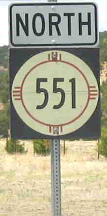
Photo taken near junction wtih NM-456, June 2004.
North terminus: Colorado State Line (CO-389) near Branson
Length: 6.440 mi.
County: Union
History: Originally part of Rt. 73, established around 1920, which kept its designation as NM-73 in 1927. The road was then removed from the state highway system in the 1940s and restored in the mid-1960s. The old designation had been reused on a road near Peñasco by then, and the route was given a new designation.
Improvements: Two-lane, paved.
Comments: Passes through Tollgate Canyon. The highway empties onto the plains right at the Colorado border, just south of Branson.
East terminus: U.S. 54 S of Logan
Length: 1.900 mi.
County: Quay
History: Date of establishment unclear because the route is so short. Probably 1980s.
Improvements: Paved, two lane road.
Comments:
East terminus: NM-111 W of Tres Piedras
Length: 42 mi.
County: Rio Arriba
History: This new crossing of the southern San Juan Mountains was completed about 1970. It became part of the westward realignment of U.S. 64 about 1975.
Improvements: Originally gravel over the summit, later paved.
Comments: The high point on this road is 10,500 feet, making it the highest through highway in New Mexico.
North(east) terminus: NM-111 S of La Madera
Length: 21.153 mi.
County: Rio Arriba
History: Originally part of NM-96, renumbered in 1988.
Improvements: Paved, two lane road.
Comments:
East terminus: BL I-25 (Loop 17) S of Raton
Length: 31.885 mi.
County: Rio Arriba
History: Appears to have been established mid-1980s.
Improvements: Paved, two lane road.
Comments: The junction with BL I-25 is just north of the southernmost Raton exit, but this route is not indicated on I-25.
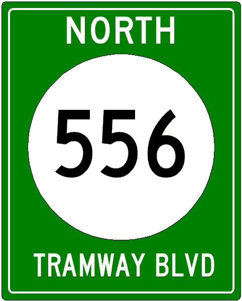
Previously --- I-25 (exit 234/Tramway Blvd. exit) c. 1970-88; indeterminate intersection in downtown Albuquerque (1988-90)
East (south) terminus: I-40 (exit 167) E of Albuquerque
Previously --- Sandia Peak Tramway (1970-mid 1980s)
National Highway System south of Paseo del Norte (NM-423)
Length: 15.701 mi.
County: Bernalillo
History: Established around 1970 along Tramway Road from I-25 east to the tramway; extended south along Tramway Blvd. to I-40 probably in the 1980s. According to the 1988 New Mexico official highway map, this route was extended all the way down 4th Street into Albuquerque replacing U.S. 85, though its southern terminus is not known. It may have extended to NM-314 or ended where 4th Street turns into a pedestrian mall. However, it's likely from other maps that this extension along 4th St. was renumbered NM-313 sometime thereafter. This 4th St. segment was subsequently removed from the highway system, probably in the mid-1990s, and somewhere in the route juggling north of Albuquerque, NM-556 was extended south 1/4 mile from NM-313 (old U.S. 85) to NM-47 at the junction of 2nd and 4th Streets NE, forming an end-to-end terminus for both routes.
Improvements: Four lane urban road from I-40 to near the tramway station, two lane road from there west.
Comments: Though it's marked as a north-south road, I've shown it in an east-west orientation to more easily accommodate its earlier extent. Reassurance markers along this road on the east-west portion take the form of the sign depicted. "North" is from I-40, and the north indication continues even after the road turns west. At the west end, when you are northbound coming off 4th Street, a sign tells you that you are going "South" on NM-556, Tramway Blvd. On the north-south leg, however (at least near Montgomery Blvd.), standard route marker signs are used.
East terminus: NM-2 at Lake Arthur
Length: 4.300 mi.
County: Chaves
History: Established around 1970
Improvements: Paved, two lane road.
Comments: The first of four routes clustered by number, and therefore probably established around the same time.
East terminus: NM-2 at Hagerman
Length: 7.103 mi.
County: Chaves
History: Established around 1970
Improvements: Paved, two lane road.
Comments: Part of the 557-560 cluster south of Roswell.
East terminus: U.S. 285 S of Roswell
Length: 5.900 mi.
County: Chaves
History: Established around 1970? Appears to be eliminated as of 2007 - it is now marked with a county route designation.
Improvements: Paved, two lane road.
Comments: This route does not show on any maps prior to 2003. It seems likely that, if it was a post-1988 route, it would have received a 2xx number. However, it is also possible that the 559 number fit into the existing sequence of 557-560 that it was used instead.

East terminus: NM-2 at Dexter
Length: 3.900 mi.
County: Chaves
History: Established around 1970. Appears to be eliminated as of 2007 with all route signage removed at its junction with U.S. 285 (but not replaced as of 3/07 with a county route number).
Improvements: Paved, two lane road.
Comments: Lastof the 557-560 cluster south of Roswell.
561
East terminus: NM-402 S of Clayton
Length: 19.562 mi.
County: Union
History: Established around 1980
Improvements: Paved, two lane road.
Comments:
563
North terminus: NM-118 at Gallup
Length: 3.291 mi.
County: McKinley
History: Probably established around 1980
Improvements: Urban street
Comments: Bypasses Gallup on the southeast side. Intersects NM-118 (66 Avenue) about 2 miles west of exit 26.
565

North terminus: Churchrock Mines near Navajo Nation boundary NE of Gallup
Length: 11.644 mi.
County: McKinley
History: Probably established 1980s
Improvements: Two lane paved
Comments: Since New Mexico does not typically use "prefix" numbering, it's most likely that the 566 designation is coincidental and not a result of its beginning at old route 66.
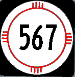
East terminus: NM-570 near Carson
Length: 11.819 mi.
County: Taos
History: Originally part of NM-96, renumbered 1988
Improvements: Two lane paved along its east-west section, then rather rough washboard dirt (but passable) where it turns south to go down into the Rio Grande Gorge.
Comments: Intersects NM-570 in an end-to-end terminus at a point where that route is closed through the Taos Pueblo.
Photos:
|
Just repeat, "This is not 35W, this is not 35W" before crossing the bridge.
This is at the end-to-end termini of NM-570 (see below) and 567 in the Rio Grande Gorge southwest of Taos. Looking west across the bridge. You can see the road angling up the gorge behind the bridge. Going north, this is the last bridge to cross the Rio Grande until the Rio Grande Gorge bridge on U.S. 64 about 10 miles north. This is a fine example of a through-truss bridge constructed in 1930. It's only one lane wide (thankfully). |
 |
| How comforting to know that in 1930 you could trust this bridge to hold two 15-ton trucks. It was built by the Virginia Bridge and Iron Co. of Roanoke. |  |

East terminus: NM-122 at Milan
Length: 1.050 mi.
County: Cibola
History: Date of establishment not known, probably pre-1988 by its number.
Improvements: Probably paved
Comments: Indicated only on state highway log.
East terminus: I-25 (exit 404) S of Springer
Length: 13.886 mi.
County: Mora, Colfax
History: Established around 1970.
Improvements: Gravel
Comments:
East terminus : NM-567
Previously --- NM-68 near Ranchos de Taos (1988-2006) [see discussion below]
Length: 8 mi.
County: Taos
History: This route in its entirety from Pilar through the gorge to the NM-567 junction and then up the hill toward Ranchos de Taos was the original route of U.S. 64. This was bypassed about 1950 when U.S. 64 (now NM-68) was rerouted up the hill from Pilar along its present alignment. At that time, NM-96 was extended from the Rio Grande bridge west to Pilar, and the rest of the road appears to have been removed from the state system. In 1988, this became NM-570 along the entire length of the original U.S. 64 alignment, but it appears that, probably due to access conflicts with Taos Pueblo, the segment from NM-567 east to NM-68 was blocked at some point by a gate to prevent through traffic. That segment was accessible from the northeast. By 2006, the east segment was turned back to Taos County and is marked Taos County 110.
Improvements: Two lane, paved
Comments: This closely parallels the Rio Grande along its entire length, and goes through the Orilla Verde Recreation Area, which provides camping and river access through this part of the gorge. It has an unusual end-to-end terminus with NM-567 due to the removal of the eastern segment from the highway system.
Photos:
| Looking upriver (northeast) at about the midway point of the road. This is inside the Orilla Verde Recreation Area. The aspens in the far background are in full fall color. |  |
|
Looking downriver at the east end of the route, just yards away from where I took the photo of the NM-567 bridge above.
More of those peaking aspens in the far background. Taken October 20, 2007 on a gorgeous New Mexico fall day with temperatures in the 70s (°F). Next day it snowed all afternoon in Taos and dropped to 14°F that night. |
 |

East terminus: NM-554 at El Rito
Length: 2.000 mi.
County: Rio Arriba
History: Date of establishment not known, but was originally designated (at least on the state route log) as NM-215 spur. This designation probably assigned in 1988.
Improvements: Two lane, paved
Comments:

East terminus: La Puente (W of NM-112)
Length: 1.100 mi.
County: Rio Arriba
History: Established 1990s.
Improvements: Two lane, paved
Comments:
North terminus: Jct. County 327 and 331 S of NM-512 near Ensenada
Length: 2.220 mi.
County: Rio Arriba
History: Originally part of NM-162. Redesignated 1988.
Improvements: Two lane, paved
Comments:
East terminus: NM-516 at Aztec
Length: 14.300 mi.
County: San Juan
History: Originally the westernmost segment of NM-173. Redesignated 1988.
Improvements: Two lane, paved
Comments:
East terminus: U.S. 64 at Blanco
Length: 7.896 mi.
County: San Juan
History: Originally (1950s) the easternmost segment of NM-173, and when that route was routed east along the north shore of Navajo Reservoir, this route continued to be a spur of NM-173. It was renumbered as a separate route in 1988.
Improvements: Mostly compacted dirt. Northernmost three miles paved in 2004.
Comments: Thanks to GS for pointing out my error in misreading the state map and thinking the road was all paved.
East terminus: NM-111 at Vallecitos
Length: 0.5 mi.
County: Rio Arriba
History: Established 1988 as a road exchange. Was formerly Rio Arriba County 247
Improvements: Condition not known
Comments:
577
North terminus: NM-38 near Red River
Length: 6.437 mi.
County: Taos
History: Probably established around 1990. Not shown on earlier maps.
Improvements: Two lane, paved
Comments: Access to recreation areas near Wheeler Peak
579
East terminus: Cañoncito
Length: 2.200 mi.
County: Rio Arriba
History: So short that this route cannot be traced on earlier maps. It does show on the 1999 Benchmark map, and is likely part of the 1988 renumbering. Was originally designated NM-75 Spur.
Improvements: Two lane, paved
Comments:
East terminus: NM-399 S of Española
Length: 0.812 mi.
County: Rio Arriba
History: So short that this route cannot be traced on earlier maps. It does show on the 1999 Benchmark map (without a route marker), and is likely a result of the 1988 renumbering. It was originally NM-399 Spur.
Improvements: Two lane, paved
Comments: Connects Lower and Upper San Pedro Roads to La Mesilla Road south of Española
North terminus: Lyden
Length: 5 mi.
County: Rio Arriba
History: Appears to be a part of NM-291 that was broken up and renumbered in 1988. This is only based on one map from the 1970s showing NM-291 along this route. Date of removal from state system not certain due to it not showning on any other maps.
Improvements: Two lane, paved with the north end gravel
Comments: Runs west of the Rio Grande opposite NM-68.
North terminus: NM-68 at Española
Length: 2.048 mi.
County: Rio Arriba, Santa Fe
History: Renumbered in 1988 with the other routes in this sequence. Too short to trace on maps. Originally part of NM-106.
Improvements: Two lane, paved
Comments: Runs up McCurdy Road from NM-76, then turns west on Fairview Lane to NM-68. From that point west, it is NM-584.
East terminus: NM-68 at Española
Length: 1.277 mi.
County: Rio Arriba
History: Probably renumbered in 1988 with the other routes in this sequence. Too short to trace on maps. Was originally NM-68 Spur.
Improvements: Two lane, paved
Comments: Runs between U.S. 84-285 and NM-68 on Fairview Lane. East of that point it becomes NM-583.
East terminus: U.S. 64 at Taos
Length: 2.208 mi.
County: Taos
History: Probably renumbered in 1988 with the other routes in this sequence. Too short to trace on maps. It was originally NM-68 Spur.
Improvements: Two lane, paved
Comments: Designated as the Taos Truck Bypass. It provides a bypass of downtown for vehicles traveling between NM-68 and U.S. 64. Whether it existed or had any special marking back in the 1970s when U.S. 64 turned south from Taos I do not know.
East terminus: NM-14 N of Cerrillos
Length: 5 mi.
County: Santa Fe
History: A piece of NM-22 that was renumbered in 1988. It was removed from the state highway system by 2000.
Improvements: Two lane, paved
Comments:
587
East terminus: U.S. 84-285 in Santa Fe
Length: 5 mi.
County: Santa Fe
History: A piece of NM-22 that was renumbered in 1988. It was removed from the state highway system by 2000 when the Santa Fe Relief Route (NM-599) was completed.
Improvements: Two lane, paved
Comments: Ran along Agua Fria Road
East terminus: NM-475 in Santa Fe
Length: 2 mi.
County: Santa Fe
History: Probably established c. 1988 on Paseo de Peralta, circling the Santa Fe Plaza area. Removed from the state highway system by the mid to late-1990s.
Improvements: Urban street
Comments:
North terminus: U.S. 84-285 at Tesuque
Length: 5 mi.
County: Santa Fe
History: Yet another piece of NM-22 that was broken off and renumbered in 1988. This route was removed from the state highway system in the early 2000s.
Improvements: Two lane, paved
Comments: This is Bishops Lodge Road
591
North terminus: Chupadero
Length: 5.345 mi.
County: Taos
History: The last (i.e., highest re-numbered) piece of NM-22 that was broken up in 1988. This one is still in existence. It was originally designated (on the books anyway) as NM-22 Spur 1.
Improvements: Two lane, paved
Comments: Since NM-590 was removed from the state highway system, this route has been an orphan not connected to any other state route. It's a little surprising that the 1/2 mile between this route's beginning and U.S. 84-285 were not maintained, unless this route is also an immediate turnback candidate.
593
East terminus: NM-599 W of Santa Fe
Length: see below
County: Santa Fe
History: Imagine my surprise to see a NM-594 between the endpoints described above, one mile in length, listed on the state highway log. First of all, those endpoints are probably 10-12 miles apart as the crow flies. There is no Rio Grande crossing in this area, and no road other than unpaved county roads that don't go all the way across shown on any maps.
Improvements: Who knows what's planned?
Comments: This appears to be a placeholder for a future route planned as a direct route between Santa Fe and Los Alamos.
North terminus: N of Galivan
Length: 25.314 mi.
County: Rio Arriba
History: Originally part of NM-95, this piece was broken off probably in 1988.
Improvements: Two lane, paved
Comments:
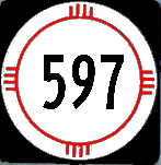
596
East terminus: U.S. 160 near Four Corners
Length: 0.447 mi.
County: San Juan
History: This appears to have been established as a state route around 2000. The road connecting to the Four Corners monument was in existence as long as U.S. 160 and its predecessor routes was.
Improvements: Two lane, paved
Comments: The Four Corners monument is part of a Navajo Tribal Park. You have to pay admission for the privilege of viewing (and walking on) the monument --- where else would you be able to stand in four states at once? --- and you are also surrounded by booths of Navajo craftsmen selling their wares. It should be noted that the NE (Colorado) quadrant is actually in the Ute Mountain reservation.

East terminus: E of Truchas
Length: 2.000 mi.
County: Rio Arriba
History: Probably established around 2000. My Benchmark map shows this as NFS 639.
Improvements: Two lane, paved
Comments: I drove by here in 2005 and don't remember seeing this marked.

Photo taken near north end of Relief Route
East terminus: U.S. 84-285 N of Santa Fe
National Highway System entire length
Length: 14.019 mi.
County: Santa Fe
History: Established and constructed beginning in the mid-1990s. It was completed around 2000.
Improvements: Four lane expressway with some interchanges on the north end, including at U.S. 84-285. There are two stoplights, one at the I-25 west frontage road and one at Airport Road.
Comments: This is the Santa Fe Relief Route, which allows you to totally bypass Santa Fe if traveling from Albuquerque north to Española. In addition, trucks southbound on I-25 that are headed for 84-285 north are instructed to continue on I-25 to the junction with NM-599 (even though this route involves a fair amount of backtracking). As noted above, there are only two stoplights along this route. The highway is posted 65 mph between I-25 and Airport Road, 45 and 55 mph the rest of the way. It should be noted, however, that traffic tends to move much faster in the 9 miles between Airport Road and U.S. 84-285, with traffic crossing the highway having to do so with extreme caution. Look for more signals in the future unless interchanges can be funded. The route was funded by the Federal Government in part to allow trucks bearing nuclear waste from Los Alamos to bypass Santa Fe.
600