Not all roads that are significant, useful or interesting are trunk highways. There are county roads that provide excellent traffic capacity or a useful shortcut, and that even may be part of the National Highway System. Some local roads have an interesting history or are just plain unusual. Finally, this page has a link to the Great River Road, the multi-state (heck, even international) parkway along the mighty Mississippi from Canada to the Gulf of Mexico. Here are a few significant roads that should be mentioned:
| Route |
Jurisdiction |
Description |
| CSAH 42 |
Scott and Dakota Counties |
The major east-west route across Scott and Dakota Counties. It is designated as a "principal arterial" by the Metropolitan Council, which means that the road is supposed to be preserved as a route with signals only at one-half mile intersections and severely limited commercial entrances. Unfortunately, through Burnsville and Apple Valley, there is a lot of demand for commercial access from this route. The counties are studying alternate routes that could be so designated, but it is unlikely that any would fit better than this existing route. It is divided road for about 10 miles between Savage and U.S. 52 in Rosemount, and is designated as part of the National Highway System between Scott CSAH 18 and T.H. 55. The designation ends southeast of Shakopee, but could ultimately be extended westward, south of Shakopee, to intersect U.S. 169.
If there is any road that could be converted to trunk highway with an infusion of funding for radical improvement, this is it. However, none of the transportation agencies involved will admit to any plans for converting this to limited access expressway or freeway.
|
| CSAH 18 |
Scott County |
This designation formerly ran north into Hennepin County along what is now U.S. 169, so the "County Road 18" name has a considerable recognition value in the Twin Cities area. Scott County has built this as an expressway running south from the junction of U.S. 169 and CSAH 101. (It is noteable for being the only county road in the state that has a speed limit over 55...one short stretch is marked 60 mph).
This route is designated as part of the National Highway System between CSAH 42 and U.S. 169.
|
|
Shepard Road
Warner Road
|
St. Paul (some Ramsey County segments but basic maintenance is city) |
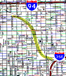
Running east from the intersection of East Mississippi River Blvd. and T.H. 5, this road closely follows the Mississippi River to downtown St. Paul. Most of St. Paul is up on the river bluff, but this road is up close and personal with the river. So much so that it is inundated on occasion during significant flood events (1993 and 1997). Being upgraded to four lane divided road over much of its length. Designated as part of the National Highway System between I-35E and downtown St. Paul. East of downtown, it becomes Warner Road and intersects U.S. 10/61 just south of I-94.
Considered for inclusion in the "East Central Business District Bypass", which would allow trucks to bypass the no-truck zone on I-35E and reenter the freeway north of downtown at Pennsylvania Avenue. One of the few routes that could also be designated as a trunk highway solely by resolution of the Commissioner of Transportation. Probably won't be, though.
|
| Ayd Mill Road (formerly Short Line Road) |
St. Paul |
 |
A very unusual road. It runs northwest from Jefferson Avenue, through a ravine next tothe Canadian Pacific Railroad tracks, to Selby Avenue just east of Snelling. Apparently, the road was constructed by the city of St. Paul in the early 1960s, envisioned as a connector between I-35E and I-94 in the Midway area. However, it was never extended to I-94, and even though there is an underpass and a cleared route that would allow connection with I-35E, the connection has been closed. It was only opened during the Mendota Bridge reconstruction. To reach it from I-35E, you must exit at Randolph, turn west, then north on Lexington and east on Jefferson. |
The road is divided and main cross streets pass over this road and the adjacent railroad. There are no interchanges per se; rather, there are ramps that connect with this road at grade, with northbound traffic having to turn left across oncoming traffic to exit. The city of St. Paul is looking at options for this road, ranging from connecting it to I-35E to turning it into a linear park.
|
| CSAH 4 |
St. Louis County |
One of Minnesota's longest county roads (over 60 miles), connecting Duluth and Biwabik. Significant enough to rate a red line on the Rand McNally. |
| CSAH 2 |
Lake County |
Another significant connecting route, between T.H. 61 at Two Harbors and T.H. 1 south of Ely. A much better road than T.H. 1. |
| Gunflint Trail (CSAH 12) |
Cook County |
Well-known to recreational enthusiasts, this road runs north from T.H. 61 at Grand Marais to the edge of the Boundary Waters Canoe Area Wilderness. Numerous lodges and campgrounds can be found along this route. |
| Grand Rounds |
City of Minneapolis |
A route along the city's extensive park system, intended to completely encircle the city. Includes St. Anthony Parkway on the northeast side, Webber Parkway and Victory Memorial Parkway on the north side, Wirth Parkway on the west side, then south along the chain of lakes to Minnehaha Parkway. It will follow this route west along Minnehaha Creek to the falls, then join the West River Parkway heading north toward the University of Minnesota. The connection along the east edge of Northeast Minneapolis isn't clear now, but will connect with Stinson Parkway (Boulevard) and join St. Anthony Pkwy to complete the loop.
This is one of the urban routes listed in TEA-21 as eligible for federal funding.
|
|
Great River Road
|
MnDOT, counties, cities. MnDOT administers the route itself and funds roadside recreational improvements, but does not maintain the roads except for trunk highways. |
This rates a page of its own, so click on the link at left. |