U.S. Highways in Minnesota
Jump to Interstate Routes below.
Jump to lists of U.S. and Interstate routes.
History of the U.S. highway system. The U.S. highway system was overlaid on the existing Minnesota trunk highway system in 1927. Also, as noted in the listings below, there were a few short segments of U.S. highway that were marked over county roads. Until the great renumbering of 1934, U.S. highways were marked with both the U.S. route and the trunk highway (constitutional route) numbers. Even though there were no defined constitutional routes through Minneapolis, St. Paul or Duluth, U.S. routes were marked through the cities to provide route continuity, just as extensions of the trunk highways terminating at the city limits had been before that time.
The original east-west U.S. routes were 2, 8, 10 (and its N and S branches between Moorhead and St. Cloud), 12, 14, 16, 210, and 212; and north-south routes were 55, 61, 71, 75, and 218. Reflecting the nationwide changes in the U.S. highway system in its first few years of existence, new routes were soon extended into Minnesota: 77 (briefly duplexed with 12 near the South Dakota border) was added about 1930; the entirely intra-state 371 was established in 1931 and 169 was extended into the state in 1932. It should be noted that U.S. 169 originally followed Constitutional Route 11 north from Virginia to International Falls, now part of the route of U.S. 53.
1934 was a year of change for both the Minnesota trunk highway and U.S. highway networks. Minnesota began to mark the additional routes added by the legislature in 1933, which required a major redesign of the numbering system. No longer was there a strict correlation between constitutional or legislative and marked trunk highway number, and U.S. routes were no longer marked separately with the constitutional route number. At the same time, there were major changes in the U.S. highway numbering system that affected the state.
Maps from the year 1934 show discrepancies in the intended marking system for U.S. highways, as well as for those state-numbered trunk highways with numbers the same as later adopted for U.S. routes. My guess is that there were at least two iterations of the highway marking plan, one of which may have been prematurely distributed to map distributors. First to go was the 10S/10N split. A 1934 Gousha map (not of Minnesota exclusively, but rather a large-scale U.S. map on the back of another state's map) shows 10S and 10N replaced by 10 and an extension of 218 respectively. On this map, U.S. 210 is (curiously) replaced by U.S. 208, which would not have been consistent with the numbering scheme. The 1934 Wisconsin travel map also shows this marking. However, this route was apparently never marked as such, since after the map was initially redrawn, U.S. 52 replaced U.S. 55 and was extended northwest to North Dakota. 1934 and later maps still show U.S. 210.
The 1934 official Minnesota highway map shows the following changes:
- U.S. 55 replaced by U.S. 52. 52 had previously ended in Illinois.
- Northwest of the Twin Cities, 10S and 10N were replaced by 52 and 10 respectively.
- U.S. 212 has been rerouted from its original terminus at Willmar along a more southerly alignment, and now goes all the way to St. Paul and east to the Wisconsin border.
- U.S. 218 has been extended from its terminus at Owatonna to St. Paul, then as MN-218 follows U.S. 10 to Big Lake just as it did for many years. (The first apparent draft plan described above to extend 218 to Moorhead may explain the somewhat curious past routing of MN-218 from St. Paul to Big Lake then north along a somewhat minor road --- now MN-25 --- to Brainerd).
- U.S. 65, which formerly ended at St. Paul, was re-routed to Minneapolis, and north to U.S. 2 at Swan River.
- Another change shown on this map: trunk highway 59 from the Iowa border to Lake City is shown as U.S. 59. Now, at that time 59 did not exist, and it is possible that this was a proposal to create a U.S. highway from Iowa to Minnesota that fortuitously could utilize the former marked route number.
- U.S. 210 is unchanged despite the other map's representation.
According to Minnesota Highway News, official publication of the Minnesota Highway Department, these routes were marked until the 1935 changes described below took place.
In 1935, some of the changes above were changed again. U.S. 63 is now marked along ConRt. 59, and U.S. 59 is in its present location in western Minnesota (along the route originally designated MN-73). Also, U.S. 69 has been extended north from Iowa. The extensions north and east of the Twin Cities of U.S. 65 and 212, and the extension to St. Paul of U.S. 218, are marked as state-numbered routes instead. My speculation is that Minnesota anticipated approval from AASHO (predecessor to AASHTO) for its proposed U.S. route changes, and had to retract the U.S. 65, 212 and 218 extensions, and original U.S. 59.
The coming of the interstate system has resulted in U.S. routes being either decomissioned because of their redundancy, or hidden where adjoining states can't be convinced to agree to a decommissioning. U.S. 8 was decommissioned between Forest Lake and Minneapolis; U.S. 65 was eliminated north of Albert Lea; U.S. 61 removed north of Wyoming (soon to be cut back to St. Paul); and U.S. 16 done away with east of Rapid City SD in its entirety. Minnesota can't convince North Dakota to eliminate U.S. 52, so MnDOT runs it along I-94 and simply doesn't mark it. U.S. 12 between Minneapolis and the Wisconsin border is similarly hidden.
There have never been U.S. routes with ALTERNATE or BYPASS designations in Minnesota. However, there is currently one BUSINESS route in the trunk highways system (U.S. 2 Business at East Grand Forks). Previously, there were Business routes in the trunk highway system of U.S. 169 at Hibbing (co-signed with MN-73) and U.S. 53 at Virginia (co-signed with MN-135). Both of these routes have been turned back to the respective cities.
Interstate routes
The interstate system is much as originally planned, except for changes in highway alignments. Major differences in what was actually built versus originally proposed are that I-335 around the north side of downtown Minneapolis never was built, and I-394 was built instead; and I-35 does not extend all the way through Duluth to connect with the highway 61 expressway northeast of that city as the original plan intended.
Lists of U.S. and Interstate Highways
List of past and present U.S. and Interstate highways in Minnesota. Details on these routes can be accessed from the "explore route" pages. Direct links for each route to the route detail pages are now active. Background of table row indicates route currently exists or era of decommissioning as follows:
| Currently authorized and marked routes |
| Routes decommissioned 1973-80 |
| Route decomissioned in the 1960s |
| Routes decommissioned in the 1930s |
| U.S. routes proposed and printed on maps but probably never actually marked, or Interstate route proposed but defeated by public opposition. |
| Route |
Approx. year introduced |
Major changes in length or routing, and year decommissioned |
|

|
1926 |
Original route ran due east from Floodwood to TH-11 (now U.S. 53) along what is now CSAH 8 until about 1933. Point of entry to Duluth and route to Wisconsin changed in 1934 |
|

|
1926 |
Originally terminated at U.S. 61 at Wyoming, extended to Minneapolis around 1931, has terminated at I-35 at Forest Lake since 1980. Alignment change about 1955 between Chisago City and U.S. 61 when U.S. 8 was routed onto former MN-98 to Forest Lake. The old alignment of U.S. 8 to Wyoming became MN-98. |
|

|
1926 |
Replaced U.S. 10N in 1934, routing from St. Paul to Wisconsin (originally duplexed with U.S. 12) changed in 1934 |
|

|
1926 |
Replaced by U.S. 10 in 1934 |
|

|
1926 |
Replaced by U.S. 52 in 1934
Part of original route was on county road rather than trunk highway.
|
|

|
1926 |
Route essentially unchanged. Not marked east of junction with I-494 where it becomes concurrent with I-394.
Part of original route was on county road rather than trunk highway.
|
|

|
1926 |
Extended east into Wisconsin from U.S. 61 at Winona in 1933. Otherwise, route essentially unchanged |
|

|
1926 |
Decommissioned 1980; replaced by I-90 and MN-16 |
|

|
1934 |
Route between Minneapolis and St. Cloud changed around 1984. Only marked on independent segment south of St. Paul, not along I-94. |
|

|
1934 |
Route essentially unchanged |
|

|
1926 |
Replaced by U.S. 52 southeast of Farmington, by U.S. 65 northwest of Farmington in 1934 |
|
Original route of

|
1934 |
Originally proposed, and printed as such on official 1934 Minnesota highway map, to run along Constitutional Route 59 (present-day U.S. 63) between Iowa border south of Spring Valley to U.S. 61 at Lake City. Evidently posted for one year, until U.S. 63 was extended north from southern Iowa in 1935 into Minnesota, and U.S. 59 was instead used for a Texas-Minnesota route along its current alignment (marked on that 1934 map as MN-73). |
|

|
1935 |
The only route change on the current route is the segment between Lancaster and Canadian border. The original route ran from Lancaster west to St. Vincent MN and into North Dakota until the mid-1950s. |
|

|
1926 |
No significant changes south of Wyoming. Decommissioned about 1991 north of Wyoming, replaced by I-35 and MN-61. |
|

|
1935 |
Route essentially unchanged |
|

|
1926 |
1934: replaced between Farmington and St. Paul by MN-218 and MN-88, re-routed along former U.S. 55 to downtown Minneapolis.
c. 1958: Between Faribault and Lakeville, re-routed along former MN-165. Old alignment became MN-218 only.
1983: Decommissioned north of Albert Lea
|
|

|
1935 |
Route essentially unchanged |
|

|
1926 |
New alignment in 1934 between Willmar and Sauk Centre |
|

|
1926 |
New alignment between Moorhead and Crookston along old MN-81 around 1955. |
|
|
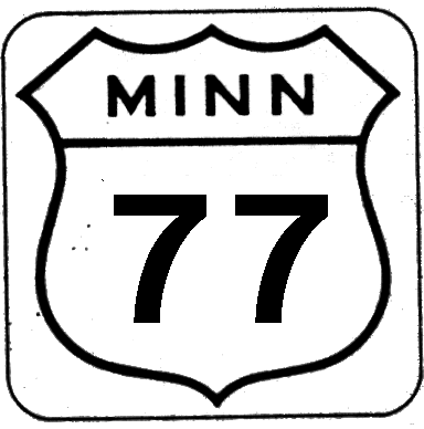
1930 |
May have been duplexed with U.S. 12 in South Dakota to U.S. 75 in Minnesota until the late 1960s. Shown as such on 1965 Minnesota Highway Map. Was only present in Minnesota duplexed with U.S. 12 for a short distance. |
|

|
1932 |
Originally routed along C.R. 11 from Virginia to Int'l Falls, terminated at Virginia in 1934 when U.S. 53 introduced. New alignment between Mankato and St. Peter around 1961. Several alignment changes in Twin Cities area 1978-96. |
|
Proposed

|
1934 |
A proposed replacement for U.S. 210 published on at least two different 1934 maps (but not on any official Minnesota highway map). The unusual designation probably would have been because the western terminus would no longer have been U.S. 10, though it would have been a non-standard number in an era when U.S. routes were uniformly standard. See U.S. 218 extension below for whole story. |
|

|
1926 |
Decommissioned 1973 |
|

|
1926 |
Former alignment from Montevideo to Willmar (along present-day MN-7 and MN-23) replaced in 1934 by current route to Twin Cities. Decommissioned in the Twin Cities area east of U.S. 169 around 1983.
Part of original route was on county road rather than trunk highway.
|
|

|
1926 |
Route essentially unchanged from original routing, except that it extended from Owatonna to St. Paul along the original route of U.S. 65 from 1934 to 1935. (This then became MN-218) |
 extension northwest of St. Paul extension northwest of St. Paul |
1934 |
As noted above, from 1934 to 1935, U.S. 218 did extend from Owatonna to St. Paul before it was changed to MN-218. However, the original proposed 1934 numbering plan went much further.
U.S. 218 was proposed to extend from St. Paul to Fargo along the alignment of U.S. 10 (to St. Cloud) and then along what had been U.S. 10N. The same map shows U.S. 10S becoming U.S. 10, and U.S. 210 becoming U.S. 208. This plan was evidently scrapped when U.S. 52 was extended north into Minnesota and occupied the route of former U.S. 10S. Instead, the extension northwest of St. Paul was re-routed to Brainerd along a new legislative route (todays MN-25) and was designated MN-218. The entire route north of Owatonna was converted to a state-numbered route in 1935.
|
|

|
1932 |
Route decommissioned 1973. |
Interstates
|
Primary routes and
Associated 3di routes
|
Coincident U.S. Routes: Decommissioned
Multiplexed & marked
Multiplexed & not marked |

|
16 - SD Border to MN-16 E of Austin |

|
52 - ND Border to St. Paul
10 - Jct. I-35E to Jct. U.S. 10/61 south
12 - Jct. I-394 in Minneapolis to WI Border
|
|

|
12 - Jct. I-494 to Jct. I-94 |
|

|
|
|

|
52 - Multiplexed segment with I-94
10 - Jct. U.S. 10 to Jct. I-35E
|

|
65 - Albert Lea to I-35W
8 - Jct. I-35W to Jct. U.S. 8
61 - Wyoming to Duluth
|
|
Proposed

|
Proposed link through northeast Minneapolis between I-35W and I-94 north of downtown. Scrapped due to public opposition.
View map of proposed I-335
|
|

|
53 - Entire length |

|
65 - Jct. I-35 to Minneapolis
8 - Jct. Ramsey CSAH 88 to Jct. I-35
|

|
10 - Jct. I-94 to Jct. I-694 |
Return to Minnesota Highways Home Page
First uploaded February 28 1998
Updated July 12, 2010