| |
Note: most of the following routes are connecting routes that connect a town (sometimes a very small town) to another highway. Many of these were likely authorized by the Minnesota Legislature as political plums for that district's legislator. The time period for authorization of these routes is about 1949. Many of the towns served are unlikely candidates for service by state trunk highways (as indicated by their populations, when included). Unless otherwise indicated, the legislative and marked route numbers are the same. |
 |
South terminus: MN-1 near Goodridge
North terminus: MN-89 W of Grygla
Length: 15 Region: NW
Counties: Marshall
History: Authorized 1949
Improvements: Paved by 1960.
|
 |
South terminus: U.S. 75 at Climax
North terminus: MN-11 E of Robbin
Length: 80 Region: NW
Counties: Polk, Marshall, Kittson
History: Authorized 1949
Improvements: Paved in its entirety by 1970
Comments: Actually, this is a true regional trunk highway that runs for quite a distance along the Red River rather than a short connecting route like most others authorized around this time.
|
 |
West terminus: MN-1 at Ely
East terminus: Fall Lake
Length: 6 mi. Region: NE
Counties: St. Louis, Lake
History: Authorized 1949, originally numbered same as its Legislative Route number. Redesignated as an extension of MN-169 in 1953. Still numbered as such.
Improvements: Paved at or shortly after the time it became a trunk highway.
Comments: Andrew Munsch caught this little piece of highway history, which I had missed, on a 1952 official Minnesota road map. I have both 1950 and 1953 official maps, which show when the change in number occurred.
|
 |
South terminus: MN-92
North terminus: Oklee (pop. 441)
Length: 1 Region: NW
Counties: Red Lake
History: Authorized 1949
Improvements: Paved by 1953
|
 |
West terminus: MN-92
East terminus: Leonard (pop. 26)
Length: 8 Region: NW
Counties: Clearwater
History: Authorized 1949
Improvements: Paved by 1961
|
 |
West terminus: U.S. 59
East terminus: White Earth (unincorporated)
Length: 4 Region: NW
Counties: Becker
History: Authorized 1949
Improvements: Paved by 1953
Comments: A reconstruction project planned for 2013 is part of a turnback agreement for this road. The route is being removed in 2005 legislation, however, so this work will apparently be done after the actual turnback.
|
 |
West terminus: Ponsford (unincorporated)
East terminus: MN-34 at Osage
Length: 9 Region: NW
Counties: Becker
History: Authorized 1949
Improvements: Paved by 1953
Comment: Original alignment of MN-34 until it was realigned the 1940s
|
 |
South terminus: MN-34
North terminus: Dorset (unincorporated)
Length: 3 Region: NW
Counties: Hubbard
History: Authorized 1949
Improvements: Paved by 1953
|
 |
West terminus: U.S. 71
East terminus: Nimrod (pop. 65)
Length: 11 Region: NW
Counties: Wadena
History: Authorized 1949
Improvements: Paved by 1953
|
 |
West terminus: Vergas (pop. 287)
East terminus: U.S. 10
Length: 8 Region: WC
Counties: Otter Tail
History: Authorized 1949
Improvements: Paved by 1960
|
 |
West terminus: U.S. 10 in Moorhead
East terminus: I-94/U.S. 52 east of Moorhead
Counties: Clay
History: Although authorized in 1949, it was not marked with this number until the I-94 bypass of Moorhead was completed around 1960. It was originally authorized so that U.S. 52 would run between U.S. 75 and the ND border on a trunk highway, later became the city route after construction of the freeway. Now city street, designated Business Loop 94. Turned back around 1987.
|
 |
West terminus: Palisade (pop. 144)
East terminus: MN-65 near Big Sandy Lake
County: Aitkin
History: Authorized 1949. 1996 Legislature approved removal of L.R. 232, with a provision the act became effective when MnDOT and Aitkin County agreed on a turnback agreement. But see discussion below.
Comment: This was a strange case of "turnbackus interruptus." Tom Fistere reported, "An article in the Aitkin newspaper two weeks ago [mid-June 1999] stated that only in the last few months has MNDOT offered to give the county $4.3 million to repair and take control of the road. Apparently this argument has been going on since 1995 and MNDOT jumped the gun changing the maps." A $1.7 million Mississippi River bridge replacement in 2000 might have been part of the turnback agreement. But, as of 2006, this route still shows in MnDOT's route logs. And Tom now reports that Aitkin County has decided not to accept the road. So, as of 2006, Minnesota Statutes shows the route being removed, but the agreement that precipitated that has been abrogated.
|
 |
West terminus: Urbank (pop. 73)
East terminus: MN-29
Length: 10 Region: WC
Counties: Otter Tail
History: Authorized 1949
Improvements: Paved 1960
|
 |
West terminus: SD State Line (county road)
East terminus: U.S. 75 N of Wheaton
Counties: Traverse
History: Authorized 1949, turned back around 1985, now Traverse CSAH 10. Only connected with a county road leading to U.S. 81 in South Dakota.
|
 |
South terminus: New Munich (pop. 314)
North terminus: I-94 exit 137
Length: 3 Region: WC
Counties: Stearns
History: Authorized 1949
Improvements: Paved by 1953
|
 |
South terminus: I-94 (exit 147) at Albany
North terminus: MN-27 near Little Falls
Length: 34 Region: WC
Counties: Stearns, Morrison
History: Authorized 1949
Improvements: Paved in its entirety by 1960
Comments: Longer than most routes authorized around this time.
|
|
|
South terminus: MN-55 in Annandale
North terminus: U.S. 10 in Clear Lake
Counties: Wright, Sherburne
| History: Now marked as part of |
 y y |
Authorized 1949, consolidated around 1963 with MN-24.
|
 |
West terminus: St. Michael (pop. 9099)
East terminus: I-94 (exit 205)
Length: 3 Region: EC
Counties: Wright
History: Authorized 1949, but actually runs on the original alignment of MN-152. The new alignment of that route around the north side of St. Michael was constructed by 1960.
Improvements: Paved before 1940 as part of MN-152.
|
 |
West terminus: U.S. 10 in Coon Rapids
East terminus: MN-65 in Blaine
Length: 7 Region: M (Anoka County)
NHS: Entire length, as well as projected eastward extension over CSAH 14 to I-35W
Counties: Anoka
History: Authorized 1949
Improvements: Paved by 1953
Comments: Runs along 125th Avenue NW and NE in Coon Rapids and Blaine. This is part of a route designated by the Twin Cities Metropolitan Council as a "Primary Arterial," which should mean that it is an unlikely turnback candidate. However, Anoka County and MnDOT have negotiated a turnback agreement reflected in 2006 legislation to remove this route that will become effective when a new interchange at MN-65 is complete. My guess is that this highway was so low in funding priority that Anoka County chose to take the turnback funding to improve the road.
|
|
West terminus: MN-95
East terminus: Wisconsin State Line (WI-243) near Osceola WI
Length: <1 Region: EC
Counties: Chisago
History: Authorized 1949
Improvements: Paved by 1953
|
|
South terminus: MN-120
Previously (southwest): U.S. 61 (1949-2002)
North terminus: MN-96
Length: 7 Region: M
Counties: Washington
History: Authorized 1949. Legislative route eliminated from trunk highway system in 2001. Shortly thereafter, the Ramsey County portion was turned back but the Washington County portion remained.
Improvements: Paved by the time it became a trunk highway
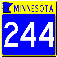
Comments: Loop around south and east side of White Bear Lake, which originally extended west along the south edge of the city of White Bear Lake to U.S. 61 along a street called --- even as a state highway --- County Road E. This is now marked Ramsey County 15. Eliminated from statute in 2001, but the turnback process with Washington County is apparently longer term. According to the Washington County Transportation Department web site, the turnback will be completed in 2009.The Ramsey County part has been redesignated County 15 (like the rest of the street named "County Road E"). The Washington County part is still marked as MN-244, with an end-to-end terminus at MN-120 (also in the turnback process). When renumbered, it may be Washington County 12 between the county line and the junction with County 12. North of there it would get a new designation.Or (more likely) the whole route may just be County 244.
|
Photo: Signage of a rare (and probably temporary) end-to-end route terminus. Looking west just east of the junction of MN-244 (which ends at the signal), MN-120 (note the sign on the signal mast arm pointing left), Ramsey County 15 (old 244, straight ahead at the signal - there is a marker visible) and Washington County 27 to the right. The 244 sign is noteable by being a rectangular sign - generally seen for Minnesota 3-digit routes on guide signs only (i.e., on a green sign), rarely on a freestanding sign.
Do these streets have names as well as numbers? It's complicated by the fact that the Ramsey-Washington County line runs up the middle of 120. In fact, 120 is called Century Avenue in Ramsey County and Geneva Avenue in Washington County (same street - different name). Straight ahead, County 15 is County Road E (which it was called even when it was MN-244), and to the right it's East County Line Road - at least from Ramsey County's viewpoint. I'm standing on Wildwood Road.
Photo taken May 2007.
|
 |
|
 |
South terminus: MN-56 N of Kenyon
Previously --- Nerstrand (1950-60) on southeast
North terminus: MN-3 at Northfield
Length: 18 Region: SE
Counties: Rice, Goodhue
Legislative Route(s): 320, 246
History: Authorized 1949 from Nerstrand to Northfield, around 1960 from Nerstrand to MN-56.
Improvements: Paved by 1960.
Comments: Route passes near Nerstrand Woods State Park. Original route 246 ended at Nerstrand. It is puzzling why the Legislature extended this route by authorizing a new route 320 instead of merely amending the definition of route 246.
|
 |
West terminus: U.S. 63 N of Rochester
East terminus: MN-42 at Plainview
Length: 13 Region: SE
Counties: Olmsted, Wabasha
History: Authorized 1949
Improvements: Paved in its entirety by 1960
|
 |
West terminus: Altura (pop. 349)
East terminus: U.S. 61 at Minnesota City
Length: 12 Region: SE
Counties: Winona
History: Authorized 1949
Improvements: Paved by 1953
|
 |
West terminus: MN-44/76 at Caledonia
East terminus: MN-26 S of Brownsville
Counties: Houston
History: Authorized 1949, turned back around 1992, now designated Houston CSAH 249. This route is noteable by the eastern part of it never having been paved.
|
 |
West terminus: MN-16 at Lanesboro
East terminus: MN-30
Length: 9 Region: SE
Counties: Fillmore
History: Authorized 1949
Improvements: Paved by 1953
Comments: Seemingly an insignificant road, but it (and MN-30) was originally the route of U.S. 16 until the 1930s before that road was constructed in the Root River valley between Lanesboro and Rushford.
|
 |
West terminus: I-35 (exit 18) at Clarks Grove
East terminus: U.S. 218 near Lansing
Length: 17 Region: SE
Counties: Freeborn, Mower
History: Authorized 1949
Improvements: Paved in its entirety by 1960
|
|
|
South terminus: U.S. 218 southeast of Austin
North terminus: U.S. 16 east of Austin
Counties: Mower
| History: Now marked as part of |
 y y |
Authorized 1949, used to designate a bypass running east of Austin from U.S. 218 to U.S. 16. Although this LR (also 252) is still described in the statutes, it is redundant because the original alignment of U.S. 218 through Austin was turned back, and U.S. 218 was realigned along the bypass route. This route designation is shown on Minnesota highway maps of the early 1960s, but it is possible it was never actually marked if U.S. 218 was moved onto the route upon its completion.
|
 |
South terminus: I-94 (exit 228) in Brooklyn Center
North terminus: MN-610 in Brooklyn Park
Previously --- U.S. (formerly 52)-169 on north (1981-88)
Length: 5 Region: M
Counties: Hennepin
Legislative Route(s): 110
How numbered: It originally terminated on the north at U.S. 52 (at the time it was designated, there was also MN-152 in the same area)
History: Authorized 1933, originally a part of U.S. 169 that ran north to the junction with former U.S. 52 (now U.S. 169) at Champlin. Redesignated around 1981 when 169 was rerouted along 52. In the Hennepin County/MnDOT highway swap, the portion north of MN-610 was turned back to the county as CSAH 12.
Improvements: Upgraded to expressway in the mid 1980s, and has a full freeway-type interchange with flyover ramps at MN-610.
Future Construction: It seems inevitable that this highway will be converted to full freeway status. Every year, bills are introduced to provide funding to accellerate this process. Nothing is currently programmed, though.
Exit List: Well, they're intersections, not really exits, but visit Adam Froehlig's exit list for Highway 252
|
 |
South terminus: Bricelyn (pop. 426)
North terminus: I-90 (exit 134)
Length: 8 Region: SE
Counties: Faribault
History: Authorized 1949
Improvements: Paved by 1953
|
 |
South terminus: Frost (pop. 236)
Previously --- Iowa border (then IA-254) (1949-88)
To: I-90 (exit 128)
Length: 5 Region: SE
Counties: Faribault
History: Authorized 1949. Formerly extended south to the Iowa border until the late 1980s.
Improvements: Paved by 1953 (remaining segment), 1960 (former segment to Iowa)
|
|
|
South terminus: Good Thunder
North terminus: U.S. 169 in Mankato
Counties: Blue Earth
| History: Now marked |
 y y |
Authorized 1949, designated since 1963 as MN-66 south of Mankato.
|
 |
West terminus: Hanska (pop. 443)
East terminus: MN-15 N of Madelia
Length: 4 Region: SW
Counties: Brown
History: Authorized 1949
Improvements: Paved by 1953
|
 |
South terminus: Comfrey (pop. 433)
North terminus: U.S. 14 E of Springfield
Length: 11 Region: SW
Counties: Brown
History: Authorized 1949
Improvements: Paved by 1953
|
|
|
South terminus: U.S. 169 in LeSueur
North terminus: MN-19 in Henderson
Counties: Le Sueur, Sibley
| History: Now marked |
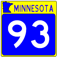 y y |
Authorized 1949, designated since 1963 as MN-93 west of Le Sueur.
|
 |
PROPOSED BUT NEVER MARKED. Originally proposed in the 1934 numbering plan as the designation for what became MN-55 between downtown Minneapolis and Hastings. The designation evidently was intended to indicate the connection with U.S. 61. There is inconsistency between the maps that show this route; some show it as U.S. 261 (which at about 25 miles long would have been a very short U.S. route, even by the lenient standards of that time). When U.S. 52 replaced U.S. 55 before the new routes could be marked, this route became the eastern end of MN-55. |
 |
South terminus: U.S. 212 E of Glencoe
North terminus: Winsted (pop. 1581)
Counties: McLeod
History: Authorized 1949, former 16-mile route. Turned back 1996, now designated McLeod CSAH 1.
|
 |
South terminus: I-90 (exit 107)
North terminus: Granada (pop. 374)
Length: 3 Region: SE
Counties: Martin
History: Authorized 1949. Legislative route eliminated by 2007 Legislature.
Improvements: Paved by 1960
|
 |
South terminus: Ceylon (pop. 461)
North terminus: I-90 (exit 93)
Length: 11 Region: SW
Counties: Martin
History: Authorized 1949
Improvements: Paved by 1953
|
 |
South terminus: Round Lake (pop. 463)
North terminus: I-90 (exit 50)
Length: 7 Region: SW
Counties: Nobles, Jackson
History: Authorized 1949
Improvements: Paved by 1960
|
 |
West terminus: Wilmont (pop. 351)
East terminus: I-90 (exit 42)
Length: 14 Region: SW
Counties: Nobles
History: Authorized 1949
Improvements: Paved in its entirety by 1960. Removed from statute in 2003, turned back to Nobles County. Now Nobles CSAH 25.
|
 |
South terminus: Iona (pop. 158)
North terminus: MN-30 near Slayton
Length: 5 Region: SW
Counties: Murray
History: Authorized 1949
Improvements: Paved by 1953
|
 |
West terminus: U.S. 75
East terminus: Edgerton (pop. 1,108)
Length: 7 Region: SW
Counties: Pipestone
History: Authorized 1949. Turned back effective 2005.
Improvements: Paved by 1953
|
|
|
West terminus: SD State Line (SD-11)
East terminus: MN-23 at Jasper
Length: 2 Region: SW
Counties: Rock, Pipestone
History: Authorized 1949
Improvements: Paved by 1953
|
 |
West terminus: Hills (pop. 607)
East terminus: U.S. 75
Length: 8 Region: SW
Counties: Rock
History: Authorized 1949
Improvements: Paved by 1960
|
|
|
South terminus: MN-19
North/west terminus: SD State Line (SD-28)
Length: 9 Region: SW
Counties: Lincoln
History: Authorized 1949
Improvements: Paved by 1960
|
|
|
West terminus: MN-19 E of Marshall
East terminus: MN-93 at Morgan
Counties: Redwood
| History: Now marked |
 y y |
Authorized 1949, designated since 1963 as an extension of MN-68.
|
 |
South terminus: MN-19 W of Redwood Falls
North terminus: Belview (pop. 383)
Length: 4 Region: SW
Counties: Redwood
History: Authorized 1949
Improvements: Paved by 1953. Removed from statute in 2003, to be turned back to Redwood County.
|
 |
South terminus: Wood Lake (pop.406)
North terminus: MN-23 S of Granite Falls
Length: 8 Region: SW
Counties: Yellow Medicine
History: Authorized 1949
Improvements: Paved by 1953
|
 |
South terminus: Boyd (pop. 251)
North terminus: U.S. 212
Length: 7 Region: SW
Counties: Lac Qui Parle
History: Authorized 1949
Improvements: Paved by 1960
|
 |
South terminus: MN-7 W of Clara City
North terminus: MN-40 20 mi W of Willmar
Length: 11 Region: SW
Counties: Chippewa
History: Authorized 1949
Improvements: Paved by 1960
|
 |
West terminus: U.S. 52 in Minneapolis
Previously --- MN-100 (1949-78)
East terminus: MN-152 in Minneapolis (Lowry Avenue at Washington Avenue)
Counties: Hennepin
History: Authorized 1949. Ran east from MN-100 in Robbinsdale to then U.S. 52 along 36th Avenue N., then east through north Minneapolis from Broadway on Lowry Avenue to Washington Ave (then MN-152). The 36th Avenue segment was turned back around 1978, and the Lowry Avenue segment around 1982.
|
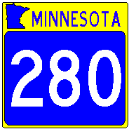 |
South terminus: I-94 (exit 236) in St. Paul
Previously --- MN-36 (1951-52); Kasota Ave (1958-63); U.S. 12/52 (University Ave.) (1963-69)
North terminus: I-35W (exit 23A) in Roseville
Previously --- U.S. 8 in New Brighton (1951-52)
Length: 4 Region: M
Counties: Ramsey
History: Authorized 1949. Not marked immediately, but for a year or two in the early 1950s was marked along Cleveland Avenue and County Rd. E between U.S. 8 in New Brighton and MN-36 (all north of the current extent of the route). Only official map I've seen showing this is the 1952 Minnesota highway map. Not shown on the 1953 map. Shown as under construction in 1958 from MN-36 south to about Kasota Avenue, by early 1960s extended to University Ave. Linked to I-94 in late 1960s after completion of I-94 from Minneapolis to St. Paul.
Improvements : A short freeway/expressway link between I-94 and I-35W. The north end had two signalized intersections at Broadway and County Road B, but these were closed beginning in 2007 when the route served as detour for I-35W after the Mississippi River bridge collapse. South of Como, highway was widened and ramps improved in the mid-90s. The Larpenteur/E. Hennepin Ave. interchange is being reconstructed in 2009 to eliminate the tight, no-acceleration lane ramps. The interchange at County Road B is also closed permanantly, as is the unsignaled intesection at Roselawn. With construction in 2009, the signal at Broadway will be modified to allow left turn from NB 280 (thus maintaining a stoplight for SB 280 only), but Broadway traffic will only be able to turn right (south). Thus, it will be, in a sense, a northbound freeway only with a single stoplight for southbound.
Visit Adam Froehlig's exit list for Highway 280
|
|
|
West terminus: U.S. 61 in Duluth
East terminus: U.S. 61 in Duluth
Counties: St. Louis
| History: Later became |
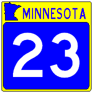 |
Now Duluth city street |
Authorized 1949, renumbered as an extension of MN-23 around 1963, turned back 1997. Ran along 2nd and Superior Streets through downtown and east Duluth.
|
 |
South terminus: U.S. 169 at Jordan
North terminus: MN-13 near Prior Lake
Length: 7 Region: M
Counties: Scott
History: Authorized 1949
Improvements: Paved by 1953
|
 |
South terminus: U.S. 212 at Cologne
North terminus: MN-5 at Waconia
Length: 4 Region: M
Counties: Carver
History: Authorized 1949
Improvements: Paved by 1953
|
 |
West terminus: MN-6 at Talmeon
East terminus: MN-38 at Marcell
Length: 4 Region: NE
Counties: Itasca
History: Authorized 1949
Improvements: Paved by 1953
|
 |
South terminus: MN-28 at Grey Eagle
North terminus: U.S. 71 at Long Prairie
Length: 14 Region: WC
Counties: Todd
History: Authorized 1949
Improvements: Paved in its entirety by 1960
|