County Highway Systems
|
Traveling rural roads through Minnesota is easier than in most states because every Minnesota county has a numbered route system. With very few exceptions, all county routes have numbers, not letters or alphanumeric combinations*. Numbers are unique only within a county.
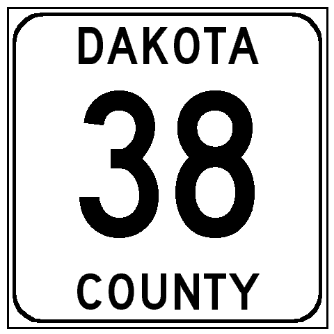
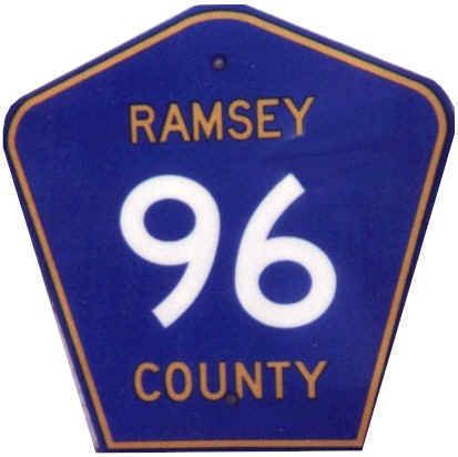
County roads fall into two categories: County State-Aid Highways (abbreviated CSAH) and County Roads. Construction and maintenance of a CSAH is funded partially from the Highway Users Fund that is derived from the state gasoline tax, while County Roads are funded strictly from local county funding sources. County highways are marked with one of two designs of sign: the old square, black on white sign, and the newer blue pentagonal marker that is in common use throughout the country. Some counties use one or the other exclusively, or may use the pentagonal sign to indicate primary county routes (but not generally as a distinction between County State-Aid Highways and County Roads). This extensively numbered county highway system provides an additional navigational aid using secondary routes throughout the state, with the only problem being that numbers tend to change at the county line. (An "Intercounty" route marking system is used in a few areas, with a rectangular blue sign under the county route marker, designated with a letter that does not change at the county line. Unfortunately, this "Intercounty" designation is not marked on any maps, thus limiting its usefulness.)
*Contrary to popular belief, Ramsey County does not have lettered county routes. There is a series of roads named "County Road B" through "J" at one-mile intervals, but this is not the official marked designation. Each of these has a separate, and usually marked number (for example, County Road E is marked Ramsey County 15). These street names are vestiges of an old numbering system that was revised by around 1960.
|
|
County markers on guide signs (green background signs used on freeways and other main roads) differ from confirmation markings in that the name of the county is omitted and the legend "COUNTY" is moved to the top of the number. Both the square white and pentagonal blue county signs are depicted in this way at freeway exits and expressway junctions. Actually, the only places one sees the blue pentagonal signs on freeway/expressway guide signs are in the outstate counties of Stearns and Wright, and the Metro counties of Anoka, Hennepin, Ramsey, Scott, Washington and Dakota.
County State-Aid Highways are found in unexpected places, and span a wide variety of road types. In the Twin Cities metro area, for instance, there are marked Hennepin County routes in downtown Minneapolis. Hennepin CSAH 81 and CSAH 152 from the northwest suburbs into Minneapolis are major feeder routes, classified as A-minor arterials, that carry large volumes of traffic. Contrasting this, Anoka CSAH 4 is mostly carried through Columbia Heights on 49th Avenue NE, which is merely a residential collector street (classified as either a B-minor arterial or collector). Quite a contrast for roads with the same route classification.
Shifts in highway jurisdiction
Currently, there are about 12,000 miles authorized in the trunk highway system. This is the limit on mileage authorized by the Minnesota Constitution. The actual total mileage in the system has been slowly decreasing the past few years. MnDOT is gradually turning back trunk highways that would more appropriately be under county or local jurisdiction because they serve a more local function. This trend is most evident in the Twin Cities metropolitan area; before construction of the Interstate system, there were numerous city streets that carried a state trunk highway designation. Today, most such streets have been turned back to county or city control, and except for a few major connecting streets (most of which connect to highways feeding into the metropolitan area), most trunk highways in the metropolitan area are Interstate or state freeways. MnDOT's Metro District has a long-term plan to turn back all roads that are not Principal Arterials to local control, and to take control those Principal Arterials that are under county or city control. Those routes are Main Street (Anoka CSAH 14) betwen TH-65 and I-35W; Shephard and Warner Road in St. Paul between I-35E and U.S. 61; and Dakota and Scott CSAH 42 and Scott CSAH 18. No timetable has been set for the turnbacks or new route acquisitions, though the Metro District's Transportation System Plan is currently being revised and may provide some insight into the timing.
No new trunk highways have been authorized in Minnesota in the past six years or so, and each year probably 10 to 20 miles of trunk highway are turned back to the counties. One significant act that underscored this trend was the MnDOT-Hennepin County Highway Swap of 1988.
In 1988 MnDOTand Hennepin County (which includes the city of Minneapolis and a large area west of that city) negotiated a major swap of highway jurisdiction, in which MnDOT assumed control of county freeways CSAH 18 and 62 (then called "The Crosstown"), and in return Hennepin County assumed control of many miles of surface roads under state control. The legislature had previously authorized special routes that allowed MnDOT to assume control of these routes. CSAH 18 became U.S. 169, and CSAH 62 became MN-62. All remaining signs indicating "Crosstown" came down on 62 as the new state route markers went up, though this name is still used by long-time residents to confuse newcomers. In exchange for about 40 miles of two to four-lane roads that are mostly local or regional feeders, MnDOT took over about 27 miles of four-lane freeway.
Possible future turnbacks (metro area only). Routes throughout the metro area that are prime candidates for future deletion from the trunk highway system are listed below. Routes marked planned are likely to be in the 2001 Metro District Transportation System Plan as turnback routes. This indicates that discussions have occurred with the counties that would take these routes over and the timing and improvements needed will be negotiated. Routes marked potential are routes for which no agreement have been reached, and/or routes that have technical issues (such as being Constitutional Routes).
|
MN-5 east of MN-55 all the way to MN-36
(planned)
|
MN-13 east of MN-55
(potential) |
MN-13 east of Cliff Road to MN-55
(future, if Cliff Road, the NHS segment, is added to trunk highway system)
|
|
|
MN-47 south of I-694
(potential)
|
MN-51
(planned south of I-94)
|
U.S. 61 north of I-94
(planned in Ramsey County, potential in Chisago County)
|
MN-65 south of I-694
(potential)
To be turned back in downtown Mpls (probably south of Washington Ave) in 2001.
|
|
MN-96
(planned)
|
|
MN-149 (planned in St. Paul, potential for part or all of rest of route)
|
MN-156 (planned in St. Paul, potential for remainder of route)
|
|
U.S. 212 between Cologne and Eden Prairie after completion of new freeway link (planned)
|
|
MN-291 (possible)
|
the unmarked MN-952A (Robert St.), (planned in St. Paul and potential south to I-494)
|
Deletion of some of these routes may be contingent on maintaining required constitutional route continuity. Some of these listings are my speculation, others taken from county and metropolitan area transportation planning documents.
Conversely, some routes will or are suggested to be added to the system. These include the planned but not yet funded U.S. 212 on its new alignment (a little piece will be complete next year and temporarily signed MN-312) from Cologne to Eden Prairie and MN-610 from I-94 to U.S. 169; and county roads that are designated as "principal arterials" by the Metropolitan Council such as CSAH 42 in Scott and Dakota Counties (same road), which would connect to U.S. 169 via CSAH 18; an extension of MN-77 along Cedar Avenue as far as current CSAH 42; and an extension of MN-242 along CSAH 14 between MN-65 and I-35W in Anoka County. (However, MnDOT would probably not agree to take over these routes without turnback of a corresponding mileage of trunk highway to the counties involved.)
Return to Minnesota Highways Home Page
| Originally uploaded December 19, 1997 |
Last updated December 28, 2003 |